geo.wikisort.org - Isola
Le Vernon Islands sono un gruppo di isole disabitate situate nel mare di Timor, lungo la costa occidentale del Territorio del Nord, in Australia. Le isole fanno parte della stessa comunità delle isole Tiwi[2] e si trova nell'area in cui il Tiwi Aboriginal Land Trust degli aborigeni di Tiwi reclama diritti sulla terra. Il gruppo di isole fa parte della Vernon Islands Conservation Reserve[3].
| Vernon Islands | |
|---|---|
| Geografia fisica | |
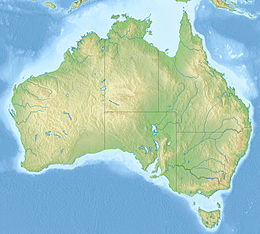
| Localizzazione | Mare di Timor |
| Coordinate | 12°03′10″S 131°04′18″E |
| Superficie | 81,58[1] km² |
| Geografia politica | |
| Stato | |
| Stato federato | |
| Cartografia | |
 | |
 Vernon Islands | |
| voci di isole dell'Australia presenti su Wikipedia | |
Le isole si trovano a sud dell'isola Melville nel canale che separa le isole Tiwi dalla terraferma: il Clarence Strait. Sono a ovest del golfo di Van Diemen e distano circa 52 km[4] da Darwin.
Le tre isole sono dotate ognuna di un faro[5].
- North West Vernon, ha una superficie di 14,25 km².
- East Vernon
- South West Vernon

Storia
Le Isole Vernon furono nominate da Phillip Parker King in onore di Edward Venables-Vernon, arcivescovo di York. In una descrizione delle isole, nel suo Narrative of a Survey of the Intertropical and Western Coasts of Australia (1818-1822)[6], Parker King parla di quattro isole. La quarta, a nord-est di North West Vernon, è oggi sommersa[7].
Note
- (EN) Vernon Islands in Australia, su protectedplanet.net. URL consultato il 21 giugno 2018 (archiviato dall'url originale il 21 giugno 2018).
- (EN) Tiwi and Vernon islands, su nt.gov.au. URL consultato il 21 giugno.
- (EN) Vernon Islands Conservation Reserve, su regions.ala.org.au. URL consultato il 21 giugno.
- (EN) Vernon Islands, su australias.guide. URL consultato il 21 giugno.
- (EN) Lighthouses of Australia: Northern Territory, su unc.edu. URL consultato il 21 giugno.
- Phillip Parker King, Capitolo VII, in Narrative of a Survey Volume 1, Londra, John Murray, 1825.
- Wikimapia, su wikimapia.org. URL consultato il 21 giugno 2018.
На других языках
[en] Vernon Islands
Vernon Islands, also known as the Potinga Islands, is an island group in the Northern Territory of Australia located in the Clarence Strait about 55 kilometres (34 mi) north-east of the territory capital of Darwin. The group consists of three islands which were first sighted by Europeans in 1818 on a British navy ship under the command of Phillip Parker King. The group were part of the subject of a successful aboriginal land claim which was resolved after 40 years in 2018 when the Tiwi people received title. All three islands host navigation aids which assist vessels passing through the Clarence Strait. It and some adjoining seabed have had protected area status since 1974 and which has been known as the Vernon Islands Conservation Reserve since 1979. Since 2007, the island group has been located in the locality of Vernon Islands.- [it] Vernon Islands
Другой контент может иметь иную лицензию. Перед использованием материалов сайта WikiSort.org внимательно изучите правила лицензирования конкретных элементов наполнения сайта.
WikiSort.org - проект по пересортировке и дополнению контента Википедии