geo.wikisort.org - Isola
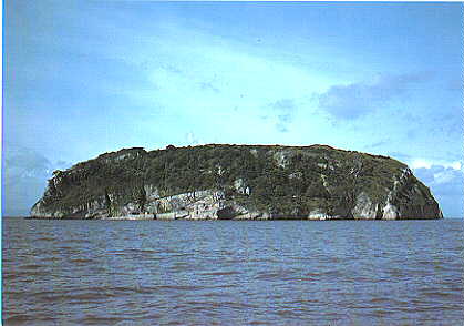
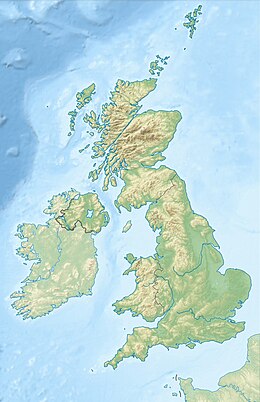
Steep Holm (a volte Ynys Ronech in gallese) è un'isola calcarea situata nell'estuario del fiume Severn nel Canale di Bristol. Amministrativamente ricade nella Contea cerimoniale di Somerset, Inghilterra. Circa 3,80 chilometri a Nord di Steep Holm si trova l'isola gallese di Flat Holm.
| Steep Holm | |
|---|---|
 | |
| Geografia fisica | |
| Localizzazione | Fiume Severn |
| Coordinate | 51°20′23″N 3°06′35″W |
| Altitudine massima | 78 m s.l.m. |
| Geografia politica | |
| Stato | |
| Nazione costitutiva | |
| Contea | Somerset |
| Autorità unitaria | North Somerset |
| Cartografia | |
 | |
 Steep Holm | |
| voci di isole del Regno Unito presenti su Wikipedia | |
Voci correlate
Altri progetti
 Wikimedia Commons contiene immagini o altri file su Steep Holm
| Controllo di autorità | VIAF (EN) 315527770 · LCCN (EN) sh93005828 |
|---|
На других языках
[de] Steep Holm
Steep Holm (walisisch Ynys Rhonech, Altenglisch: Ronech, Steopanreolice) ist eine englische Insel im Bristolkanal. Die Insel hat eine Fläche von 48.87 acre (19,78 ha) bei Flut und dehnt sich bei Ebbe bis auf 63.26 acre (25,6 ha) aus.[1] Der höchste Punkt liegt bei 78 m über dem Meer. Die Insel gehört historisch zu Somerset und verwaltungstechnisch zu North Somerset.[2] Vom 1. April 1974 bis zum 1. April 1996 gehörte sie zum County of Avon. Das Nahe gelegene Flat Holm gehört zu Wales.[en] Steep Holm
Steep Holm (Welsh: Ynys Rhonech, Old English: Ronech and later Steopanreolice[1]) is an English island lying in the Bristol Channel. The island covers 48.87 acres (19.78 ha) at high tide, expanding to 63.26 acres (25.60 ha) at mean low water.[2] At its highest point it is 78 metres (256 ft) above mean sea level. Administratively it forms part of the unitary authority of North Somerset within the ceremonial county of Somerset;[3] between 1 April 1974 and 1 April 1996, it was administered as part of Avon.[2] Nearby is Flat Holm island (Welsh: Ynys Echni), part of Wales.[fr] Steep Holm
Steep Holm est une île anglaise située dans le canal de Bristol. L'île a une superficie de 19,78 ha à marée haute, surface augmentant jusqu'à 25,60 ha à marée basse (1 km de long sur 400 m de large)[1]. Le plus haut point de l'île est à 78 m au-dessus du niveau de la mer. L'île est incluse dans les frontières historiques du Somerset et appartient administrativement au North Somerset[2]. L'île a été administrée entre le 1er avril 1974 et le 1er avril 1996 par le comté d'Avon[1].- [it] Steep Holm
Текст в блоке "Читать" взят с сайта "Википедия" и доступен по лицензии Creative Commons Attribution-ShareAlike; в отдельных случаях могут действовать дополнительные условия.
Другой контент может иметь иную лицензию. Перед использованием материалов сайта WikiSort.org внимательно изучите правила лицензирования конкретных элементов наполнения сайта.
Другой контент может иметь иную лицензию. Перед использованием материалов сайта WikiSort.org внимательно изучите правила лицензирования конкретных элементов наполнения сайта.
2019-2026
WikiSort.org - проект по пересортировке и дополнению контента Википедии
WikiSort.org - проект по пересортировке и дополнению контента Википедии