geo.wikisort.org - Isola
St Francis Island (nome originale in olandese: Eyland St. François) è un'isola del Nuyts Archipelago, si trova nella Gran Baia Australiana lungo la costa dell'Australia Meridionale (Australia). L'isola fa parte ed è la maggiore del sottogruppo delle Isles of St Francis assieme alle quali costituisce il Isles of St Francis Conservation Park.[2] È compresa inoltre nel Nuyts Archipelago Wilderness Protection Area[3], mentre le acque che circondano le sue coste si trovano all'interno del Nuyts Archipelago Marine Park[4].
| St Francis Island | |
|---|---|
| Geografia fisica | |
| Localizzazione | Gran Baia Australiana |
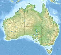
| Coordinate | 32°31′S 133°17′E |
| Arcipelago | Nuyts Archipelago |
| Superficie | 8,09[1] km² |
| Altitudine massima | 81 m s.l.m. |
| Geografia politica | |
| Stato | |
| Stato federato | |
| Cartografia | |
 St Francis Island | |
| voci di isole dell'Australia presenti su Wikipedia | |
Geografia
St Francis Island si trova a sud-ovest della città di Ceduna, alla distanza di 27 km da Rocky Point. L'isola ha una superficie di 8,09 km²[1] e una vetta di 81 m sulla costa sud-orientale, sormontata da un faro automatico e da un radiofaro.[2] L'isola supporta una grande colonie di berta codacorta (273 000 coppie stimate)[1].

Note
- (EN) Nuyts Archipelago, su datazone.birdlife.org. URL consultato il 27 marzo 2018.
- Island Parks of Western Eyre Peninsula Management Plan (PDF), Adelaide, Department for Environment and Heritage, South Australia, 2006, pp. 2-3, ISBN 1-921238-18-6.
- (EN) Nuyts Archipelago Wilderness Protection Area, su protectedplanet.net. URL consultato il 26 marzo 2018.
- (EN) Nuyts Archipelago Marine Park (PDF), su environment.sa.gov.au. URL consultato il 27 marzo 2018 (archiviato dall'url originale il 7 aprile 2019).
На других языках
[en] St Francis Island
St Francis Island (originally in Dutch: Eyland St. François) is an island on the south coast of South Australia near Ceduna. It is part of the Nuyts Archipelago. It was one of the first parts of South Australia to be discovered and named by Europeans, along with St Peter Island, mapped by François Thijssen in 't Gulden Zeepaert in 1627.- [it] St Francis Island
Другой контент может иметь иную лицензию. Перед использованием материалов сайта WikiSort.org внимательно изучите правила лицензирования конкретных элементов наполнения сайта.
WikiSort.org - проект по пересортировке и дополнению контента Википедии