geo.wikisort.org - Isola
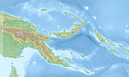
Manus è un'isola dell'Oceania localizzata nel nord della Papua Nuova Guinea.
| Manus | |
|---|---|
 | |
| Geografia fisica | |
| Localizzazione | Oceano Pacifico |
| Coordinate | 2°05′S 147°00′E |
| Arcipelago | Isole dell'Ammiragliato |
| Superficie | 2.100 km² |
| Altitudine massima | Monte Dremsel, 718 m s.l.m. |
| Geografia politica | |
| Stato | |
| Provincia | |
| Centro principale | Lorengau |
| Demografia | |
| Abitanti | 33.000 |
| Densità | 15,71 ab./km² |
| Cartografia | |
 | |
| voci di isole della Papua Nuova Guinea presenti su Wikipedia | |
È l'isola più grande delle Isole dell'Ammiragliato, e la quinta per dimensione di Papua Nuova Guinea con una superficie di circa 2.100 km². L'isola è coperta prevalentemente dalla giungla.
Il punto più alto è il Monte Dremsel con 718 metri sul livello del mare, localizzato nella parte centrale della costa meridionale. Manus è di origine vulcanica, emersa dalla superficie dell'oceano nel tardo Miocene, 8-10 milioni di anni fa.
Manus ha una popolazione di circa 33.000 abitanti. Amministrativamente è un distretto della provincia di Manus e Lorengau, la capitale della provincia, si trova sull'isola.
Altri progetti
 Wikimedia Commons contiene immagini o altri file su Manus
Collegamenti esterni
- (EN) Manus, su Enciclopedia Britannica, Encyclopædia Britannica, Inc.
| Controllo di autorità | VIAF (EN) 315528137 |
|---|
На других языках
[de] Manus (Insel)
Manus (weitere Bezeichnungen: Moánus, Taui, Tjawomu, Kor[1]) ist eine Insel im Norden von Papua-Neuguinea. Sie liegt in der Bismarcksee und gehört zur Manus Province von Papua-Neuguinea.[en] Manus Island
Manus Island is part of Manus Province in northern Papua New Guinea and is the largest of the Admiralty Islands. It is the fifth-largest island in Papua New Guinea, with an area of 2,100 km2 (810 sq mi), measuring around 100 km × 30 km (60 mi × 20 mi). Manus Island is covered in rugged jungles which can be broadly described as lowland tropical rain forest. The highest point on Manus Island is Mt. Dremsel, 718 metres (2,356 ft) above sea level at the centre of the south coast. Manus Island is volcanic in origin and probably broke through the ocean's surface in the late Miocene, 8 to 10 million years ago. The substrate of the island is either directly volcanic or from uplifted coral limestone.[fr] Manus
Manus est une des îles de l'Amirauté, de la Papouasie-Nouvelle-Guinée faisant partie de la province de Manus.- [it] Manus (isola)
[ru] Манус (остров)
Ма́нус[1] (англ. Manus Island) — главный остров островов Адмиралтейства, подгруппы архипелага Бисмарка. Занимает площадь около 1940,2 км²[2], протяженность береговой линии 361,3 км. Является пятым по величине островом Папуа — Новой Гвинеи. Административно относится к провинции Манус региона Айлендс.Текст в блоке "Читать" взят с сайта "Википедия" и доступен по лицензии Creative Commons Attribution-ShareAlike; в отдельных случаях могут действовать дополнительные условия.
Другой контент может иметь иную лицензию. Перед использованием материалов сайта WikiSort.org внимательно изучите правила лицензирования конкретных элементов наполнения сайта.
Другой контент может иметь иную лицензию. Перед использованием материалов сайта WikiSort.org внимательно изучите правила лицензирования конкретных элементов наполнения сайта.
2019-2025
WikiSort.org - проект по пересортировке и дополнению контента Википедии
WikiSort.org - проект по пересортировке и дополнению контента Википедии
