geo.wikisort.org - Isola
Ko Samet è una isola del Golfo di Thailandia, posta a circa 220 km da Bangkok, non lontano dalla città di Rayong.
| Ko Samet เกาะเสม็ด | |
|---|---|
 | |
| Geografia fisica | |
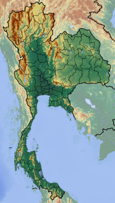
| Localizzazione | Golfo di Thailandia |
| Coordinate | 12°34′04″N 101°27′17″E |
| Geografia politica | |
| Stato | |
| Provincia | Rayong |
| Cartografia | |
 Ko Samet | |
| voci di isole della Thailandia presenti su Wikipedia | |
Altre isole nelle vicinanze sono :
- Ko Kruai, Ko Kham e Ko Pla Tin;
- Ko Kudi (chiamata anche Ko Kut);
- Ko Thalu;
- Ko Chan.
Monumenti e luoghi d'interesse
Hat Sai Kaeo
Ao Noi Na
Ao Hin Khok
Ao Pai
Ao Phutsa
Ao Thapthim
Ao Nuan
Ao Wong Duean

Una delle spiagge più belle dell'isola, tranquilla e riparata.
Ao Thian
Ao Wai
Ao Kiu Nok
Ao Karang
Ao Wiang Wan
Ao Phrao
Altri progetti
 Wikimedia Commons contiene immagini o altri file su Ko Samet
Collegamenti esterni
- Ente del turismo thailandese, su tourismthailand.org. URL consultato il 7 luglio 2009 (archiviato dall'url originale il 17 dicembre 2007).
| Controllo di autorità | VIAF (EN) 315530062 · WorldCat Identities (EN) viaf-315530062 |
|---|
На других языках
[de] Ko Samet
Ko Samet (Thai: .mw-parser-output .Thai{font-size:115%}เกาะเสม็ด, auch Koh Samed und ähnliche Schreibweisen) ist eine Insel (Ko, Thai เกาะ = Insel) im Golf von Thailand, die der Küstenlinie der Provinz Rayong (Thailand) etwa 6,5 Kilometer vorgelagert ist.[en] Ko Samet
Ko Samet[1] (Cajeput Island; Thai: เกาะเสม็ด, Thai pronunciation: [kɔ̀ʔ samèt]) is one of the eastern seaboard islands of Thailand. It is in the Gulf of Thailand off the coastline of the Thai province of Rayong, approximately 220 kilometres (140 mi) southeast of Bangkok. Ko Samet is part of the Phe (Thai: เพ) Subdistrict of the Amphoe Mueang Rayong (Thai: เมืองระยอง, the capital district, or Amphoe Mueang), of Rayong Province. Ko Samet is the largest and westernmost of a cluster of islands not far from the coast. Ko Samet measures 6.8 kilometres (4.2 mi) from north to south. At its closest point to the mainland, the island is 2.6 kilometres (1.6 mi) south of mainland Rayong Province; however the actual travelling distance from the main commercial tourist pier in the town of Phe to the island's closest tourist beach is about 10 kilometres (6.2 mi).[es] Ko Samet
Ko Samet (en idioma tailandés:เกาะเสม็ด) es una isla en la provincia de Rayong, Tailandia, situada en el golfo de Tailandia aproximadamente a 220 km al sudeste de Bangkok. Ko Samet es parte del distrito Amphoe Mueang Rayong. La isla recibe su nombre de un tipo de árbol que se encuentra a lo largo y ancho de la isla, cuyo nombre en tailandés es Samet. En el pasado la isla también era conocida como Ko Kaew Phitsadan, que significa la isla del cristal mágico.[fr] Ko Samet
Ko Samet (thaï : เกาะเสม็ด), est une île thaïlandaise située dans le golfe de Thaïlande, à environ 220 kilomètres au sud de Bangkok[1], capitale du pays.- [it] Ko Samet
[ru] Самет
Самет (тайск. เกาะเสม็ด) — небольшой (13,1 км²) остров в Сиамском заливе, административно относится к провинции Районг в 6,5 км к югу от континента. Имеется один небольшой населенный пункт, деревня Надан. Отели бунгального типа имеются практически на всех основных пляжах острова. Самет — самый большой из небольшой группы островов, расположенных недалеко от берега.Текст в блоке "Читать" взят с сайта "Википедия" и доступен по лицензии Creative Commons Attribution-ShareAlike; в отдельных случаях могут действовать дополнительные условия.
Другой контент может иметь иную лицензию. Перед использованием материалов сайта WikiSort.org внимательно изучите правила лицензирования конкретных элементов наполнения сайта.
Другой контент может иметь иную лицензию. Перед использованием материалов сайта WikiSort.org внимательно изучите правила лицензирования конкретных элементов наполнения сайта.
2019-2026
WikiSort.org - проект по пересортировке и дополнению контента Википедии
WikiSort.org - проект по пересортировке и дополнению контента Википедии