geo.wikisort.org - Isola
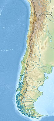
L'isla Gordon è un'isola del Cile meridionale nell'oceano Pacifico. Appartiene alla regione di Magellano e dell'Antartide Cilena, alla provincia dell'Antartica Cilena e al comune di Cabo de Hornos. Si trova nel canale di Beagle, fa parte dell'arcipelago della Terra del Fuoco e si trova all'interno del Parco nazionale Alberto de Agostini.
| Isla Gordon | |
|---|---|
 | |
| Geografia fisica | |
| Localizzazione | Canale di Beagle |
| Coordinate | 54°58′S 69°35′W |
| Arcipelago | Terra del Fuoco |
| Superficie | 591,3[1] km² |
| Sviluppo costiero | 228,3[1] |
| Geografia politica | |
| Stato | |
| Regione | di Magellano e dell'Antartide Cilena |
| Provincia | dell'Antartica Cilena |
| Comune | Cabo de Hornos |
| Cartografia | |
 | |
 Isla Gordon | |
| voci di isole del Cile presenti su Wikipedia | |
Geografia
L'isola Gordon ha la forma di un triangolo isoscele con la base a ovest; il vertice (a est), costituito dalla punta Divide, separa il canale di Beagle in due bracci: il Brazo del Sudoeste che scorre lungo tutta la sua costa meridionale, e il Brazo del Noroeste, che bagna la costa settentrionale. A sud-ovest l'isola si affaccia sulla baia Cook. La sua superficie è di 591,3 km²[1] e lo sviluppo costiero di 228,3 km[1]; l'isola è lunga 28 miglia (est-ovest) e larga 9,5 nel punto massimo. Nel suo settore orientale c'è un picco senza nome alto 1 584 metri. L'insenatura maggiore si apre sulla costa nord: la bahía Tres Brazos; più a est si trova la bahía Romanche e sul lato sud la bahía Fleuriais.
Storia
Dato il suo carattere montuoso e la mancanza di risorse, l'isola era disabitata e solo occasionalmente visitata dai membri del popolo Kaweshkar e Yámana, che a metà del XIX secolo erano praticamente scomparsi per l'azione dell'uomo bianco. Gli indigeni erano soliti cercare nell'area la pirite necessaria per accendere il fuoco.[2]
Nel maggio del 1830 Robert FitzRoy a bordo della HMS Beagle percorse il Brazo del Noroeste del canale di Beagle fino all'altezza della baia Tres Brazos. Durante questo viaggio egli imbarcò un indio Yámana (che in seguito chiamò Jemmy Button) ed altri 3 prigionieri Kaweshkar e li portò con sé in Inghilterra.[3]
Nei mesi di gennaio e febbraio del 1833 il comandante FitzRoy era nuovamente nell'area a bordo della Beagle per completare i rilievi idrografici dei canali della terra del Fuoco. In tale occasione riportò nelle loro terre i tre fuegini sopravvissuti al viaggio in Inghilterra (Jemmy Button, Fuegia Basket e York Minster).[4]
Note
- Gordon, su islands.unep.ch. URL consultato il 3 agosto 2018.
- Anne Chapman, Yaganes del cabo de Hornos. Encuentro con los europeos antes y después de Darwin, Santiago del Cile, Pehuén editores S.A., 2012.
- Phillip Parker King, Robert FitzRoy, Chapter XXIII, in Narrative of the surveying voyages of His Majesty's Ships Adventure and Beagle between the years 1826 and 1836, describing their examination of the southern shores of South America, and the Beagle's circumnavigation of the globe. Proceedings of the first expedition, 1826-30, under the command of Captain P. Parker King, Londra, Henry Colburn, 1839.
- Robert FitzRoy, Chapter X,XV, in Narrative of the surveying voyages of His Majesty's Ships Adventure and Beagle between the years 1826 and 1836, describing their examination of the southern shores of South America, and the Beagle's circumnavigation of the globe. Proceedings of the second expedition, 1831-36, under the command of Captain Robert Fitz-Roy, Londra, Henry Colburn, 1839.
Voci correlate
На других языках
[en] Gordon Island
Gordon Island (Spanish: Isla Gordon) is an island in the Tierra del Fuego archipelago located between the Tierra del Fuego (Isla Grande) and the Hoste Island. It divides the Beagle Channel in two arms, the Northwest arm or Pomar Channel and the Southwest arm.[es] Isla Gordon
La isla Gordon forma parte del archipiélago de Tierra del Fuego ubicado en la región austral de Chile. Pertenece al sector que para su estudio se ha denominado como de las islas del S y SE.[fr] Île Gordon
L'île Gordon (en espagnol : Isla Gordon) est une île de l'archipel de Terre de Feu. L'île est rattachée administrativement à la commune de Cabo de Hornos, dans la région de Magallanes et de l'Antarctique chilien, au Chili. Elle a une superficie de 591 km2. Son point culminant (non nommé) est à une altitude de 1 548 mètres, il se situe dans la partie orientale de l'île.- [it] Isla Gordon
[ru] Гордон (остров)
Гордон (исп. Isla Gordon) — необитаемый остров архипелага Огненная Земля, административно относящийся к коммуне Кабо-де-Орнос (провинция Антарктика-Чилена, область Магальянес, Чили). Находится в проливе Бигл, разделяя его на два рукава: северный и южный. Остров является частью национального парка Альберто-де-Агостини[en][1]Другой контент может иметь иную лицензию. Перед использованием материалов сайта WikiSort.org внимательно изучите правила лицензирования конкретных элементов наполнения сайта.
WikiSort.org - проект по пересортировке и дополнению контента Википедии