geo.wikisort.org - Isola
Inglis Island è la maggiore isola del gruppo delle The English Company's Islands[2]. È situata nel mare degli Arafura, all'estremità nord-est della Terra di Arnhem nel Territorio del Nord, in Australia. L'isola fa parte della contea di East Arnhem.
| Inglis Island | |
|---|---|
| Geografia fisica | |
| Localizzazione | Mare degli Arafura |
| Coordinate | 12°01′S 136°13′E |
| Arcipelago | The English Company's Islands |
| Superficie | 83,5[1] km² |
| Dimensioni | 23,4 × 7 km |
| Sviluppo costiero | 106[1] km |
| Altitudine massima | 70[1] m s.l.m. |
| Geografia politica | |
| Stato | |
| Stato federato | |
| Local government area | Contea di East Arnhem |
| Cartografia | |
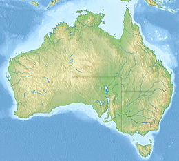
| voci di isole dell'Australia presenti su Wikipedia | |
Geografia
Inglis Island si trova a nord-est della baia di Buckingham, a nord della baia di Arnhem e a sud delle Wessel Islands. La superficie dell'isola è di 83,5 km², l'altezza di 70 m.[1] L'isola è separata dal continente dal Nalwarung Strait, largo 2,5 km nel punto più stretto. Accostato alla sua estremità nord-orientale si trova l'isolotto di Bosanquet (11°57′33″S 136°19′45″E). A sud di Inglis Island, all'ingresso della baia di Arnhem, si trova Mallison Island (12°11′06″S 136°07′48″E).
Storia
L'isola è stata così nominata nel febbraio del 1803 da Matthew Flinders che mappava la zona sul HMS Investigator. Egli nominò molte isole del gruppo prendendo i nomi di personaggi dell'East India Directory.[3][4]
Note
- Inglis, su islands.unep.ch. URL consultato il 6 marzo 2018.
- United States. National Geospatial-Intelligence Agency., North, West and South Coasts of Australia, Annapolis, Lighthouse Press, 2004, p. 21, ISBN 9781577856559.
- A New Oriental Register and East-India Directory for 1802, Londra.
- Matthew Flinders, A Voyage to Terra Australis ..in the years 1801-1803, vol. 2, Londra, G. & W. Nicol, Pall-Mall, 1814, p. 233.
Collegamenti esterni
- (EN) Wessel and English Company island groups (PDF), su territorystories.nt.gov.au. URL consultato il 6 marzo 2018 (archiviato dall'url originale il 6 marzo 2018).
На других языках
[en] Inglis Island
Inglis Island is the largest of a group called the English Company's Islands, in Northern Territory, Australia. It is 23.4 km long and up to 7 km wide. Its area is 83.5 km2, and it reaches a height of 70 meters.[1] The distance to the mainland south of it is 2.5 km at the closest place, across Nalwarung Strait, which is the southwestern continuation of Malay Road.[fr] Île Inglis
L'île Inglis est la plus grande des îles de l'archipel appelé The English Company's Islands, dans le Territoire du Nord en Australie.- [it] Inglis Island
Другой контент может иметь иную лицензию. Перед использованием материалов сайта WikiSort.org внимательно изучите правила лицензирования конкретных элементов наполнения сайта.
WikiSort.org - проект по пересортировке и дополнению контента Википедии
