geo.wikisort.org - Isola
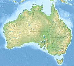
French Island è un'isola situata a sud-est di Melbourne, nello stato di Victoria, in Australia. Appartiene a un'area non incorporata. L'isola si trova al centro della Western Port Bay, insenatura che si apre nella parte settentrionale dello stretto di Bass. Due terzi dell'isola sono parco nazionale (French Island National Park)[4].
| French Island | |
|---|---|
 | |
| Geografia fisica | |
| Coordinate | 38°21′00″S 145°22′12″E |
| Superficie | 218[1] km² |
| Dimensioni | 20 × 14 (ca)[2] km |
| Geografia politica | |
| Stato | |
| Stato federato | |
| Local government area | Area non incorporata |
| Demografia | |
| Abitanti | 116[3] (2011) |
| Cartografia | |
| voci di isole dell'Australia presenti su Wikipedia | |
Ci sono due piccoli insediamenti sul lato occidentale dell'isola: Tankerton e Fairhaven.[2] Al censimento del 2011 la popolazione era di 116 abitanti.[3]
Geografia
L'isola, lunga circa 20 km e larga 14[2], ha una superficie di circa 218 km²[1]; il punto più alto è il monte Wellington (96 m).[2]
Isole adiacenti:
- Philliph Island, a sud-ovest di French Island.
- Elizabeth Island, piccola isola a sud; ha una superficie di 0,26 km² ed è alta 20 m.
Fauna
French Island ha una numerosa e sana colonia di koala; regolarmente la popolazione in eccesso viene portata sulla terraferma per ripopolare aree in sofferenza. È presente il potoroo dal naso lungo.
L'isola offre riparo a 260 specie di uccelli, tra cui spiccano la quaglia pettoblu, il pappagallo panciarancio (specie in pericolo critico), la sterna delle fate e l'aquila pescatrice panciabianca.
Storia
Prima dell'insediamento europeo, l'isola era utilizzata come terreno di caccia dagli aborigeni della tribù Bunurong. Vivevano sulla terraferma e andavano su French Island per raccogliere molluschi e uova di cigno.
Nell'aprile del 1802, la nave da spedizione francese Le Naturaliste guidata da Jacques Hamelin esplorò l'area, come parte della spedizione di Nicolas Baudin in Australia. Chiamò l'isola Ile de France[1], anglicizzato poi in French Island.[5]
Note
- (EN) French Island, su britannica.com. URL consultato il 16 aprile 2018.
- (EN) French Island, su victorianplaces.com.au. URL consultato il 16 aprile 2018.
- French Island, su censusdata.abs.gov.au. URL consultato il 16 aprile 2018.
- French Island National Park (PDF), su parkweb.vic.gov.au. URL consultato il 16 aprile 2018 (archiviato dall'url originale il 17 aprile 2018).
- Ernest Scott, Terre Napoléon: A History of French Explorations and Projects in Australia, Cambridge, Cambridge University Press, 2011, p. 191, ISBN 9781108030786.
Altri progetti
 Wikimedia Commons contiene immagini o altri file su French Island
Collegamenti esterni
- (EN) French Island, su Enciclopedia Britannica, Encyclopædia Britannica, Inc.
| Controllo di autorità | VIAF (EN) 315131130 · LCCN (EN) sh90004672 · J9U (EN, HE) 987007536932605171 (topic) |
|---|
На других языках
[de] French Island (Victoria)
French Island ist eine Insel in der Western Port Bay 61 km südlich von Melbourne, Victoria (Australien). Rund 70 Prozent der Inselfläche von 170 km² gehören zum French-Island-Nationalpark.[en] French Island (Victoria)
French Island (Boonwurrung: Bellarmarin, Woone, or Jouap)[3] is the largest coastal island of Victoria, Australia, located in Western Port, 61 km (38 mi) southeast of Melbourne. In 1997, about 70% of the island was declared the French Island National Park, administered by Parks Victoria, and was listed in the former Register of the National Estate in 1984.[4] The island is an unincorporated area under the direct administration of the government of Victoria, and is a declared locality of Victoria having its own postcode. Community issues are dealt by the French Island Community Association. The island is otherwise administered by the Department of Transport (Victoria). The population of the island in 2011 was around 116 people,[1] of which about 60 were permanent residents.[fr] French Island
French Island est une île située dans la baie de Western Port, au sud de Melbourne ; c'est une zone non incorporée de l'État de Victoria en Australie.- [it] French Island (Victoria)
[ru] Френч (остров)
Френч (англ. French Island) — прибрежный остров в штате Виктория, Австралия. Постоянное население — 119 человек (2016). Туристическая инфраструктура для нужд экологического туризма, отделение почты, один универсальный магазин. Около 70 % площади острова занимает национальный парк[en].Другой контент может иметь иную лицензию. Перед использованием материалов сайта WikiSort.org внимательно изучите правила лицензирования конкретных элементов наполнения сайта.
WikiSort.org - проект по пересортировке и дополнению контента Википедии
