geo.wikisort.org - Île
Les îles Chandeleur ou îles de Chandeleur se situent dans le golfe du Mexique, au large des côtes de la Louisiane.
Cet article est une ébauche concernant le monde insulaire et la Louisiane.
Vous pouvez partager vos connaissances en l’améliorant (comment ?) selon les recommandations des projets correspondants.
| Îles Chandeleur | |||

| |||
| Géographie | |||
|---|---|---|---|
| Pays | |||
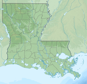
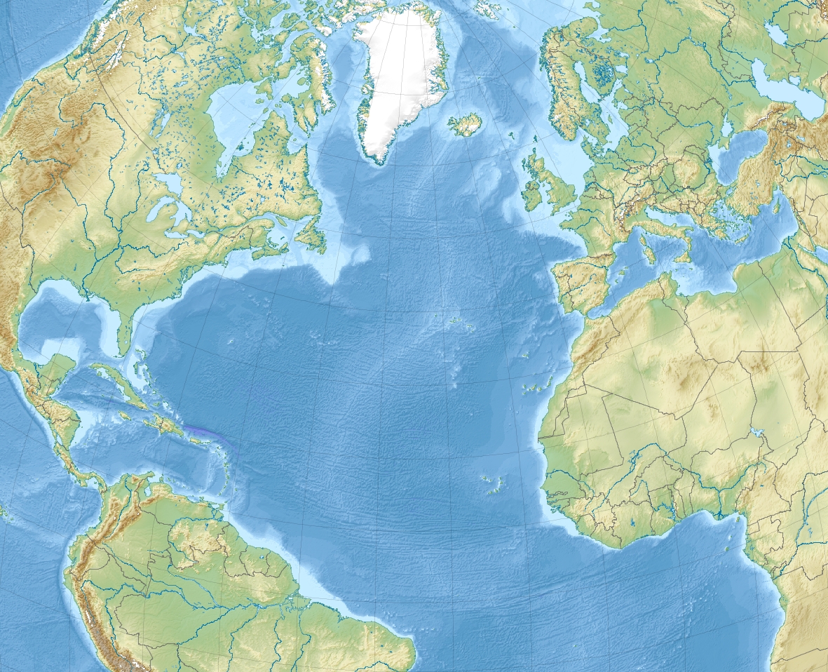
| Localisation | Golfe du Mexique (Océan Atlantique) | ||
| Coordonnées | 29° 50′ 09″ N, 88° 50′ 04″ O | ||
| Nombre d'îles | 7 | ||
| Île(s) principale(s) | Chandeleur Islands | ||
| Administration | |||
| Statut | Inclus dans le National Wildlife Refuge Breton (en) | ||
| États des États-Unis | Louisiane | ||
| Démographie | |||
| Population | Aucun habitant | ||
| Autres informations | |||
| Géolocalisation sur la carte : Louisiane
Géolocalisation sur la carte : océan Atlantique
| |||
| Île aux États-Unis | |||
| modifier |
|||
Géographie
Elles forment une barrière d'environ 80 km de long et sont composées de 7 îles principales :
- North Chandeleur Islands :
- Chandeleur Island (la plus longue)
- North Island
- New Harbor Island
- Freemason Island
- South Chandeleur Islands :
- Curlew Island
- Grand Gosier Island
- Breton Island
Histoire
Les îles ont été formées il y a plus de deux mille ans dans le delta du Mississippi.
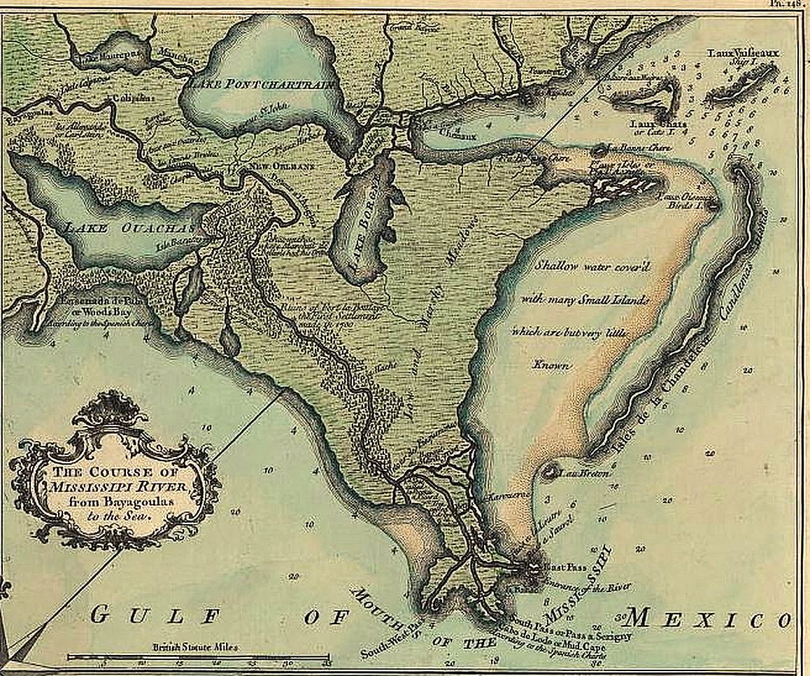
Les îles ont été nommées au début du XVIIIe siècle par des colons français lors de l'exploration du fleuve par l'explorateur Pierre Le Moyne d'Iberville (1661-1706), qui les découvrit le [1], la veille du jour de la fête religieuse de la Chandeleur.
Les îles ont été constituées en réserve naturelle en 1904. Elle est le second plus ancien refuge pour oiseaux du système National Wildlife Refuge.
Galerie

Carte de 1720 
Pointe nord avec le phare 
Après l'ouragan Georges (1989) 
Avant et après l'ouragan Katrina (2005)


Références
- Camille Le Tallec, « Chandeleur », La Croix, (ISSN 0242-6056, lire en ligne).
Voir aussi
Lien interne
 Portail de la Louisiane
  Portail du monde insulaire
На других языках
[de] Chandeleur Islands
Die Chandeleur Islands, älter auch Candlemas Islands, sind eine rund 90 Kilometer lange, flache, unbewohnte Inselkette im Golf von Mexiko vor der Küste Louisianas, dessen östlichster Punkt auf ihnen liegt. Sie gehören zum Territorium des St. Bernard Parish.[en] Chandeleur Islands
The Chandeleur Islands (French: Îles Chandeleur) are a chain of uninhabited barrier islands approximately 50 miles (80 km) long, located in the Gulf of Mexico, marking the outer boundary of the Chandeleur Sound. They form the easternmost point of the state of Louisiana, United States and are a part of the Breton National Wildlife Refuge. They are an important migrating point for many birds on their way south, and are a prime marsh and forest wildlife area.- [fr] Îles Chandeleur
Другой контент может иметь иную лицензию. Перед использованием материалов сайта WikiSort.org внимательно изучите правила лицензирования конкретных элементов наполнения сайта.
WikiSort.org - проект по пересортировке и дополнению контента Википедии