geo.wikisort.org - Île
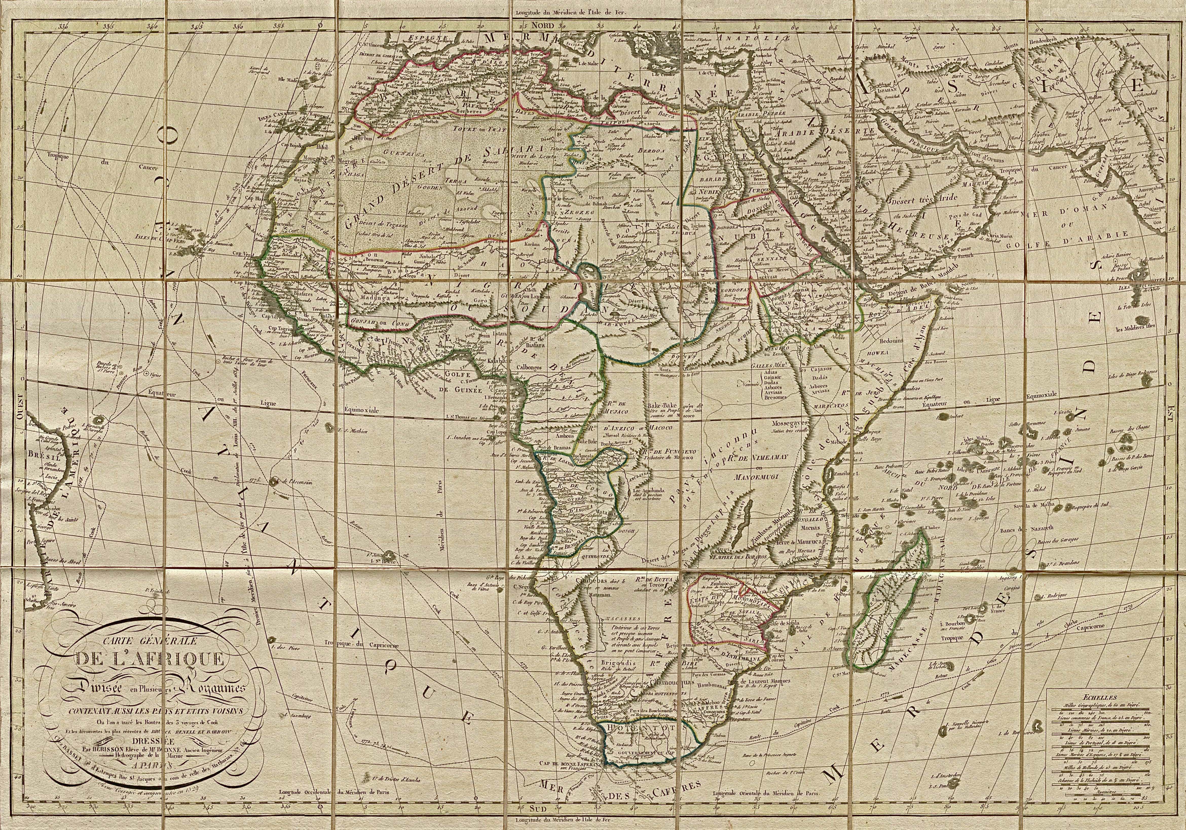
L’île Saint-Mathieu est une île fantôme, indiquée sur plusieurs cartes du début du XVIe siècle au début du XXe siècle, environ 1 000 kilomètres au nord-est de l'île de l'Ascension, approximativement à 2°S et 8°W. Elle aurait été découverte par des explorateurs portugais en 1516, le jour de la Saint-Mathieu. García Jofre de Loaísa l'aurait visitée le , au cours d'un voyage en direction des Moluques. Elle apparaît sous ce nom sur plusieurs cartes à partir du début du XVIe siècle, notamment la carte du continent africain Africae Tabula Nova d'Abraham Ortelius. James Cook tente en vain de l'atteindre en 1775, au cours de son deuxième voyage[1]. Peter Leonard (1833) indique que l'erreur pourrait venir d'une confusion avec l'île d'Annobón, située à la même latitude, mais à 5°38' E de longitude[2]. Elle disparaît progressivement des cartes entre le début du XIXe siècle et le début du XXe siècle[3].
Pour l'île alaskane en mer de Béring, voir Île Saint-Matthieu.
Cet article est une ébauche concernant le monde insulaire.
Vous pouvez partager vos connaissances en l’améliorant (comment ?) selon les recommandations des projets correspondants.
Consultez la liste des tâches à accomplir en page de discussion.

Cartes mentionnant l'île Saint-Mathieu
- « S. Matheo », Atlas Vallard, Nicolas Vallard, 1547
- « S. Matheo », Africae Tabula Nova, Abraham Ortelius, 1570
- « I.de S.Matheus », Gerard de Jode, 1593
- « S. Matheo », Atlas sive Cosmographicae meditationes de fabrica mvndi et fabricati figvra, Mercator, 1595
- « I. de S. Matheus », Jan Huygen van Linschoten, 1596
- « S. Matthew », James Rennell, 1799
- « St. Mathew », Arrowsmith et Lewis, 1812
- « St. Mathäus », 1828
- « I. S. Mathieu », 1829
- « St Mattheus », Thomas Bradford, 1835
Notes et références
- James Cook, The voyages of Captain James Cook round the world: printed verbatim from the original editions, and embellished with a selection of the engravings, vol. 4, Londres, Sherwood, Neely, and Jones, 1813, p. 248.
- Peter Leonard, Records of a voyage to the western coast of Africa in His Majesty's ship Dryad: during the years 1830, 1831, and 1832, Édimbourg, A. Shortrede, 1833, p. 216.
- (en) « Mar di Æthiopia Vulgo Oceanus Æthiopicus, Jansson, 1650 », The St. Helena Virtual Library and Archive.
Voir aussi
- Saxemberg
- Île Thompson
 Portail du monde insulaire
  Portail de l’océan Atlantique
На других языках
[de] St. Matthäusinsel
Die St. Matthäusinsel ist eine Phantominsel im südlichen Atlantischen Ozean, die vom sechzehnten bis in das frühe zwanzigste Jahrhundert in Nachschlagewerken und auf Landkarten eingetragen war.[en] St. Matthew Island (phantom island)
St Matthew Island is a phantom island once thought to lie roughly one thousand kilometers northeast of Ascension Island in the Atlantic Ocean. It appeared on navigational charts until as late as the early twentieth century. It was supposedly located at approximately 2°S 8°W, and was alleged to have been discovered by the Portuguese on St. Matthew's Day 1516.[citation needed] It was shown and named on several maps going back to the beginning of the sixteenth century, and it was supposedly visited by García Jofre de Loaísa on 20 October 1525 while on a voyage to the Moluccas. It appeared on early Portuguese charts and world maps, and appears on Ortelius' 1570 map of the African continent Africae Tabula Nova. It thereafter regularly featured on charts and maps, and though it began to disappear from standard charts starting in the early nineteenth century, it was not completely removed from charts until the early twentieth century.[1]- [fr] Île Saint-Mathieu
Другой контент может иметь иную лицензию. Перед использованием материалов сайта WikiSort.org внимательно изучите правила лицензирования конкретных элементов наполнения сайта.
WikiSort.org - проект по пересортировке и дополнению контента Википедии