geo.wikisort.org - Île
L'île Popof (Siitikdax en aléoute) est une des îles Shumagin, située au sud de la péninsule d'Alaska (États-Unis).
Cet article est une ébauche concernant le monde insulaire et l’Alaska.
Vous pouvez partager vos connaissances en l’améliorant (comment ?) selon les recommandations des projets correspondants.
| Île Popof | |||

| |||
| Géographie | |||
|---|---|---|---|
| Pays | |||
| Archipel | Îles Shumagin | ||
| Coordonnées | 55° 19′ N, 160° 24′ O | ||
| Superficie | 93 km2 | ||
| Point culminant | 472 m | ||
| Administration | |||
| État | Alaska | ||
| Autres informations | |||
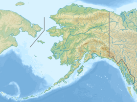
| Géolocalisation sur la carte : Alaska
Géolocalisation sur la carte : océan Pacifique
| |||
| Île aux États-Unis | |||
| modifier |
|||

La superficie de l'île Popof est de 93 km² et son point culminant est à 472 mètres au-dessus de la mer. Sa population est de 952 personnes. Le plus grand village des îles Shumagin, Sand Point, est situé au nord-ouest de cette île.
Un troupeau de 120 bisons vit dans une partie inhabitée de l'île.
 Portail de l’Alaska
  Portail du monde insulaire
На других языках
[en] Popof Island
Popof Island (Siitikdax̂[1] in Aleut) is an island in the Shumagin Islands south of mainland Alaska. The largest community in the area, Sand Point, is located on the northwest coast. Popof Island is 10 miles (16 km) long, 5 miles (8 km) wide and the peak elevation is 1,550 feet (472 meters). It is located at .mw-parser-output .geo-default,.mw-parser-output .geo-dms,.mw-parser-output .geo-dec{display:inline}.mw-parser-output .geo-nondefault,.mw-parser-output .geo-multi-punct{display:none}.mw-parser-output .longitude,.mw-parser-output .latitude{white-space:nowrap}55°18′49″N 160°22′29″W. It has a land area of 93.651 km2 (36.159 sq mi) and a total population of 578 persons at the 2020 census.- [fr] Île Popof
[it] Isola Popof
Popof (in lingua aleutina Siitikdax̂[2]) è una delle isole Shumagin, un gruppo di 20 isole al largo della costa meridionale della penisola di Alaska che appartengono amministrativamente al Borough delle Aleutine orientali. L'isola, lunga 16 km e larga 8, con un'altitudine massima di 472 m, ha una superficie di 93,65 km² ed è la seconda in ordine di grandezza, dopo l'isola Unga del gruppo delle Shumangin.[ru] Остров Попова (США)
Остров Попова[1] (англ. Popof Island, алеут. Siitikdax̂[2]) — один из островов Шумагинской группы к югу от полуострова Аляска. Входит в состав штата Аляска, США. Впервые официально отметил на карте российский гидрограф Михаил Тебеньков в 1852 году [3].Текст в блоке "Читать" взят с сайта "Википедия" и доступен по лицензии Creative Commons Attribution-ShareAlike; в отдельных случаях могут действовать дополнительные условия.
Другой контент может иметь иную лицензию. Перед использованием материалов сайта WikiSort.org внимательно изучите правила лицензирования конкретных элементов наполнения сайта.
Другой контент может иметь иную лицензию. Перед использованием материалов сайта WikiSort.org внимательно изучите правила лицензирования конкретных элементов наполнения сайта.
2019-2026
WikiSort.org - проект по пересортировке и дополнению контента Википедии
WikiSort.org - проект по пересортировке и дополнению контента Википедии