geo.wikisort.org - Île
L'Île Loaita, en tagalog : Kota Island, est une île située dans les îles Spratleys en mer de Chine méridionale. Elle est contrôlée par les Philippines depuis 1968, mais est revendiquée par la Chine, Taïwan et le Viêt Nam.
Cet article est une ébauche concernant le monde insulaire et les Philippines.
Vous pouvez partager vos connaissances en l’améliorant (comment ?) selon les recommandations des projets correspondants.
| Île Loaita | ||
| Géographie | ||
|---|---|---|
| Pays | ||
| Revendication par | ||
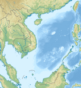
| Localisation | Mer de Chine méridionale (océan Pacifique) | |
| Coordonnées | 10° 40′ 07″ N, 114° 25′ 26″ E | |
| Administration | ||
| Géolocalisation sur la carte : mer de Chine méridionale
| ||
| modifier |
||
Références
 Portail des Philippines
  Portail du monde insulaire
  Portail de l’océan Pacifique
На других языках
[en] Loaita Island
Loaita Island also known as Kota Island (Filipino: Pulo ng Kota; Mandarin Chinese: 南鑰島/南钥岛; pinyin: Nányào Dǎo, and Vietnamese: Đảo Loại Ta), with an area of 6.45 hectares (15.9 acres) -- is the tenth largest of the naturally-occurring Spratly Islands, and the fifth largest of the Philippine-occupied islands.[1] It is located just to the west of the northern part of Dangerous Ground, and is 22 miles (35 km) southeast of Philippine-occupied Thitu Island (Pag-asa) and 22 miles (35 km) north-northeast of Taiwan-occupied Itu Aba Island.[2]- [fr] Île Loaita
Текст в блоке "Читать" взят с сайта "Википедия" и доступен по лицензии Creative Commons Attribution-ShareAlike; в отдельных случаях могут действовать дополнительные условия.
Другой контент может иметь иную лицензию. Перед использованием материалов сайта WikiSort.org внимательно изучите правила лицензирования конкретных элементов наполнения сайта.
Другой контент может иметь иную лицензию. Перед использованием материалов сайта WikiSort.org внимательно изучите правила лицензирования конкретных элементов наполнения сайта.
2019-2026
WikiSort.org - проект по пересортировке и дополнению контента Википедии
WikiSort.org - проект по пересортировке и дополнению контента Википедии