geo.wikisort.org - Île
L'île Kuiu est une île de l'archipel Alexandre, au sud-est de l'état d'Alaska aux États-Unis. Elle fait 105 km de longueur et de 6 km à 23 km de largeur.
Cet article est une ébauche concernant le monde insulaire et l’Alaska.
Vous pouvez partager vos connaissances en l’améliorant (comment ?) selon les recommandations des projets correspondants.
| Île Kuiu | |||
 Phare du cap Decision sur l'île Kuiu. | |||
| Géographie | |||
|---|---|---|---|
| Pays | |||
| Archipel | Archipel Alexandre | ||
| Localisation | Océan Pacifique | ||
| Coordonnées | 56° 32′ 26″ N, 134° 03′ 04″ O | ||
| Administration | |||
| État | Alaska | ||
| Autres informations | |||
| Géolocalisation sur la carte : océan Pacifique
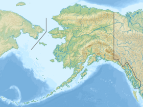
Géolocalisation sur la carte : Alaska
| |||
| Île aux États-Unis | |||
| modifier |
|||

Elle est située entre l'île Kupreanof à l'est et l'île Baranof à l'ouest et est séparée en deux parties par le canal Affleck. C'est la quinzième plus grande île des États-Unis. Elle fait intégralement partie de la forêt nationale de Tongass et héberge environ 10 personnes.
On y trouve le phare du cap Decision, construit en 1932.
L'île a été cartographiée pour la première fois par Joseph Whidbey et James Johnstone, tous deux collaborateurs de George Vancouver pendant son expédition de 1791-1794[1].
Notes et références
- (en) Cet article est partiellement ou en totalité issu de l’article de Wikipédia en anglais intitulé « Kuiu Island » (voir la liste des auteurs).
Voir aussi
Articles connexes
- Archipel Alexandre
- Île Kupreanof
- Île Baranof
- Forêt nationale de Tongass
 Portail de l’Alaska
  Portail du monde insulaire
  Portail de l’océan Pacifique
На других языках
[de] Kuiu Island
Kuiu Island ist eine im Südosten von Alaska (Panhandle) gelegene Insel des Alexanderarchipels im Pazifischen Ozean. Die Insel ist etwa 1936 km² groß, 105 km lang und an ihrer breitesten Stelle etwa 37 km breit. Die Insel ist durch die Chatham Strait von Chichagof Island, Baranof Island und Admiralty Island getrennt.[en] Kuiu Island
Kuiu Island is an island in the Alexander Archipelago in southeastern Alaska. It lies between Kupreanof Island, to its east, and Baranof Island, to its west. The island is 105 km (65 mi) long, and 10 to 23 km (6–14 miles) wide. It is nearly cut in two by Affleck Canal. It has 1,936.16 km2 (747.56 sq mi) of land area, making it the 15th largest island in the United States. The entire island is part of Tongass National Forest. The population was 10 persons at the 2000 census. It is separated from Baranof Island by Chatham Strait.[es] Isla Kuiu
La isla Kuiu es una de las principales islas del archipiélago Alexander, perteneciente al área censal de Wrangell-Petersburgo, en la región sudeste del estado de Alaska, en los Estados Unidos. Tiene una superficie de 1 936,1 km², siendo por tamaño la 16ª isla de los Estados Unidos y la (210ª del mundo).- [fr] Île Kuiu
[it] Kuiu Island
Kuiu Island fa parte dell'arcipelago Alexander, nell'Alaska sud-orientale, Stati Uniti d'America. Amministrativamente appartiene al Borough di Petersburg. L'isola si trova all'interno della Tongass National Forest[2].[ru] Кую
Кую[2] (англ. Kuiu Island) — остров в составе архипелага Александра, штат Аляска, США.Другой контент может иметь иную лицензию. Перед использованием материалов сайта WikiSort.org внимательно изучите правила лицензирования конкретных элементов наполнения сайта.
WikiSort.org - проект по пересортировке и дополнению контента Википедии