geo.wikisort.org - Île
L'Île Kekerten (anglais : Kekerten Island) est une île canadienne inhabitée de la baie Cumberland au large de l'île de Baffin à environ 50 km au sud du Pangnirtung. La totalité du territoire de l'île fait partie du parc territorial Kekerten. L'île fut une station baleinière importante pour les chasseurs britanniques et américains en 1840 et 1912.
Cet article est une ébauche concernant les cétacés, le monde insulaire, le Nunavut et l’Arctique.
Vous pouvez partager vos connaissances en l’améliorant (comment ?) selon les recommandations des projets correspondants.
| Île Kekerten Kekerten Island (en) | ||
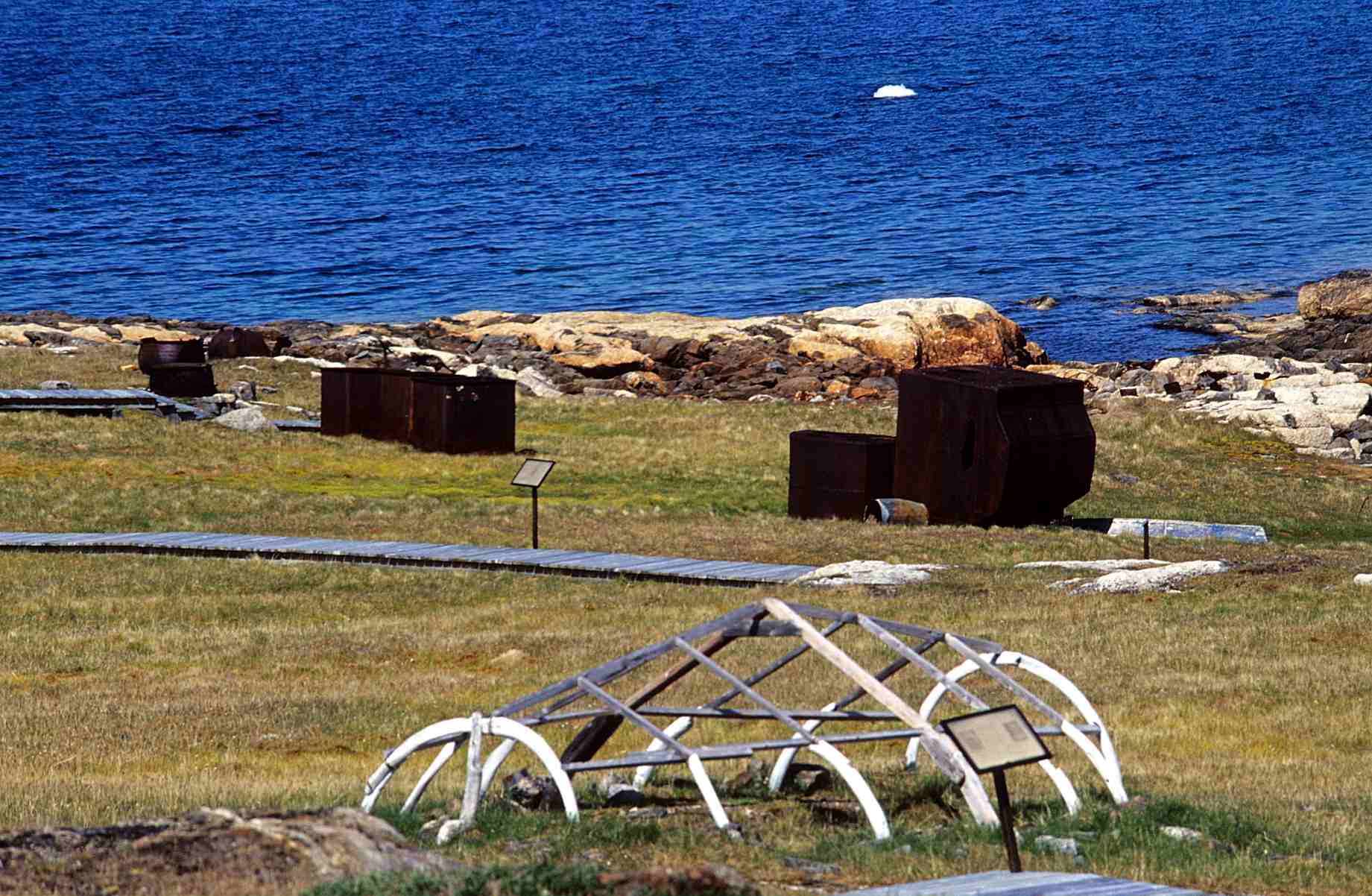 Reste d'Umiak en os de baleine. | ||
| Géographie | ||
|---|---|---|
| Pays | ||
| Archipel | Archipel arctique canadien | |
| Coordonnées | 65° 42′ N, 65° 49′ O | |
| Superficie | 13,65 km2 | |
| Administration | ||
| Statut | Parc territorial | |
| [[|Territoire]] | Nunavut | |
| [[|Région]] | Qikiqtaaluk | |
| Démographie | ||
| Population | Aucun habitant | |
| Autres informations | ||
| Géolocalisation sur la carte : Canada
| ||
| Île au Canada | ||
| modifier |
||

Histoire
À partir du milieu du XIXe siècle, l'île Kekerten est occupée par deux postes d'observation de la baleine. Entre 1860 et 1880, elle possède l'une des deux plus importantes stations baleinières de la baie Cumberland, l'autre étant l'île Blacklead. Les marins qui mouraient à la station était enterrés au « Penny’s Burying Ground ». L'endroit est devenu avec le temps un poste d’hivernage pour les Inuits environnants qui s'adaptèrent au mode de vie des baleiniers. Les capitaines de baleiniers échangeaient contre le travail des Inuits des armes, des munitions, des télescopes, et même des baleinières. Le poste fut finalement complètement abandonné en 1923 quand la Gendarmerie royale du Canada déménagea à Pangnirtung[1].
L'île ainsi que les îles Miliakdjuin et Tuapain ont été désignées lieu historique national du Canada le [1].
Notes et références
- « Lieu historique national du Canada du Poste-de-pêche-à-la-baleine-de-l'Île-Kekerten », sur Lieux patrimoniaux du Canada (consulté le )
Annexes
Liens externes
 Portail du Nunavut
  Portail de l’Arctique
  Portail du monde insulaire
  Portail des cétacés
  Portail de la conservation de la nature
  Portail des lieux patrimoniaux du Canada
На других языках
[de] Kekerten Island
Kekerten Island (Inuktitut Qikiqtaq) ist eine unbewohnte Insel in der Qikiqtaaluk Region von Nunavut, Kanada. Ihre ehemalige Walfangstation besitzt seit 1985 den Status einer National Historic Site of Canada.[1][en] Kekerten Island
Kekerten Island is an uninhabited island in the Qikiqtaaluk Region of Nunavut, Canada. Southernmost of the Kikastan Islands, it is located in the Cumberland Sound, off Baffin Island's Cumberland Peninsula. Akulagok Island forms Kekerten Harbour with the island. Tuapait Island lies to the north. Beacon Island, Kekertukdjuak Island, Miliakdjuin Island, Tesseralik Island, and Ugpitimik Island are in the vicinity.[1]- [fr] Île Kekerten
[ru] Кекертен (остров)
Кекертен (англ. Kekerten Island) — остров в заливе Камберленд, близ юго-восточного побережья острова Баффинова Земля. Самый южный в составе группы островов Кикастан. В административном отношении входит в состав региона Кикиктани канадской территории Нунавут. На территории острова располагается одноимённый территориальный парк[1].Другой контент может иметь иную лицензию. Перед использованием материалов сайта WikiSort.org внимательно изучите правила лицензирования конкретных элементов наполнения сайта.
WikiSort.org - проект по пересортировке и дополнению контента Википедии