geo.wikisort.org - Île
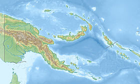
Tagula Island[1] ou Sudest Island, désignée parfois Vanatinai, du nom du peuple qui l'habite, est la plus grande île des Louisiades, dans la province de Baie Milne, en Papouasie-Nouvelle-Guinée. Elle couvre 865,7 km2.
| Tagula Island | |
 Tagula Island vue de l'espace | |
| Géographie | |
|---|---|
| Pays | |
| Archipel | Louisiades |
| Localisation | Baie de Milne |
| Coordonnées | 11° 30′ S, 153° 26′ E |
| Superficie | 865 km2 |
| Administration | |
| Région | Papouasie |
| Province | Baie Milne |
| Autres informations | |
| Fuseau horaire | UTC+10 |
| modifier |
|
La population de l'île était de 3 628 habitants en 2014[2].
Géographie

L'île est volcanique et montagneuse, ses sommets sont :
- le mont Riu (806 m) ;
- le mont Gangulua (439 m) ;
- le mont Arumbi (350 m) ;
- le mont Madau (269 m).
Histoire
La première mention de l'île par des européens remonte au par l'expédition espagnole de Luis Váez de Torrès[3],[4],[5]. Tagula Island fut également l'objet d'une ruée vers l'or qui atteint son apogée en 1889[6] .
Articles connexes
- Liste des îles de Papouasie-Nouvelle-Guinée
- Vanatinai (peuple)
Notes et références
- National Geospatial-Intelligence Agency Site Internet: http://geonames.nga.mil/namesgaz/
- Revolvy Site Internet: http://broom02.revolvy.com/main/index.php?s=tagula%20island&stype=topics
- Hilder, Brett The voyage of Torres, Brisbane, 1980, pp.XXIV,24
- Sharp, Andrew The discovery of the Pacific Islands Oxford, 1960, p.66.
- Brand, Donald D. The Pacific Basin: A History of its Geographical Explorations The American Geographical Society, New York, 1967, p.137.
- Pacific Islands Yearbook, 13th ed., Sydney, New York 1972
- Portail du monde insulaire
- Portail de la Papouasie-Nouvelle-Guinée
На других языках
[de] Vanatinai
Vanatinai (früher Sudest, auf vielen Landkarten auch Tagula) ist eine Insel vulkanischen Ursprungs im Südosten des Louisiade-Archipel in der Provinz Milne Bay von Papua-Neuguinea. Die von Korallenriffen umsäumte Insel liegt 360 km südöstlich von Neuguinea und 35 km südöstlich der Insel Misima.[en] Tagula Island
Vanatinai Island (also called Tagula and Sudest, for the names of the extreme capes of the island) is a volcanic island in the south-east of the Louisiade Archipelago within Milne Bay Province of Papua New Guinea. The reef-fringed island is approximately 360 kilometres (224 miles) south-east of New Guinea and 30 kilometres (19 miles) south of Misima. With an area of 830 square kilometres (320.5 square miles), it is the largest island of the archipelago. Tagula town, the main settlement, is located on the north-west coast. The population was 3628 as of 2014[update]. The principal export is copra.- [fr] Tagula Island
[it] Tagula
Tagula (nota anche come Vanatinai o Sudest) è un'isola d'origine vulcanica di Papua Nuova Guinea.[ru] Ванатинаи
Ванатинаи (англ. Vanatinai; также Тагула (англ. Tagula), Садест (англ. Sudest) — остров в Тихом океане в составе островов Луизиада. Является территорией государства Папуа — Новая Гвинея. Административно входит в состав провинции Милн-Бей региона Папуа.Текст в блоке "Читать" взят с сайта "Википедия" и доступен по лицензии Creative Commons Attribution-ShareAlike; в отдельных случаях могут действовать дополнительные условия.
Другой контент может иметь иную лицензию. Перед использованием материалов сайта WikiSort.org внимательно изучите правила лицензирования конкретных элементов наполнения сайта.
Другой контент может иметь иную лицензию. Перед использованием материалов сайта WikiSort.org внимательно изучите правила лицензирования конкретных элементов наполнения сайта.
2019-2025
WikiSort.org - проект по пересортировке и дополнению контента Википедии
WikiSort.org - проект по пересортировке и дополнению контента Википедии
