geo.wikisort.org - Île
Sand Cay, en vietnamien : Dảo Sơn Ca, est une île située, dans le banc de l'Union, dans les îles Spratleys en mer de Chine méridionale. Il est contrôlé par le Viêt Nam depuis 1974, mais est revendiqué par les Philippines, la Chine et Taïwan. Elle a fait l'objet d'une extension de sa superficie par remblaiement entre 2011 et 2015[1].
Cet article est une ébauche concernant le monde insulaire et le Viêt Nam.
Vous pouvez partager vos connaissances en l’améliorant (comment ?) selon les recommandations des projets correspondants.
| Sand Cay | ||
| Géographie | ||
|---|---|---|
| Pays | ||
| Revendication par | ||
| Localisation | Mer de Chine méridionale (océan Pacifique) | |
| Coordonnées | 10° 22′ 42″ N, 114° 28′ 34″ E | |
| Administration | ||
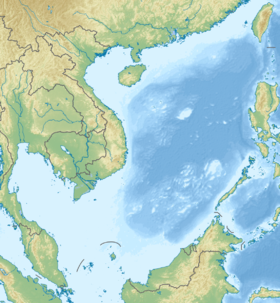
| Géolocalisation sur la carte : mer de Chine méridionale
| ||
| modifier |
||
Références
- What China Has Been Building in the South China Sea, Derek Watkins, The New York Times, 31 juillet 2015
 Portail du Viêt Nam
  Portail du monde insulaire
  Portail de l’océan Pacifique
На других языках
[en] Sand Cay
Sand Cay 10°22′30″N 114°28′48″E, also known as Bailan Island (Tagalog: Pulo ng Bailan); Son Ca Island (Vietnamese: Đảo Sơn Ca); Mandarin Chinese: 敦謙沙洲/敦谦沙洲; pinyin: Dūnqiān Shāzhōu, is a cay on the north edge of the Tizard Bank of the Spratly Islands in the South China Sea. With an area of 7 hectares (17 acres), it is the ninth largest, and the fourth largest former Vietnamese-administered, of the Spratly Islands. The island has been occupied by Vietnam since 1974, (first by South Vietnam, then by the Socialist Republic of Vietnam after 1975). It is also claimed by China (PRC), the Philippines, Vietnam, and Taiwan (ROC).[es] Cayo Sand
Cayo Sand (en español:Cayo Arena) o Isla Son Ca (tagalo: Bailan; chino: 沙洲 谦 敦, pinyin: Dunqian Shazhou; vietnamita: Đảo Sơn Ca) es una isla del archipiélago Spratly en el Mar de China Meridional. Con una superficie de 7 hectáreas (0,07 km² ), es la novena mayor de las islas Spratly y la cuarta en tamaño entre las Spratly ocupadas por los vietnamitas. Se encuentra a 6 millas (10 km) al este de Taiwán que ocupa la isla de Itu Aba. Entre Cayo Sandy y la isla Itu Aba esta otra de las más representativas islas ocupadas por Taiwán el Arrecife Ban Que. Esta cubierta de árboles y arbustos. Situada a lo largo de un arrecife debido en parte a que está fuera del agua durante la marea baja. Por esta característica es que suele confundirse con Cayo Sandy, un banco de arena cercano de la isla Thitu. Esta isla, ocupada por Vietnam desde 1974, también está siendo reclamada por China, Taiwán y Filipinas. Es parte de los Bancos Tizard.[1]- [fr] Sand Cay
Текст в блоке "Читать" взят с сайта "Википедия" и доступен по лицензии Creative Commons Attribution-ShareAlike; в отдельных случаях могут действовать дополнительные условия.
Другой контент может иметь иную лицензию. Перед использованием материалов сайта WikiSort.org внимательно изучите правила лицензирования конкретных элементов наполнения сайта.
Другой контент может иметь иную лицензию. Перед использованием материалов сайта WikiSort.org внимательно изучите правила лицензирования конкретных элементов наполнения сайта.
2019-2026
WikiSort.org - проект по пересортировке и дополнению контента Википедии
WikiSort.org - проект по пересортировке и дополнению контента Википедии