geo.wikisort.org - Île
Pipéri (en grec moderne : Πιπέρι) est une île de l'archipel des Sporades dans la mer Égée en Grèce.
Pour les articles homonymes, voir Piperi.
| Pipéri Πιπέρι Αλοννήσου (el) | |
 Vue de l'île de Pipéri | |
| Géographie | |
|---|---|
| Pays | |
| Archipel | Îles Sporades |
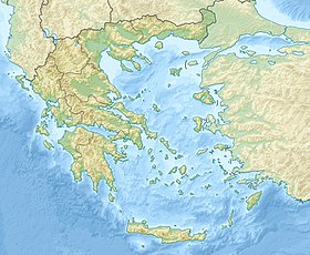
| Localisation | Mer Égée (mer Méditerranée) |
| Coordonnées | 39° 20′ 53″ N, 24° 19′ 26″ E |
| Point culminant | 324 m |
| Administration | |
| Périphérie | Thessalie |
| District régional | Sporades |
| Municipalité | Alonissos |
| Autres informations | |
| Fuseau horaire | UTC+2 |
| Île en Grèce | |
| modifier |
|
Pipéri mesure environ 4,2 km de long sur 1 km de large. Son altitude maximale est de 324 m. L'île la plus proche est Gioúra, à l'ouest. Pipéri est rattachée administrativement à la municipalité d'Alonnisos.

L'île est située dans un parc national marin qui compte des espèces rares[1]. Constituant une aire de reproduction du phoque moine, la zone autour de Pipéri est protégée par la convention de Barcelone[2], son approche est ainsi strictement interdite.
Notes et références
- The Sporades Sailing Pilot, Dave Nairn
- « Nisis Piperi (Greece) »
Voir aussi
Liens externes
- Portail de la Grèce
- Portail du monde insulaire
- Portail de la mer Méditerranée
На других языках
[en] Piperi (island)
Piperi (Greek: Πιπέρι, meaning pepper) is a Greek island in the Northern Sporades. It is administratively part of the municipality of Alonnisos and, after Skyros, is the Sporades' easternmost island. Piperi is the core of the marine park and the approach within 3 nautical miles is forbidden. As of 2011[update], the resident population of the island was 6.[1]- [fr] Pipéri (île)
[ru] Пиперион
Пипе́рион[1][2] (греч. Πιπέριον[3]) или Пипе́ри[4] (греч. Πιπέρι) — небольшой остров в Греции. Входит в острова Северные Спорады в Эгейском море. Расположен в 14 километрах к юго-востоку от острова Юра. Расстояние до порта Патитириона на Алонисосе 25 морских миль, до Перистеры — 25 морских миль, до Волоса — 90 морским миль, до Айос-Констандиноса[el] — 85 морских миль. Площадь острова составляет 4,166 квадратных километров[5], наивысшая точка — 354 метра[6]. Входит в общину (дим) Алонисос в периферийной единице Спорадах в периферии Фессалии. Население 6 жителей по переписи 2011 года[3]. На острове обитают редкие тюлени-монахи и 33 вида исчезающих птиц, находящиеся под охраной Барселонской конвенции[en][7].Текст в блоке "Читать" взят с сайта "Википедия" и доступен по лицензии Creative Commons Attribution-ShareAlike; в отдельных случаях могут действовать дополнительные условия.
Другой контент может иметь иную лицензию. Перед использованием материалов сайта WikiSort.org внимательно изучите правила лицензирования конкретных элементов наполнения сайта.
Другой контент может иметь иную лицензию. Перед использованием материалов сайта WikiSort.org внимательно изучите правила лицензирования конкретных элементов наполнения сайта.
2019-2025
WikiSort.org - проект по пересортировке и дополнению контента Википедии
WikiSort.org - проект по пересортировке и дополнению контента Википедии
