geo.wikisort.org - Île
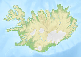
Papey est une île du sud-est de l'Islande. Elle s'étend sur 2 km2 de superficie[1]. Son nom signifie île des papar, c'est-à-dire des moines irlandais.
| Papey Papey (is) | |
 Église de Papey. | |
| Géographie | |
|---|---|
| Pays | |
| Coordonnées | 64° 36′ N, 14° 11′ O |
| Superficie | 2 km2 |
| Administration | |
| Démographie | |
| Population | Aucun habitant (2016) |
| modifier |
|
Références
- (en) « Iceland in statistics » (consulté le )
Voir aussi
- Portail du monde insulaire
- Portail de l’Islande
На других языках
[de] Papey
Papey ist eine Insel im Südosten Islands.[en] Papey
Papey (Icelandic pronunciation: [ˈpʰaːpˌeiː]) is an island near the east coast of Iceland in the municipality Djúpavogshreppur and is about 2 square kilometres (0.77 sq mi) in extent, the highest point on the island being about 58 metres above sea level.- [fr] Papey
[ru] Папей
Папей[1] (исл. Papey, исландское произношение: [ˈpʰaːpˌeiː] ( слушать)) — небольшой необитаемый остров на востоке Исландии (община Мулатинг в регионе Эйстюрланд).[2][3]Текст в блоке "Читать" взят с сайта "Википедия" и доступен по лицензии Creative Commons Attribution-ShareAlike; в отдельных случаях могут действовать дополнительные условия.
Другой контент может иметь иную лицензию. Перед использованием материалов сайта WikiSort.org внимательно изучите правила лицензирования конкретных элементов наполнения сайта.
Другой контент может иметь иную лицензию. Перед использованием материалов сайта WikiSort.org внимательно изучите правила лицензирования конкретных элементов наполнения сайта.
2019-2025
WikiSort.org - проект по пересортировке и дополнению контента Википедии
WikiSort.org - проект по пересортировке и дополнению контента Википедии
