geo.wikisort.org - Île
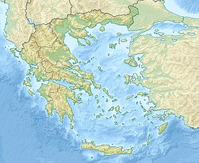
Megalonisi (grec moderne : Μεγαλονήσι, Grande île) est un îlot situé au Sud de l'île grecque de Crète dans la Mer de Libye. Cet îlot accueille un phare. L'îlot se situe dans une baie entre les caps Lithino et Kefalas, à Kommos (en), près de Gortyne. Il dépend du Nome d'Héraklion.
| Megalonisi Μεγαλονήσι | ||
 Site archéologique de Kommos | ||
| Géographie | ||
|---|---|---|
| Pays | ||
| Coordonnées | 34° 55′ 23″ N, 24° 48′ 00″ E | |
| Administration | ||
| [[|Nome]] | Héraklion | |
| Démographie | ||
| Population | Aucun habitant (2001) | |
| Autres informations | ||
| Géolocalisation sur la carte : Crète
| ||
| modifier |
||
Groupe d'îlots
Il fait partie d'un groupe de quatre îlot dans la baie, les îlots Papadoplaka (en) (à l'Ouest), Megalonisi, Mikronisi (en) (aussi connu sous le nom d'Agios Pavlos) et Trafos (en).
Notes et références
- (en) Cet article est partiellement ou en totalité issu de l’article de Wikipédia en anglais intitulé « Megalonisi » (voir la liste des auteurs).
- Portail du monde insulaire
- Portail de la mer Méditerranée
- Portail de la Crète
На других языках
[en] Megalonisi (Crete)
Megalonisi (Greek: Μεγαλονήσι, "big island") is an uninhabited islet off the southern coast of the Greek island of Crete in the Libyan Sea that hosts a lighthouse.[1][2][3] The islet is in a bay between the capes of Lithino and Kefalas, at Kommos, and close to Gortyn which was the ancient capital of Crete. It is administered within Heraklion regional unit.- [fr] Megalonisi (Crète)
Текст в блоке "Читать" взят с сайта "Википедия" и доступен по лицензии Creative Commons Attribution-ShareAlike; в отдельных случаях могут действовать дополнительные условия.
Другой контент может иметь иную лицензию. Перед использованием материалов сайта WikiSort.org внимательно изучите правила лицензирования конкретных элементов наполнения сайта.
Другой контент может иметь иную лицензию. Перед использованием материалов сайта WikiSort.org внимательно изучите правила лицензирования конкретных элементов наполнения сайта.
2019-2025
WikiSort.org - проект по пересортировке и дополнению контента Википедии
WikiSort.org - проект по пересортировке и дополнению контента Википедии

