geo.wikisort.org - Île
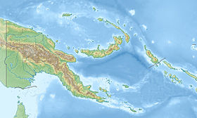
Lihir, également nommée Niolam, est une île volcanique de Papouasie-Nouvelle-Guinée située au nord de la Nouvelle-Irlande dans l'archipel Bismarck.
Cet article possède un paronyme, voir Lire (paronymie).
Géographie
C'est la principale île d'un groupe appelé îles Lihir. Elle est incorporée administrativement dans la province de Nouvelle-Irlande.
Économie
De l'or a été découvert sur l'île en 1982 et a commencé à être exploité en 1997. Deux gisements, "Minifie" and "Lienetz", sont situés dans le cratère d'un volcan inactif appelé Luise Caldera sur la côte est de l'île.
Notes et références
Voir aussi
Articles connexes
Liens externes
- Portail de la Papouasie-Nouvelle-Guinée
- Portail du monde insulaire
На других языках
[de] Niolam
Niolam (auch Aniolam) ist der offizielle Name der Hauptinsel der Lihir-Inseln. Sie wird daher häufiger auch Lihir genannt. Alternativ wurde die Hauptinsel auch als Lir, Gardenijs, Gerrit Denys, Gerrit de Nijs, Garde Neys, Gerard de Nys, Isle du Bouchage oder Day (bzw. Dayinsel[1]) bezeichnet. Die Insel liegt nördlich von Neuirland im Bismarck-Archipel und gehört zu Papua-Neuguineas Provinz New Ireland. Sie ist die größte Insel der Tabar-Lihir-Tanga-Feni-Inselkette. Nebeninseln von Niolam sind Mali, Mahur, Masahet und Sanambiet.[en] Lihir Island
Lihir Island (a.k.a. Niolam Island) is the largest island in the Lihir group of islands, 22 km long and 14.5 km wide, in Papua New Guinea's New Ireland Province. It consists of a complex of several overlapping basaltic stratovolcanoes rising 700 m above sea level. While the volcanoes are not currently active, geothermal activity is still present. The island is in what was the forearc basin associated with the subduction of the Pacific Plate beneath the North Bismarck Plate.[1] Subduction stopped about 10 million years ago with the collision of the Ontong Java plateau with the subduction zone.[2]- [fr] Lihir
[it] Lihir
Lihir (nota anche come Niolam ed in passato come Gardeney) è un'isola vulcanica di Papua Nuova Guinea.[ru] Лихир (остров)
Лихир (англ. Lihir Island) или Ниолам (англ. Niolam Island) — крупнейший остров архипелага Лихир. Административно относится к провинции Новая Ирландия, Папуа — Новая Гвинея. Составляет 22 км в длину и 14,5 км в ширину. Состоит из комплекса перекрывающих друг друга стратовулканов, конусы которых достигают высоты 700 м над уровнем моря[1]. В настоящее время вулканы не являются активными, хотя геотермальная активность по-прежнему присутствует. Остров находится на месте бывшего преддугового бассейна в зоне субдукции между Тиоокеанской плитой и Северной плитой Бисмарка[2]. Субдукция прекратилась примерно 10 млн лет назад в результате столкновения с плато Онгонг-Ява[3].Текст в блоке "Читать" взят с сайта "Википедия" и доступен по лицензии Creative Commons Attribution-ShareAlike; в отдельных случаях могут действовать дополнительные условия.
Другой контент может иметь иную лицензию. Перед использованием материалов сайта WikiSort.org внимательно изучите правила лицензирования конкретных элементов наполнения сайта.
Другой контент может иметь иную лицензию. Перед использованием материалов сайта WikiSort.org внимательно изучите правила лицензирования конкретных элементов наполнения сайта.
2019-2025
WikiSort.org - проект по пересортировке и дополнению контента Википедии
WikiSort.org - проект по пересортировке и дополнению контента Википедии

