geo.wikisort.org - Île
Lazarus Island ou Pulau Sakijang Pelepah (en chinois : 卫星地图), est une île située dans le Sud de l'île principale de Singapour.
Cet article est une ébauche concernant le monde insulaire et Singapour.
Vous pouvez partager vos connaissances en l’améliorant (comment ?) selon les recommandations des projets correspondants.
| Lazarus Island Pulau Sakijang Pelepah (ms) | ||
| Géographie | ||
|---|---|---|
| Pays | ||
| Localisation | Singapour | |
| Coordonnées | 1° 13′ 26″ N, 103° 51′ 18″ E | |
| Point culminant | 43 m | |
| Administration | ||
| Autres informations | ||
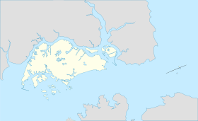
| Géolocalisation sur la carte : Singapour
| ||
| Îles à Singapour | ||
| modifier |
||
Géographie
Elle s'étend sur une longueur d'environ 2,2 km pour une largeur approximative de 1,1 km.
Histoire
Cette section est vide, insuffisamment détaillée ou incomplète. Votre aide est la bienvenue ! Comment faire ?
Notes et références
Lien externe
 Portail de Singapour
  Portail du monde insulaire
На других языках
[en] Lazarus Island
Lazarus Island, also known as Pulau Sakijang Pelepah, is one of the Southern Islands in Singapore. It is south of the main island of Singapore, off the Straits of Singapore and is uninhabited. It is connected by a causeway to Saint John's Island, which is reachable by ferry.- [fr] Lazarus Island
[ru] Сакиджанг-Пелепах
Сакиджанг-Пелепах (малайск. Pulau Sakijang Pelepah) — необитаемый остров в Сингапурском проливе. Также известен как остров Лазаря. Расположен между островами Тембакул и Сакиджанг-Бендера. С последним связан мостом[1].Текст в блоке "Читать" взят с сайта "Википедия" и доступен по лицензии Creative Commons Attribution-ShareAlike; в отдельных случаях могут действовать дополнительные условия.
Другой контент может иметь иную лицензию. Перед использованием материалов сайта WikiSort.org внимательно изучите правила лицензирования конкретных элементов наполнения сайта.
Другой контент может иметь иную лицензию. Перед использованием материалов сайта WikiSort.org внимательно изучите правила лицензирования конкретных элементов наполнения сайта.
2019-2026
WikiSort.org - проект по пересортировке и дополнению контента Википедии
WikiSort.org - проект по пересортировке и дополнению контента Википедии