geo.wikisort.org - Île
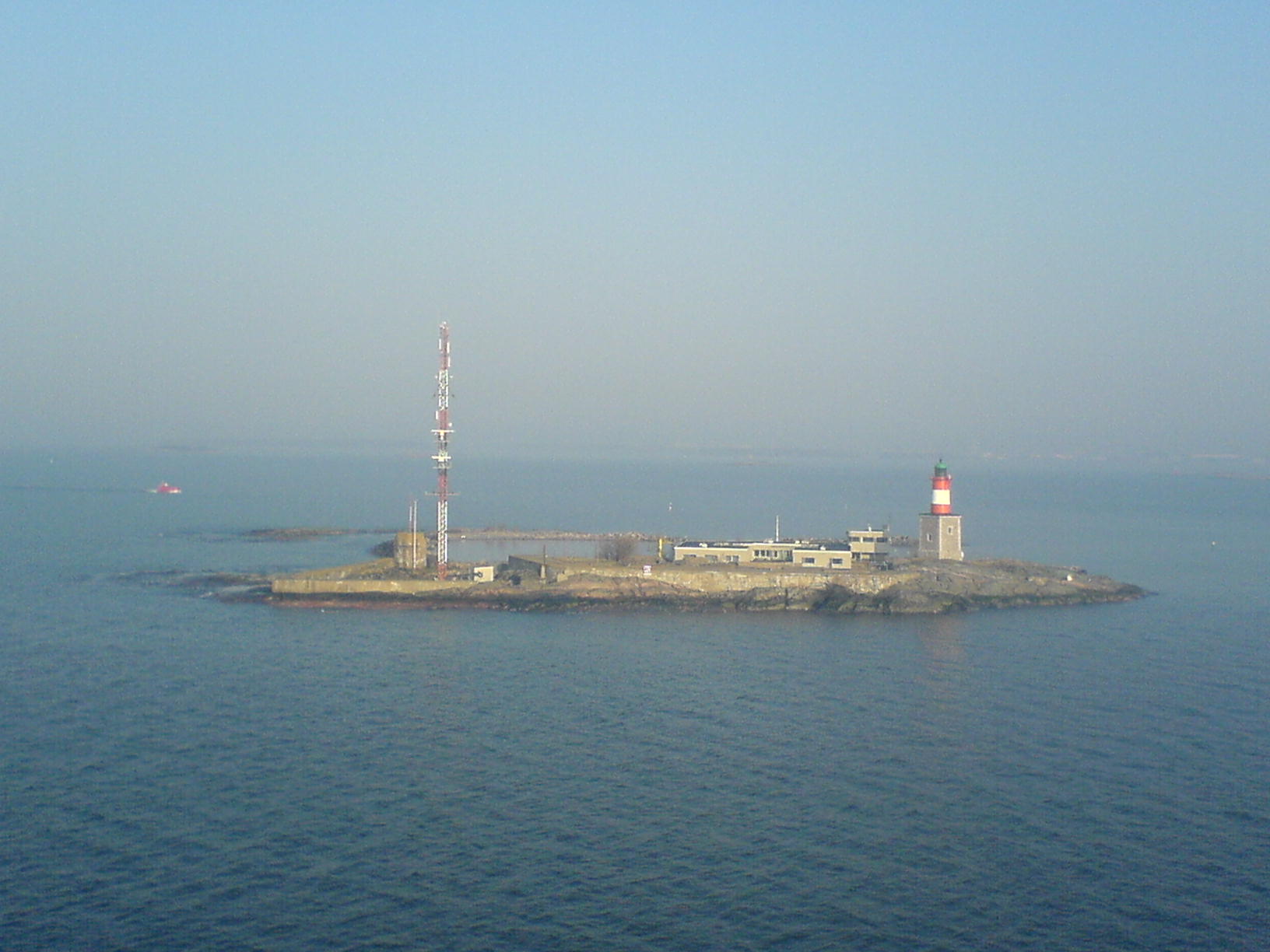
Harmaja, en suédois Gråhara, est une île du sud de la Finlande située au sud de la forteresse de Suomenlinna.
Cet article est une ébauche concernant le monde insulaire, la mer Baltique et la géographie de la Finlande.
Vous pouvez partager vos connaissances en l’améliorant (comment ?) selon les recommandations des projets correspondants.
| Harmaja Gråhara (sv) | ||
| ||
| Géographie | ||
|---|---|---|
| Pays | ||
| Localisation | Golfe de Finlande | |
| Coordonnées | 60° 06′ 18″ N, 24° 58′ 32″ E | |
| Administration | ||
| Autres informations | ||
| Fuseau horaire | UTC+2 | |
| Géolocalisation sur la carte : Finlande
| ||
| Îles en Finlande | ||
| modifier |
||

L'île abrite le phare d'Harmaja et une station de pilotes. L'île a aussi été le site principal des épreuves de voile aux Jeux olympiques d'été de 1952[1].
Notes et références
 Portail du monde insulaire
  Portail de la mer Baltique
  Portail de la Finlande
На других языках
[de] Harmaja
Harmaja (schwedisch Gråhara) ist eine Insel südlich der finnischen Hauptstadt Helsinki.[en] Harmaja
Harmaja (Swedish: Gråhara) is an island and a lighthouse outside Helsinki, south of the Suomenlinna sea fortress. The island has been functioning as a landmark since the 16th century. A landmark structure was built on the island in the 18th century and a light house in 1883.[1] The first lighthouse was only 7.3 m high and it soon proved to be too low. In 1900 the height was doubled by creating a rectangular brick building on a granite base. A large foghorn alerted ships in fog and in bad visibility. Harmaja received the world's first directed and undirected radio beacon in 1936. The lighthouse is fully automated today.- [fr] Harmaja
Текст в блоке "Читать" взят с сайта "Википедия" и доступен по лицензии Creative Commons Attribution-ShareAlike; в отдельных случаях могут действовать дополнительные условия.
Другой контент может иметь иную лицензию. Перед использованием материалов сайта WikiSort.org внимательно изучите правила лицензирования конкретных элементов наполнения сайта.
Другой контент может иметь иную лицензию. Перед использованием материалов сайта WikiSort.org внимательно изучите правила лицензирования конкретных элементов наполнения сайта.
2019-2026
WikiSort.org - проект по пересортировке и дополнению контента Википедии
WikiSort.org - проект по пересортировке и дополнению контента Википедии