geo.wikisort.org - Île
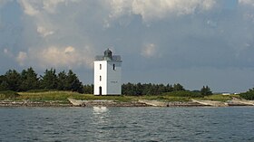
Bågø est une île du Danemark situé entre l'île de Fyn et la péninsule de Jutland.
- Portail du monde insulaire
- Portail de la mer Baltique
- Portail du Danemark
На других языках
[de] Bågø
Bågø (selten auch Baagø oder Baagö) ist eine dänische Insel im kleinen Belt.[en] Bågø
Bågø is a small Danish island located in the Little Belt 5 km north-west of Assens on the island of Funen belonging to Assens Municipality. With an area of 6.2 km2 (2.4 sq mi), as of 1 January 2015 it has a population of 25.[2] The island is divided into three low slopes reaching a maximum height of 8 meters above sea level. Essentially an agricultural community, the island's population has decreased drastically since 1950. The village, Bågø By, with its large farm houses lies at the centre of the island. There is a ferry connection with Assens.[3][es] Baagø
Baagø, Bågø o Baagö es una isla de Dinamarca, ubicada en el estrecho del Pequeño cinturón (Lillebælt en danés), al oeste de Fionia. Pertenece al municipio de Assens.- [fr] Bågø
Текст в блоке "Читать" взят с сайта "Википедия" и доступен по лицензии Creative Commons Attribution-ShareAlike; в отдельных случаях могут действовать дополнительные условия.
Другой контент может иметь иную лицензию. Перед использованием материалов сайта WikiSort.org внимательно изучите правила лицензирования конкретных элементов наполнения сайта.
Другой контент может иметь иную лицензию. Перед использованием материалов сайта WikiSort.org внимательно изучите правила лицензирования конкретных элементов наполнения сайта.
2019-2025
WikiSort.org - проект по пересортировке и дополнению контента Википедии
WikiSort.org - проект по пересортировке и дополнению контента Википедии

