geo.wikisort.org - Île
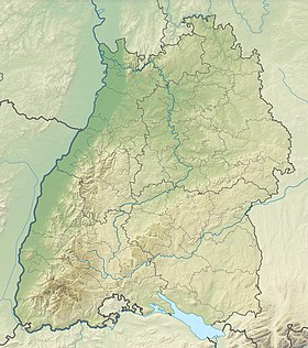
Triboldingerbohl, également Triboltinger ou großes Bohl, ou Langenrain, est une île allemande située sur l’Untersee, partie inférieure du lac de Constance.
| Triboldingerbohl Langenrain (de) | |
| Géographie | |
|---|---|
| Pays | |
| Localisation | Lac de Constance |
| Coordonnées | 47° 40′ 18″ N, 9° 07′ 21″ E |
| Superficie | 0,135 57 km2 |
| Géologie | Île lacustre |
| Administration | |
| Land | |
| District | Fribourg-en-Brisgau |
| Arrondissement | Constance |
| Démographie | |
| Population | Aucun habitant |
| Autres informations | |
| Île en Allemagne | |
| modifier |
|
Avec une superficie de 135 570 m2, elle est la quatrième plus grande île du lac de Constance. Elle fait partie de la réserve naturelle Wollmatinger Ried. Jusqu'en 1934 l'île faisait partie de la commune de Wollmatingen qui fut alors intégrée à la ville de Constance.
Notes et références
- (de) Cet article est partiellement ou en totalité issu de l’article de Wikipédia en allemand intitulé « Triboldingerbohl » (voir la liste des auteurs).
Lien externe
- Portail du Bade-Wurtemberg
- Portail du monde insulaire
- Portail des lacs et cours d'eau
На других языках
[de] Triboldingerbohl
Der Triboldingerbohl, auch Triboltinger oder großes Bohl, oder Langenrain, ist mit einer Fläche von 135.570 m² die viertgrößte Insel des Bodensees. Sie ist 780 Meter lang und bis zu 230 Meter breit. Sie liegt im östlichsten Teil des Untersees in der Nähe der Stelle, wo der Seerhein in den Untersee (hier Rheinsee) mündet. Sie gehört zum Naturschutzgebiet Wollmatinger Ried, und zum Konstanzer Stadtteil Industriegebiet. Bis 1934 gehörte dieses Gebiet zur Gemeinde Wollmatingen, die dann in die Stadt Konstanz eingegliedert wurde. Der Triboldingerbohl liegt 2,1 km südöstlich der Insel Reichenau bzw. 1,6 km des Reichenauer Damms und ist von diesem durch das Ermatinger Becken getrennt, eine ökologisch wichtige Flachwasserzone.[en] Triboldingerbohl
Triboldingerbohl, also known as Triboltingen or großes Bohl or Langenrain, is the fourth largest island of Lake Constance, with an area of 0.13557 square kilometres (0.05234 sq mi). It is 780 meters (2,560 ft) long and up to 230 meters (750 ft) wide. It is located in the easternmost part of the Untersee (Lake Constance), near the point where the Seerhein flows into the lake. This part of the lake is also known as the Rheinsee. It belongs to the Wollmatinger Ried nature conservation area; administratively it belongs to the district industrial area of the City of Constance. Until 1934, it belonged to the municipality of Wollmatingen, which was then annexed by Constance. Triboldingerbohl lies 2.1 km (1.3 mi) southeast of Reichenau Island and 1.6 km (0.99 mi) from the dam that connects Reichenau to the mainland. The area between Triboldingerbohl island and the Reichenau dam is called Ermatinger pool and is an ecologically important shallow-water zone.- [fr] Triboldingerbohl
Текст в блоке "Читать" взят с сайта "Википедия" и доступен по лицензии Creative Commons Attribution-ShareAlike; в отдельных случаях могут действовать дополнительные условия.
Другой контент может иметь иную лицензию. Перед использованием материалов сайта WikiSort.org внимательно изучите правила лицензирования конкретных элементов наполнения сайта.
Другой контент может иметь иную лицензию. Перед использованием материалов сайта WikiSort.org внимательно изучите правила лицензирования конкретных элементов наполнения сайта.
2019-2025
WikiSort.org - проект по пересортировке и дополнению контента Википедии
WikiSort.org - проект по пересортировке и дополнению контента Википедии

