geo.wikisort.org - Île
Gugh (Keow en cornique) est une île de l'archipel des Sorlingues, au sud-ouest de l'Angleterre.
Cet article est une ébauche concernant le monde insulaire et l’Angleterre.
Vous pouvez partager vos connaissances en l’améliorant (comment ?) selon les recommandations des projets correspondants.
| Gugh | ||
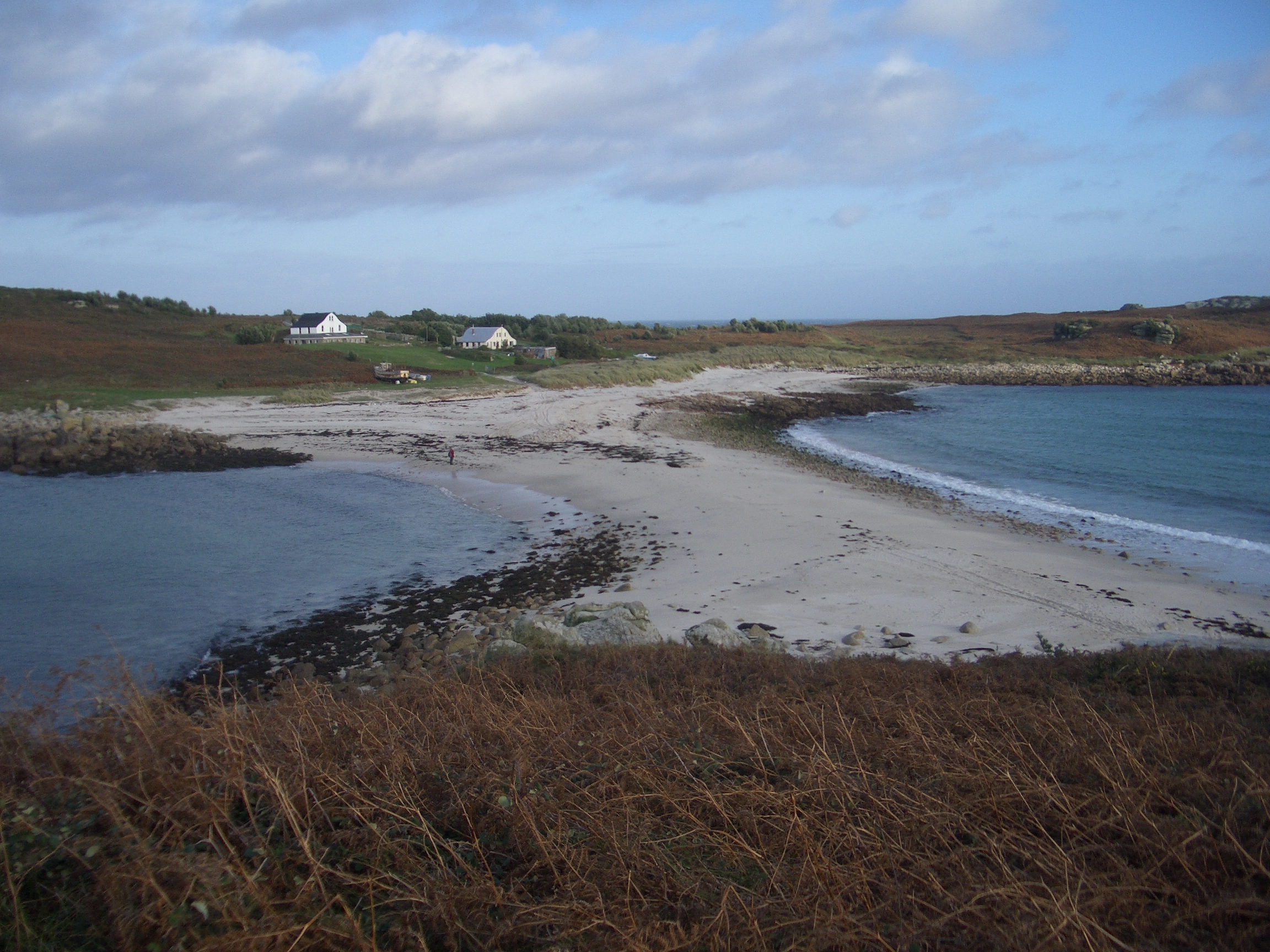
 Gugh et St Agnes | ||
| Géographie | ||
|---|---|---|
| Pays | ||
| Archipel | Sorlingues | |
| Coordonnées | 49° 53′ 40″ N, 6° 19′ 55″ O | |
| Administration | ||
| Comté | ||
| Démographie | ||
| Population | 3 hab. (2001) | |
| Autres informations | ||
| Géolocalisation sur la carte : Angleterre
| ||
| modifier |
||

Un banc de sable la relie à marée basse à l'île voisine de St Agnes. Avec trois habitants (2001), Gugh est la moins peuplée des six îles habitées des Sorlingues.
 Portail de l’Angleterre
  Portail du monde insulaire
На других языках
[de] Gugh
Gugh (kornisch Keow) ist eine Insel der Scilly-Inseln. Das Eiland ist etwa einen Kilometer lang und einen halben Kilometer breit. An seinem höchsten Punkt Kittern Hill liegt Gugh 34 m über dem Meeresspiegel. Die Insel ist durch den nur gut 60 Meter breiten Tombolo The Bar, der The Cove im Süden vom Forth Conger im Norden trennt, mit St. Agnes verbunden.[en] Gugh
Gugh (/ˈɡjuː/; Cornish: Keow, meaning "hedge banks")[1] could be described as the sixth inhabited island of the Isles of Scilly, but is usually included with St Agnes with which it is joined by a sandy tombolo known as "The Bar" when exposed at low tide. The island is only about 1 km (0.62 mi) long and about 0.5 km (0.31 mi) wide, with the highest point, Kittern Hill at 34 m (112 ft).[2] The geology consists of Hercynian granite with shallow podzolic soils on the higher ground and deeper sandy soils on the lower ground. The former Gugh farm is just north of the neck across the middle of the island between the two hills. The two houses were designed and built in the 1920s by Charles Hamlet Cooper.[3] The name is often mispronounced as "Goo", "Guff" or even "Gogh".- [fr] Gugh
[it] Gugh
Gugh (cornico Keow, file di siepi)[1] si potrebbe descrivere come la sesta isola abitata dell'arcipelago delle Isole Scilly, ma è solitamente conteggiata assieme a St Agnes, alla quale è unita da un tombolo di sabbia detto "The Bar" durante le basse maree. L'isola è lunga solamente 1 km e larga circa 0,5; la massima elevazione è Kittern Hill, alta 34 m.[2] Dal punto di vista geologico è costituita da granito ercinico con sottili suoli podzolici nei terreni più elevati e suoli sabbiosi più profondi nei terreni più bassi. L'antica fattoria di Gugh si trova immediatamente a nord della strozzatura al centro dell'isola, tra le due colline; le due case furono progettate e costruite negli anni venti del XX sec. da un certo Cooper.[3]Текст в блоке "Читать" взят с сайта "Википедия" и доступен по лицензии Creative Commons Attribution-ShareAlike; в отдельных случаях могут действовать дополнительные условия.
Другой контент может иметь иную лицензию. Перед использованием материалов сайта WikiSort.org внимательно изучите правила лицензирования конкретных элементов наполнения сайта.
Другой контент может иметь иную лицензию. Перед использованием материалов сайта WikiSort.org внимательно изучите правила лицензирования конкретных элементов наполнения сайта.
2019-2025
WikiSort.org - проект по пересортировке и дополнению контента Википедии
WikiSort.org - проект по пересортировке и дополнению контента Википедии