geo.wikisort.org - Île
Arey Island est un banc de sable de 11 km de long du North Slope, sur la côte arctique de l'Alaska. Il est situé à l'ouest de Barter Island, entre le lagon Arey et la mer de Beaufort.
Cet article est une ébauche concernant le monde insulaire et l’Alaska.
Vous pouvez partager vos connaissances en l’améliorant (comment ?) selon les recommandations des projets correspondants.
| Île Arey Arey Island (en) | ||
| Géographie | ||
|---|---|---|
| Pays | ||
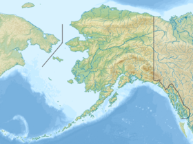
| Localisation | Mer de Beaufort | |
| Coordonnées | 70° 06′ 20″ N, 143° 57′ 19″ O | |
| Administration | ||
| [[|État]] | Alaska | |
| [[|Comté]] | North Slope | |
| Autres informations | ||
| Géolocalisation sur la carte : Alaska
| ||
| modifier |
||
L'île prend la forme d'un accent circonflexe, sa partie médiane étant la plus au nord.
Lien externe
Source
- (en) Cet article est partiellement ou en totalité issu de l’article de Wikipédia en anglais intitulé « Arey Island » (voir la liste des auteurs).
Galerie
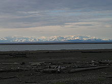 La chaîne Brooks vue depuis Arey Island
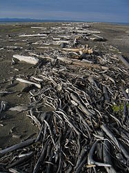 Bois flotté sur Arey Island


 Portail de l’Alaska
  Portail du monde insulaire
На других языках
[en] Arey Island
Arey Island is a 7-mile-long (11 km) barrier island on the North Slope of the U.S. state of Alaska. It is located west of Barter Island, between Arey Lagoon and the Beaufort Sea. In the past, visitors and guides have used Arey Island as a departure point from the coastal plain. Though this may still be possible, most of Arey Island is private land, so permission for its use must be obtained from, and the access fees paid to, the Kaktovik Inupiat Corporation (KIC). Without this permission, public access to Arey Island is limited.[es] Isla Arey
La Isla Arey (en inglés: Arey Island) se encuentra situada en el estado de Alaska, Estados Unidos, al oeste de la Isla Barter, entre la laguna Arey y el mar de Beaufort.[1]- [fr] Île Arey
Текст в блоке "Читать" взят с сайта "Википедия" и доступен по лицензии Creative Commons Attribution-ShareAlike; в отдельных случаях могут действовать дополнительные условия.
Другой контент может иметь иную лицензию. Перед использованием материалов сайта WikiSort.org внимательно изучите правила лицензирования конкретных элементов наполнения сайта.
Другой контент может иметь иную лицензию. Перед использованием материалов сайта WikiSort.org внимательно изучите правила лицензирования конкретных элементов наполнения сайта.
2019-2026
WikiSort.org - проект по пересортировке и дополнению контента Википедии
WikiSort.org - проект по пересортировке и дополнению контента Википедии