geo.wikisort.org - Island
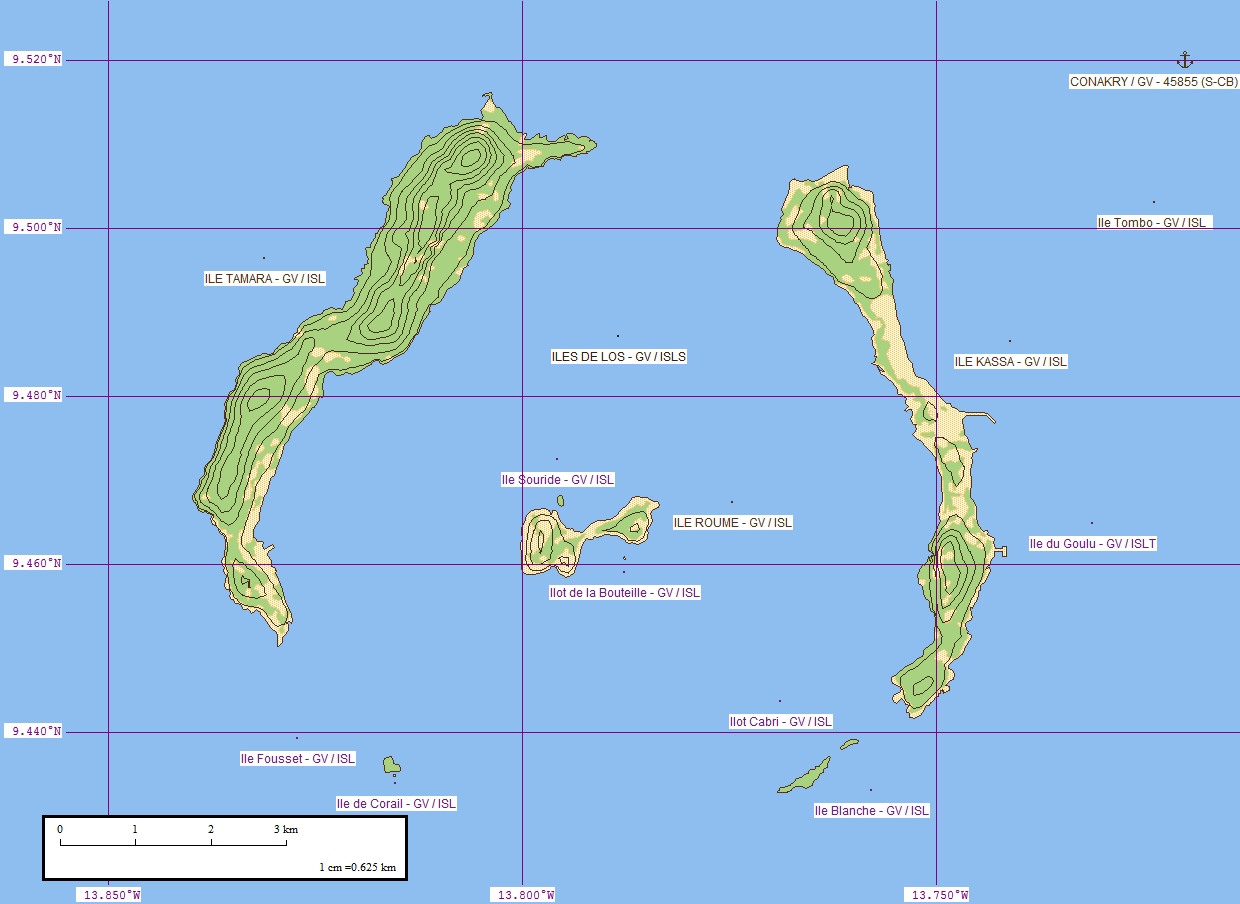
Îles de Los [il də lo] are an island group lying off Conakry in Guinea, on the west coast of Africa. Their name is derived from the Portuguese: Ilhas dos Ídolos, "Islands of the Idols".[1] They are located about two kilometres (one nautical mile) off the headland limiting the southern side of Sangareya Bay.[2]
 | |
 Îles de Los | |
| Geography | |
|---|---|
| Location | Atlantic Ocean |
| Coordinates | 09°27′45″N 13°47′42″W |
| Archipelago | Îles de Los |
| Total islands | 8 |
| Major islands | Tamara (Fortoba), Kassa and Roume |
| Area | 80 km2 (31 sq mi) |
| Length | 10 km (6 mi) |
| Width | 7 km (4.3 mi) |
| Highest elevation | 47 m (154 ft) |
| Highest point | Sommet Lacroix |
| Administration | |
Guinea | |
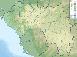
| Region | Conakry Region |
| Prefecture | Conakry Special Zone |
| Sub-Prefecture | Kaloum |
The islands are best known for their beaches and forested interiors and are popular with tourists. Ferries sail to the Los from Conakry.
Geography
There are three main islands: Tamara (Fortoba), Kassa and Roume. Île de Corail, Île Blanche, Île Cabris, Île Poulet, Îlot Cabri and Îlot de la Bouteille are smaller islands and islets located in the southern half.[1]
Tamara
Tamara is home to the Île Tamara Lighthouse. The island used to have a prison.
Kassa
Formerly known as Factory Island, the current name is derived from the Portuguese word "casa", meaning "house".
History
The islands have been inhabited for a long time and rose to prominence for their role in the Atlantic slave trade. The Kaloum or Kalum dialect of the Baga language was originally spoken on the island by a group of Baga people.[3]
In 1755, Miles Barber of the African Company of Liverpool established a trading post (then known as a factory) there employing workers skilled in ship repair as well as pilots for the local rivers. This led to Kassa being known as "Factory Island".[4] English-language sources in the 18th century gave various corrupted names for the islands including "Isles of Loss", "the Edlesses", "The Idols", or "Las Idolas".[5]
In 1812 Samuel Samo, a Dutch slave trader, was seized by the British there and taken to Freetown, Sierra Leone where he appeared before the Vice Admiralty Court. He was the first person tried under the British Slave Trade Felony Act 1811.[6] (See for context the 1818 Anglo-Dutch Slave Trade Treaty which established Mixed Commission Courts.)
British possession (1818–1904)
Charles MacCarthy, the Governor of Sierra Leone, signed a treaty with Mangé Demba on 6 July 1818, whereby the islands were ceded to the British Empire for the payment of an annual rent.[7] McCarthy then asked Peter Machlan, a surgeon with the 2nd West Indian Regiment to write an account of the islands and surrounding areas. This was published as Travels into the Baga and Soosoo country during the year 1821.[7]
Part of French Guinea (1904–1958)
Following a visit by Edward VII to France, and a return visit by the French President Émile Loubet, the French and British governments signed the Entente Cordiale on 7 April 1904: among many other matters, Îles de Los was handed over to France in exchange for France relinquishing fishing rights in Newfoundland.[8] The islands were incorporated into French Guinea, one of the constituent parts of French West Africa, on July 1904.[9] Scipio O'Connor was the first colonial administrator appointed by the French.[8]
See also
 Geographic data related to Îles de Los at OpenStreetMap
References
- "Îles de Los". Mapcarta. Retrieved 16 October 2016.
- "Baie de Sangareya". Mapcarta. Retrieved 16 October 2016.
- Fields-Black, Edda L. 2008. Deep Roots: Rice Farmers in West Africa and the African Diaspora. (Blacks in the Diaspora.) Bloomington: Indiana University Press.
- Mouser, Bruce (2002). A slaving voyage to Africa and Jamaica : the log of the Sandown, 1793–1794. Bloomington, Ind. [u.a.]: Indiana University Press. p. viii. ISBN 0-253-34077-2.
- Farrow, Anne (3 April 2005). "Sam Gould and the Isles Of Loss". www.courant.com. Hartford Courant. Retrieved 18 January 2017.
- Haslam, Emily (2012). "Redemption, Colonialism and International Criminal Law". In Kirkby, Diane (ed.). Past law, present histories. Canberra, Acton, A.C.T.: ANU E Press. ISBN 978-1-922144-03-4.
- Machlan, Peter (1821). Travels into the Baga and Soosoo Countries in 1821. Freetown, Sierra Leone: J. Mitton and Co.
- Diallo, Mamadou; Coquery-Vidrovitch, Catherine (2005). Répression et enfermement en Guinée : Le pénitencier de Fotoba et la prison centrale de Conakry de 1900 à 1958. Paris: L'Harmattan.
- "IV. La formation de la colonie de la Guinée française (1875–1904)". webguinee.net. Afriq Access & Tierno S. Bah. 6 June 2015. Retrieved 1 April 2016.
- Barb Rayner (29 July 2003). "Grand Manan to twin with African Islands". The Saint Croix Courier. Retrieved 16 April 2009.
| Authority control |
|
|---|
На других языках
[de] Îles de Los
Die Los-Inseln (Îles de Los) sind eine Inselgruppe vor der Küste des westafrikanischen Staates Guinea.- [en] Îles de Los
[fr] Îles de Loos
Les îles de Loos sont un groupe d'îles situées au large de Conakry en Guinée. Ce nom vient du portugais : Ilhas dos Idolos : « Île des Idoles »[1].[it] Isole di Los
Le isole di Los chiamate anche Loos (in francese Îles de Loos) sono un gruppo di piccole isole che si trovano al largo della costa della Guinea, di fronte a Conakry. Il centro principale delle isole è Roume sull'Isola di Roume che prende nome da Ernest Roume, governatore generale dell'Africa Occidentale Francese dal 1902 al 1907. Roume ha ispirato il romanzo del 1883 di Robert Louis Stevenson L'isola del tesoro per il suo ruolo nel commercio degli schiavi.Другой контент может иметь иную лицензию. Перед использованием материалов сайта WikiSort.org внимательно изучите правила лицензирования конкретных элементов наполнения сайта.
WikiSort.org - проект по пересортировке и дополнению контента Википедии