geo.wikisort.org - Island
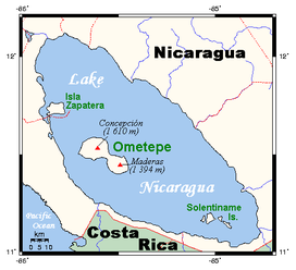
Zapatera is a shield volcano located in the southern part of Nicaragua. It forms the island of Isla Zapatera in the Lake Nicaragua. Isla Zapatera constitutes one of 78 protected areas of Nicaragua.
| Zapatera | |
|---|---|
 | |
| Highest point | |
| Elevation | 629 m (2,064 ft)[1] |
| Coordinates | 11°44′N 85°49′W[1] |
| Geography | |
 Zapatera Location in Nicaragua | |
| Location | Granada Department, Nicaragua |
| Geology | |
| Mountain type | Shield volcano |
| Last eruption | Unknown |
As of 1850, Zapatera was described "uninhabited" by British writer John Baily.[2] The archaeological site of Zapatera is located on the island.
See also
References
- "Zapatera". Global Volcanism Program. Smithsonian Institution. Retrieved 2020-03-17.
- Baily, John (1850). Central America; Describing Each of the States of Guatemala, Honduras, Salvador, Nicaragua, and Costa Rica. London: Trelawney Saunders. p. 156.
Protected areas of Nicaragua | |
|---|---|
| Nature Reserves |
|
| Genetic / Biosphere / Biological / Forest Reserves |
|
| Wildlife Refuges |
|
| National Monuments / Parks / etc |
|
This Nicaragua location article is a stub. You can help Wikipedia by expanding it. |
На других языках
[de] Zapatera
Zapatera ist eine durch den nicht mehr tätigen gleichnamigen Schildvulkan gebildete 52 km² große Insel im Nordwesten des Nicaraguasees, der sich im Süden Nicaraguas befindet.- [en] Zapatera
[es] Zapatera (volcán)
Zapatera (Xomotename) es un volcán en escudo que forma la isla Zapatera situada dentro del Gran Lago de Nicaragua o Cocibolca cerca de su costa sur occidental.[fr] Zapatera
Le Zapatera, aussi appelé Zapatero ou Zapeton, est un volcan bouclier du Nicaragua formant une île dans le lac Nicaragua. L'île de Zapatera et l'archipel alentour appartiennent administrativement au département de Granada.[ru] Сапатера (вулкан)
Сапатера (исп. Zapatera) — стратовулкан в Центральной Америке на одноимённом острове озера Никарагуа. Остров образовался одноимённым вулканом на озере Никарагуа в Республике Никарагуа, в северной части озера. Высота вулкана Сапатера 629 метров. Площадь острова Сапатера — 52 км ².Текст в блоке "Читать" взят с сайта "Википедия" и доступен по лицензии Creative Commons Attribution-ShareAlike; в отдельных случаях могут действовать дополнительные условия.
Другой контент может иметь иную лицензию. Перед использованием материалов сайта WikiSort.org внимательно изучите правила лицензирования конкретных элементов наполнения сайта.
Другой контент может иметь иную лицензию. Перед использованием материалов сайта WikiSort.org внимательно изучите правила лицензирования конкретных элементов наполнения сайта.
2019-2026
WikiSort.org - проект по пересортировке и дополнению контента Википедии
WikiSort.org - проект по пересортировке и дополнению контента Википедии