geo.wikisort.org - Island
Ytter-Vikna (sometimes Ytre Vikna) is one of the three major islands in the municipality of Nærøysund in Trøndelag county, Norway. It is located in the western part of Vikna. Norwegian County Road 770 crosses the 82-square-kilometre (32 sq mi) island. The villages of Austafjord and Valøya are located on this island.[1]
 | |
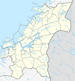 Ytter-Vikna Location of the island  Ytter-Vikna Ytter-Vikna (Norway) | |
| Geography | |
|---|---|
| Location | Trøndelag, Norway |
| Coordinates | 64.9113°N 10.8821°E |
| Area | 82 km2 (32 sq mi) |
| Length | 25 km (15.5 mi) |
| Width | 7 km (4.3 mi) |
| Highest elevation | 173 m (568 ft) |
| Highest point | Vattafjellet |
| Administration | |
Norway | |
| County | Trøndelag |
| Municipality | Nærøysund |
See also
References
- Rosvold, Knut A., ed. (2017-12-25). "Vikna". Store norske leksikon (in Norwegian). Kunnskapsforlaget. Retrieved 2018-05-05.
This Trøndelag location article is a stub. You can help Wikipedia by expanding it. |
Текст в блоке "Читать" взят с сайта "Википедия" и доступен по лицензии Creative Commons Attribution-ShareAlike; в отдельных случаях могут действовать дополнительные условия.
Другой контент может иметь иную лицензию. Перед использованием материалов сайта WikiSort.org внимательно изучите правила лицензирования конкретных элементов наполнения сайта.
Другой контент может иметь иную лицензию. Перед использованием материалов сайта WikiSort.org внимательно изучите правила лицензирования конкретных элементов наполнения сайта.
2019-2026
WikiSort.org - проект по пересортировке и дополнению контента Википедии
WikiSort.org - проект по пересортировке и дополнению контента Википедии