geo.wikisort.org - Island
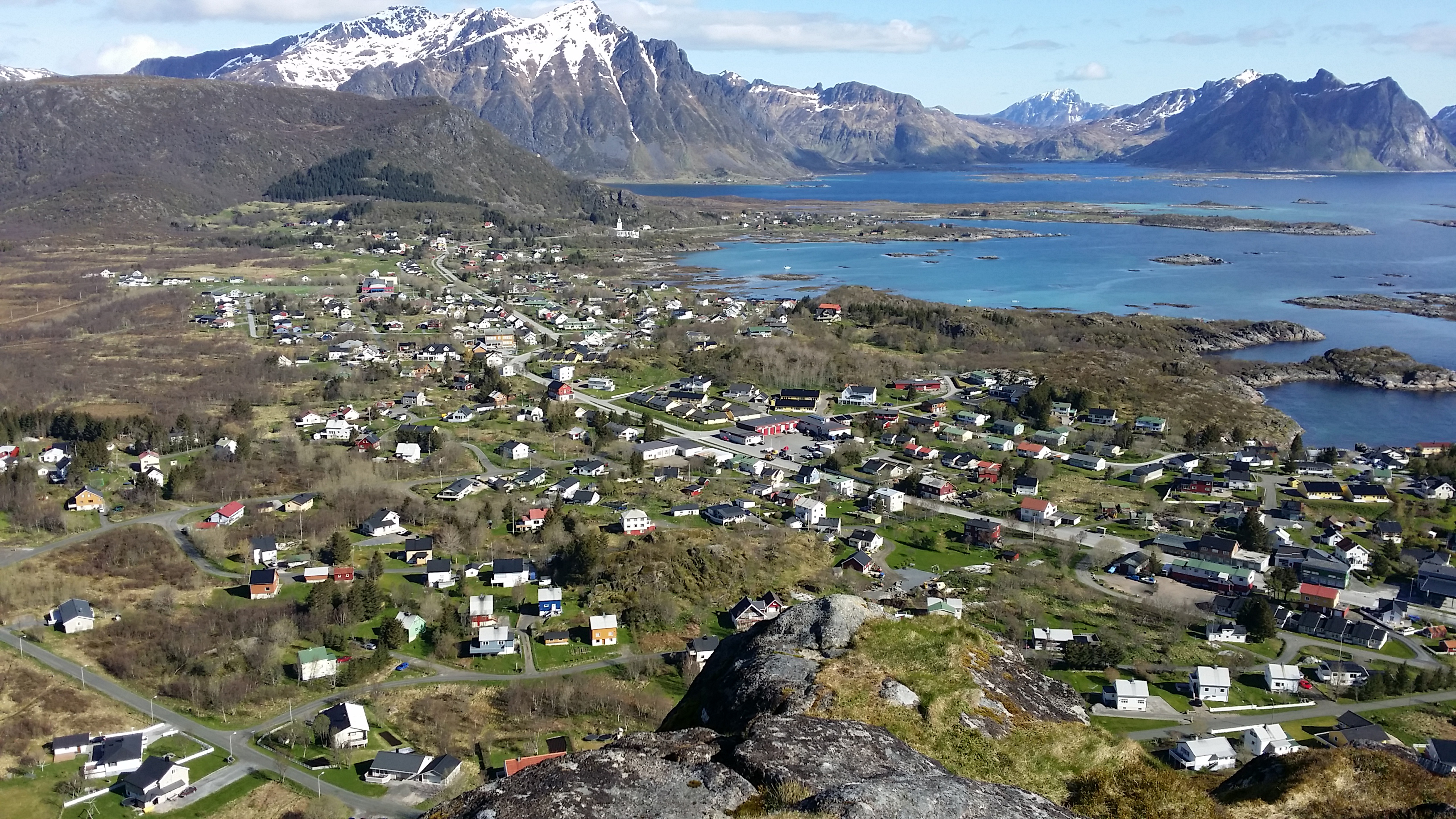
Vestvågøya or Vest-Vågøy is an island in the Lofoten archipelago in Nordland county, Norway. The island is located within Vestvågøy Municipality. The island lies between the islands of Austvågøya and Gimsøya to the northeast and Flakstadøya to the southwest. There are also several small islands and skerries surrounding the island. Vestvågøya makes up over 97% of the municipal area and about 99% of the inhabitants of the municipality live on the island. The European route E10 highway crosses the island connecting to Flakstadøya by the Nappstraum Tunnel and to Gimsøya by the Sundklakkstraumen Bridge.[1]

 | |
 Vestvågøya Location of the island  Vestvågøya Vestvågøya (Norway) | |
| Geography | |
|---|---|
| Location | Nordland, Norway |
| Coordinates | 68.2114°N 13.5566°E |
| Archipelago | Lofoten |
| Area | 411 km2 (159 sq mi) |
| Length | 37 km (23 mi) |
| Width | 21 km (13 mi) |
| Highest elevation | 964 m (3163 ft) |
| Highest point | Himmeltindan |
| Administration | |
Norway | |
| County | Nordland |
| Municipality | Værøy Municipality |
| Demographics | |
| Population | 10,670[1] (2016) |
| Pop. density | 26/km2 (67/sq mi) |
The middle part of the island is relatively flat and marshy, while the outer parts in the north and south are mountainous. The highest point on the island is the 964-metre (3,163 ft) tall mountain Himmeltindan. The flat parts of the island are largely agricultural land. There is one town on the island (Leknes) and several large villages on the island including Stamsund, Ballstad, and Gravdal.
In Vestvågøya mountains have steep slopes towards the open sea in the northwest and southeast while slopes pointing towards the interior of the island are more gentle. This is the result of erosion acting on a landscape that has been uplifted along southwest-northwest-trending faults in the margins of Lofoten while the interior axis has remained more stable.[2]
See also
References
- Store norske leksikon. "Vestvågøy – øy" (in Norwegian). Retrieved 2012-06-22.
- Bergh, Steffen G.; Liland, Kristian H.; Corner, Geoffred D.; Henningsen, Tormod; Lundekvam, Petter A. (2018). "Fault-controlled asymmetric landscapes and low-relief surfaces on Vestvågøya, Lofoten, North Norway: inherited Mesozoic rift-margin structures?" (PDF). Norwegian Journal of Geology. 98 (4). Retrieved January 29, 2019.
This article about an island in Nordland is a stub. You can help Wikipedia by expanding it. |
На других языках
[de] Vestvågøya
Vestvågøya (seltener Vest-Vågøy[1]) ist eine Insel der norwegischen Inselgruppe Lofoten. Die Insel gehört zur Kommune Vestvågøy im Fylke Nordland. Mit einer Fläche von 413,28 km² ist sie die zwölftgrößte Insel des norwegischen Hauptlandes.[2]- [en] Vestvågøya
[fr] Vestvågøya
Vestvågøya (en norvégien : « l'île de Vestvåg ») est une île de l'archipel des Lofoten, en Norvège.Другой контент может иметь иную лицензию. Перед использованием материалов сайта WikiSort.org внимательно изучите правила лицензирования конкретных элементов наполнения сайта.
WikiSort.org - проект по пересортировке и дополнению контента Википедии