geo.wikisort.org - Island
Uvita Island, or Isla Uvita (Spanish: "little grape island"), officially Isla Quiribrí, is a small 0.8-square-kilometre (0.3-square-mile) island 885 metres (2,904 feet) offshore of the port at Limón on the Caribbean coast of Costa Rica. The island is 420 metres (1,380 feet) long from north to south and 315 metres (1,033 feet) wide, northwest to southeast.[1] It is currently uninhabited, but there is at least one structure on the island, and a small dock. It is possible to visit the island by renting a boat and a driver at one of the fishing docks on the Cieneguita River.
Native name: Quiribrí Nickname: La Huerta | |
|---|---|
 Uvita Island | |
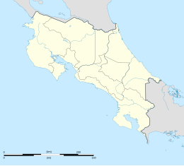 Uvita Island Location in Costa Rica | |
| Geography | |
| Location | Caribbean Sea |
| Coordinates | 09°59′37.68″N 83°0′40.68″W |
| Area | 0.8 km2 (0.31 sq mi) |
| Length | 420 m (1380 ft) |
| Width | 315 m (1033 ft) |
| Highest elevation | 15 m (49 ft) |
| Administration | |
Costa Rica | |
| Demographics | |
| Population | 0 |

Island name
Uvita has had several names over the years; in English, these include Grape Cay, Grape Island, and Uvia Island; in Spanish, the names Isla Uvita and La Uvita are now most common. The Cariari Indians called the island Quiribrí. In 1986 the Comisión Nacional de Nomenclatura (National Commission of Nomenclature) approved the restoration of the name Isla Quiribrí, and the Academia de Geografía e Historia de Costa Rica (Academy of Geography and History of Costa Rica) asked that the Comisión and the Municipality of Limón publish the name change in 2002 during the 500th anniversary of the arrival of Christopher Columbus on the island. Isla Quiribrí is now the official name but is seldom used; locally, the island is still referred to as Isla Uvita, even on official government maps.[2]
History
Christopher Columbus anchored his ships on the island for repairs during his final voyage to America in 1502, and gave the island the name of La Huerta (Spanish: "the orchard").[3] The two-week visit allowed contact with the Indigenous people, who welcomed the Europeans dressed in clothing of gold, which was the reason that some mistakenly attributed to Columbus the naming of Costa Rica (Spanish: "rich coast"), a name which was actually first used by the Royal Audiencia of Panama in 1538.
References
- Ray, R. C. (1890), The navigation of the Caribbean Sea and the Gulf of Mexico, vol. 2 (2nd. ed.), Washington: Government Printing Office, p. 163
- ACADEMIA DE GEOGRAFIA E HISTORIA DE COSTA RICA. "MEMORIA DEDICADA A LA CONMEMORACIÓN DE SUS 70 AÑOS" (PDF) (in Spanish).
- Baker, Christopher P. (2007), Costa Rica (6th. ed.), Emeryville, California: Avalon Travel, p. 179, ISBN 978-1-56691-847-3
На других языках
[de] Isla Quiribrí
Isla Quiribrí (auch: Isla Uvita spanisch: „Kleine Traubeninsel“, Uvita Island) ist eine kleine Insel bei Puerto Limón an der karibischen Küste von Costa Rica.- [en] Uvita Island
[fr] Île Uvita
L'île Uvita (en anglais : Uvita Island) est une petite île située au large du port de Limón au Costa Rica, dans la mer des Caraïbes. Elle appartient administrativement à la province de Limón.[ru] Увита
Уви́та (исп. Isla Uvita) — небольшой необитаемый остров в Карибском море, в трёх километрах от побережья Коста-Рики. Входит в черту города Пуэрто-Лимон, но отделён от него проливом.Другой контент может иметь иную лицензию. Перед использованием материалов сайта WikiSort.org внимательно изучите правила лицензирования конкретных элементов наполнения сайта.
WikiSort.org - проект по пересортировке и дополнению контента Википедии