geo.wikisort.org - Island
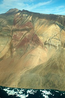
Traill Island (Danish: Traill Ø) is a large island in eastern Greenland. It is named after zoologist Thomas Stewart Traill. The island is a part of the Northeast Greenland National Park.
Native name: Traill Ø | |
|---|---|
 Traill Island seen from space | |
 Map of Traill Island | |
 Traill Island Location of Traill Island in Greenland | |
| Etymology | Named after zoologist Thomas Stewart Traill |
| Geography | |
| Location | Greenland Sea |
| Coordinates | 72°32′N 23°10′W |
| Area | 3,452 km2 (1,333 sq mi) |
| Area rank | 4th largest in Greenland 153rd largest in world |
| Highest elevation | 1,884 m (6181 ft)[1] |
| Highest point | Unnamed |
| Administration | |
Greenland | |
| Unincorporated area | NE Greenland National Park |
| Demographics | |
| Population | 0 (2021) |
| Pop. density | 0/km2 (0/sq mi) |
| Ethnic groups | none |
Geography
Traill Island is a coastal island located in the desolate region of Eastern Greenland on the eastern side of King Oscar Fjord, northeast of Davy Sound. Geographical Society Island lies to the north, separated by a narrow channel, the Vega Sound.
The southernmost point of the island is Cape Simpson. Dream Bay (Drømmebugten) is located 14 km (8.7 mi) WNW of the headland and larger Mountnorris Fjord to the northeast.[2]
The highest summit of the island, a 1,884 metres (6,181 feet) high unnamed peak of the Svinhufvud Range is one of the ultra-prominent summits of Greenland.
 |
See also
References
- Traill High Point
- "Traill Ø". Mapcarta. Retrieved 19 August 2019.
External links
 Media related to Traill Island at Wikimedia Commons
На других языках
[de] Traill Ø
Traill Ø ist mit knapp 3542 km² Fläche[1] die viertgrößte Insel Grönlands und nach Milneland die zweitgrößte Insel vor der Ostküste dieser autonomen Nation. Administrativ gehörte sie bis Ende 2008 zur Provinz Tunu („Ostgrönland“), seit 2009 zum gemeindefreien Gebiet des Nordost-Grönland-Nationalparks.- [en] Traill Island
[fr] Île Traill
L'île Traill ou île de Traill (en danois Traill Ø) est une île côtière du nord-est du Groenland.[it] Traill Ø
Traill Ø è un'isola disabitata della Groenlandia di 3542 km². Si trova a 72°32'N 23°10'O; è situata nel Parco nazionale della Groenlandia nordorientale, fuori da qualsiasi comune.[ru] Трейлл
Трейлл[1] (дат. Traill Ø) — остров у восточного побережья Гренландии. Был назван 10 августа 1822 года Уильямом Скорсби во время его плавания на китобойном судне Баффин, в честь зоолога Томаса Стюарта Трейлла[2]. Наивысшая точка острова имеет высоту 1884 м. Остров входит в состав Северо-Восточного Гренландского национального парка.Другой контент может иметь иную лицензию. Перед использованием материалов сайта WikiSort.org внимательно изучите правила лицензирования конкретных элементов наполнения сайта.
WikiSort.org - проект по пересортировке и дополнению контента Википедии