geo.wikisort.org - Island
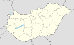
Szentendre Island (Hungarian: Szentendrei-sziget) is an island in the Danube River between the Danube Bend and Budapest in Hungary. The island is flanked by the Szentendre branch of the Danube to the west, and the main branch of the river to the east. It is 31 km long with an area of 56 km², and forms part of the Szentendre District of Pest County.[1][2]
Native name: Szentendrei-sziget | |
|---|---|
 The north end of Szentendre Island is visible on the left of this aerial view of the Danube Bend | |
 Szentendre Island | |
| Geography | |
| Location | Danube River |
| Coordinates | 47°44′50″N 19°06′32″E |
| Administration | |
Hungary | |
The Megyeri Bridge, carrying Budapests's M0 motorway ring road, crosses the southern tip of the island, but there is no access to the island's road network from it. The island is connected to the mainland by the Tildy Bridge that crosses the Szentendre branch. There are also a number of ferries, across both the Szentendre and main branches of the Danube.[1][2]
Several villages are located on the island including (from north to south) Kisoroszi, Tahitótfalu, Pócsmegyer, Surány, Szigetmonostor and Horány. In addition to farmland, orchards and vineyards, the island's most important role is to supply Budapest and the neighbouring towns with water.[1][2]
References
- "47°44'50"N 19°06'32"E" (Map). openstreetmap.org. Retrieved 18 July 2019.
- "Islands of the Danube around Budapest". 11 June 2017. Retrieved 18 July 2019.
This Pest County location article is a stub. You can help Wikipedia by expanding it. |
На других языках
[de] Szentendre-Insel
Die Szentendre-Insel (ungarisch: Szentendrei-sziget, deutsch: Sankt-Andrä-Insel)[1] ist eine ungarische Donauinsel im Komitat Pest. Sie trennt den schmäleren Donauwestarm vom östlichen Hauptstrom. Die Insel ist Bestandteil des Duna-Ipoly-Nationalparks.[2]- [en] Szentendre Island
[it] Isola di Szentendre
L'isola di Szentendre, o Isola di Sant'Andrea in italiano, (ungherese: Szentendrei-sziget) è un'isola fluviale che si trova nel Danubio in territorio ungherese. L'isola è lunga circa 31 km con una larghezza massima di 3,8 km, ed è la seconda per dimensioni nel tratto ungherese del Danubio.Другой контент может иметь иную лицензию. Перед использованием материалов сайта WikiSort.org внимательно изучите правила лицензирования конкретных элементов наполнения сайта.
WikiSort.org - проект по пересортировке и дополнению контента Википедии