geo.wikisort.org - Island
Silda (Northern Sami: Sildi) is an uninhabited island in Loppa Municipality in Troms og Finnmark county, Norway. The 48-square-kilometre (19 sq mi) island lies in the Lopphavet Sea, north of the villages of Bergsfjord and Sør-Tverrfjord on the mainland. The island is very mountainous, the tallest being the 628-metre (2,060 ft) tall mountain Sunnáčohkka. The name of the island may be derived from the Norwegian words for "seal" or "herring".[1]
Native name: Sildi | |
|---|---|
 | |
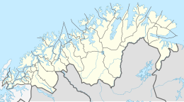
 Silda Location of the island  Silda Silda (Norway) | |
| Geography | |
| Location | Troms og Finnmark, Norway |
| Coordinates | 70.3216°N 21.7398°E |
| Area | 48 km2 (19 sq mi) |
| Length | 15 km (9.3 mi) |
| Width | 4 km (2.5 mi) |
| Highest elevation | 628 m (2060 ft) |
| Highest point | Sunnáčohkka |
| Administration | |
Norway | |
| County | Troms og Finnmark |
| Municipality | Loppa Municipality |
| Demographics | |
| Population | 0 |
Archaeological findings on the islands include farm mounds, traces of houses, burial cairns from the Iron Age and Middle Ages.[2]
See also
References
- Askheim, Svein, ed. (2018-02-20). "Silda i Loppa". Store norske leksikon (in Norwegian). Kunnskapsforlaget. Retrieved 2018-06-23.
- Bruun, Inga Malene (2010). Kulturminneregistrering i gamle fiskevær. Tromsø Museum.
Текст в блоке "Читать" взят с сайта "Википедия" и доступен по лицензии Creative Commons Attribution-ShareAlike; в отдельных случаях могут действовать дополнительные условия.
Другой контент может иметь иную лицензию. Перед использованием материалов сайта WikiSort.org внимательно изучите правила лицензирования конкретных элементов наполнения сайта.
Другой контент может иметь иную лицензию. Перед использованием материалов сайта WikiSort.org внимательно изучите правила лицензирования конкретных элементов наполнения сайта.
2019-2025
WikiSort.org - проект по пересортировке и дополнению контента Википедии
WikiSort.org - проект по пересортировке и дополнению контента Википедии