geo.wikisort.org - Island
Salliaruseq Island (old spelling: Sagdliaruseq, Danish: Storøen, translated: The-big-island) is an uninhabited[1] island in Avannaata municipality[2] in northwestern Greenland. At 130 km2 (50.2 sq mi),[1] it is one of the larger islands in the Uummannaq Fjord system, located in its central part due east of Uummannaq Island. [3]
 Location of Salliaruseq Island | |
| Geography | |
|---|---|
| Location | Uummannaq Fjord |
| Coordinates | 70°41′30″N 51°50′00″W |
| Area | 130 km2 (50 sq mi) |
| Length | 20.5 km (12.74 mi) |
| Width | 9.6 km (5.97 mi) |
| Coastline | 53.5 km (33.24 mi) |
| Highest elevation | 1,418 m (4652 ft) |
| Highest point | Inussugtalik |
| Administration | |
Greenland | |
| Municipality | Avannaata |
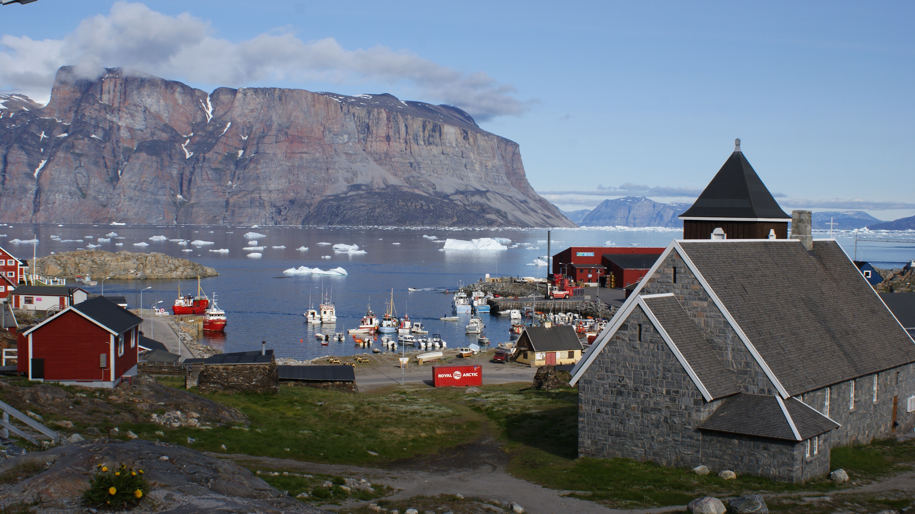
Air Greenland helicopters approach Uummannaq Heliport on the way from Qaarsut Airport alongside the western wall of Salliaruseq, first converging to the island, to then turn 90 degrees to the west due to winds in the Assorput Strait.
Geography

Salliaruseq is separated from the Uummannaq Island in the west by the Assorput Strait; from Appat Island and Saattut archipelago in the north by the central arm of Uummannaq Fjord; from the Qaqullussuit Peninsula jutting off the mainland in the east by Alaanguarqap Suullua strait; from the Ikerasak and Talerua islands in the southeast by the southern arm of the central Uummannaq Fjord, and from the Nuussuaq Peninsula in the south by the Sarqarput Strait.[3]
It is very mountainous, with precipitous walls falling from the summit plateau (Qollortoq) to the south (Ujarassuaq), west (Innarsuaq), and north (Alaanguaraq). The highest point on the island is Inussugtalik (1,418 m (4,652.2 ft)) above the northern wall.[3] The next highest point in the vicinity of the island is the Uummannaq Mountain on the western side of the Assorput Strait.
Promontories
| Name | Direction | Latitude N | Longitude W |
|---|---|---|---|
| Qillorfik | Western Cape | 70°40′22″ | 51°56′04″ |
| Qingaarsuaq | Northwestern Cape | 70°43′42″ | 51°55′20″ |
| Pamiallua | Eastern Cape | 70°39′44″ | 51°25′10″ |
| Ujarassuaq | Southern Cape | 70°39′05″ | 51°49′55″ |
Photographs
 Salliaruseq, a landmark of Uummannaq
 Salliaruseq
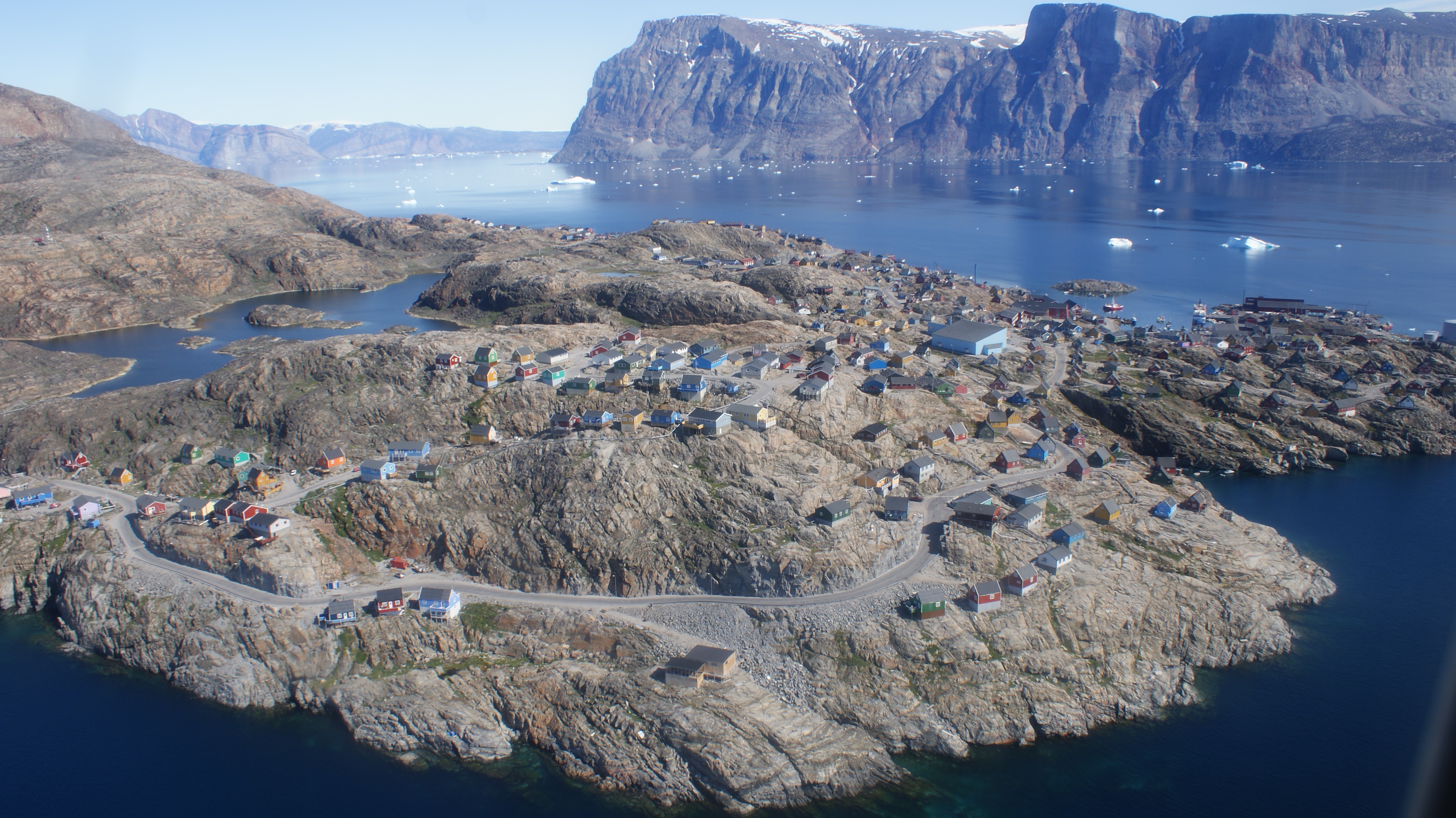
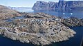 Aerial view of Salliaruseq Island and Uummannaq, photographed from Air Greenland Bell 212 helicopter during Uummannaq-Qaarsut flight
![Qingaarsuaq, the northwestern cape and pillar, a breeding site for thousands of fulmars[4]](//upload.wikimedia.org/wikipedia/commons/thumb/b/b1/Salliaruseq-qingaarssuaq.jpg/120px-Salliaruseq-qingaarssuaq.jpg) Qingaarsuaq, the northwestern cape and pillar, a breeding site for thousands of fulmars[4]
Qingaarsuaq, the northwestern cape and pillar, a breeding site for thousands of fulmars[4]

![Qingaarsuaq, the northwestern cape and pillar, a breeding site for thousands of fulmars[4]](http://upload.wikimedia.org/wikipedia/commons/b/b1/Salliaruseq-qingaarssuaq.jpg)
References
| Wikimedia Commons has media related to Salliaruseq Island. |
- Norwegian University of Science and Technology Archived 2011-06-15 at the Wayback Machine
- kanukoka.gl Archived 2011-07-21 at the Wayback Machine
- Nuussuaq, Saga Map, Tage Schjøtt, 1992
- Uummannaq Tourist Service
На других языках
- [en] Salliaruseq Island
[it] Salliaruseq
Salliaruseq (o Sagdliaruseq, danese Storøen) è un'isola disabitata della Groenlandia di 130 km². Si trova nel fiordo di Uummannaq; appartiene al comune di Avannaata.Другой контент может иметь иную лицензию. Перед использованием материалов сайта WikiSort.org внимательно изучите правила лицензирования конкретных элементов наполнения сайта.
WikiSort.org - проект по пересортировке и дополнению контента Википедии