geo.wikisort.org - Island
Round Island or Ngan Chau (Chinese: 銀洲) is an island in Hong Kong.[1] Administratively part of the Southern District, the island has an area of 0.17 km2. An unmanned navigational beacon was constructed on the island in 1972.
Native name: 銀洲 | |
|---|---|
 Round Island | |
 Round Island | |
| Geography | |
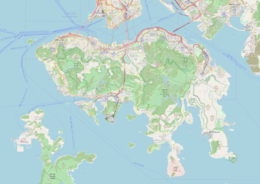
| Location | Southern District |
| Coordinates | 22.21588°N 114.18577°E |
| Area | 0.17 km2 (0.066 sq mi) |
| Administration | |
| Districts | Southern District |
Geology
Round Island has a hilly terrain.[lower-alpha 1] The island's highest point is 49 metres over the sea. It stretches 0.6 km in north–south direction, and 0.5 km in east–west direction. [lower-alpha 2]
Climate
The climate in the area is temperate. The yearly mean temperature in the region is 21 °C. The warmest month is August, when the mean temperature is 24 °C, and the coldest is February at 16 °C.[3] The average yearly precipitation is 2150 mm. The rainiest month is May, with in average 538 mm precipitation, and the driest month is October, with 18 mm precipitation.[4]
| Round Island | ||||||||||||||||||||||||||||||||||||||||||||||||||||||||||||
|---|---|---|---|---|---|---|---|---|---|---|---|---|---|---|---|---|---|---|---|---|---|---|---|---|---|---|---|---|---|---|---|---|---|---|---|---|---|---|---|---|---|---|---|---|---|---|---|---|---|---|---|---|---|---|---|---|---|---|---|---|
| Climate chart (explanation) | ||||||||||||||||||||||||||||||||||||||||||||||||||||||||||||
| ||||||||||||||||||||||||||||||||||||||||||||||||||||||||||||
| ||||||||||||||||||||||||||||||||||||||||||||||||||||||||||||
Notes
- Counting in front from height information (DEM 3") from Viewfinder Panoramas.[2] More about the algorithm exists here: sv:Användare:Lsjbot/Algoritmer.
- Counting in front from height information (DEM 3") from Viewfinder Panoramas.[2] More about the algorithm exists here: sv:Användare:Lsjbot/Algoritmer.
References
- Round Island at Geonames.org (cc-by); post updated 2014-11-05; database dump downloaded 2015-05-23
- "Viewfinder Panoramas Digital elevation Model". Retrieved 2015-06-21.
- "NASA Earth Observations Data Set Index". NASA. Retrieved 30 January 2016.
- "NASA Earth Observations: Rainfall (1 month - TRMM)". NASA/Tropical Rainfall Monitoring Mission. Retrieved 30 January 2016.
This Hong Kong location article is a stub. You can help Wikipedia by expanding it. |
Другой контент может иметь иную лицензию. Перед использованием материалов сайта WikiSort.org внимательно изучите правила лицензирования конкретных элементов наполнения сайта.
WikiSort.org - проект по пересортировке и дополнению контента Википедии