geo.wikisort.org - Island
Rebbenesøya (Norwegian) or Ruobbá (Northern Sami)) is an island in Troms og Finnmark county, Norway. The southern third of the 80.6-square-kilometre (31.1 sq mi) island is part of Tromsø Municipality while the northern (larger) portion of the island is part of Karlsøy Municipality. There is a regular ferry connection from Bromnes on the eastern end on Rebbensøya to Mikkelvik on the northwestern end of the neighboring island of Ringvassøya.[1]
 Rebbenesøy ferry | |
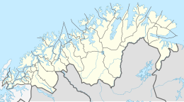
 Rebbenesøya Location of the island  Rebbenesøya Rebbenesøya (Norway) | |
| Geography | |
|---|---|
| Location | Troms og Finnmark, Norway |
| Coordinates | 70.0523°N 18.7225°E |
| Area | 80.6 km2 (31.1 sq mi) |
| Length | 14 km (8.7 mi) |
| Width | 10 km (6 mi) |
| Highest elevation | 694 m (2277 ft) |
| Highest point | Geittinden |
| Administration | |
Norway | |
| County | Troms og Finnmark |
| Municipality | Karlsøy and Tromsø |
| Demographics | |
| Population | 140 (2001) |
| Pop. density | 1.7/km2 (4.4/sq mi) |
On Rebbenesøya, there are many mountains that are suitable for tourists who enjoy the outdoors and hiking. The highest point on the island is Geittinden at a height of 694 metres (2,277 ft). There are also about 20 fishing lakes. The uninhabited island nature reserve of Sørfugløya lies off the north-west coast.
The island's school is in Skogvika; it had six students in the 2012/2013 school year. The island also has a convenience store located in Engvika.
History
Twelve Norwegian commandos from Company Linge were attacked by a German minesweeper in Toftefjord on the island of Rebbenesøya on 30 March 1943. The only man who escaped was Jan Baalsrud. Over a period of three months and enduring harsh conditions, he was aided by patriots in escaping to Sweden. A monument to those killed is located in Toftefjord.
Representation in other media
- Baalsrud's escape is the subject of the book We Die Alone: A WWII Epic of Escape and Endurance (1955) by British author David Howarth. This was adapted as a Norwegian film, called Nine Lives (1957), directed by Arne Skouen. It was nominated for an Oscar in 1958 for best Foreign Language Film.[2]
- The book Jan Baalsrud and Those Who Saved Him (2001), written by Tore Haug and Astrid Karlsen Scott, also recounted his remarkable survival. A Norwegian film based on the book, The 12th Man (2017), was directed by Harald Zwart. It was released on Netflix in 2020.
See also
References
- Store norske leksikon. "Rebbenesøy" (in Norwegian). Retrieved 2010-04-06.
- "The 30th Academy Awards (1958) Nominees and Winners". Oscars.org. Retrieved 2011-10-25.
На других языках
[de] Rebbenesøya
Die Rebbenesøya (nordsamisch: Ruobbá[1]) ist eine Insel in der norwegischen Provinz (Fylke) Troms og Finnmark. Sie gehört zu den Kommunen Tromsø und Karlsøy.- [en] Rebbenesøya
Другой контент может иметь иную лицензию. Перед использованием материалов сайта WikiSort.org внимательно изучите правила лицензирования конкретных элементов наполнения сайта.
WikiSort.org - проект по пересортировке и дополнению контента Википедии