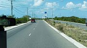
 The Leeward Highway
 The Leeward Highway
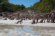 Providenciales Mangrove Reflections
 A Blue Chromis in Providenciales
 A French Angelfish in Providenciales
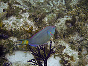 A Stoplight Parrotfish in Providenciales
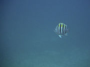 A Sergeant Major in Providenciales
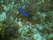 A Blue Tang and Squirrelfish in Providenciales
geo.wikisort.org - Island
Providenciales (known locally as Provo) is an island in the northwest Caicos Islands, part of the Turks and Caicos Islands, a British Overseas Territory.[2] The island has an area of 98 km2 (38 sq mi) and a 2012 Census population of 23,769.[1] Providenciales is the largest island in population, the third largest in area, and is home to a large majority of the population of the Turks and Caicos Islands.[3] Providenciales was ranked the best beach destination in the world by TripAdvisor in 2011.[4]
 Turtle Cove, Providenciales | |
 Providenciales The location of Providenciales within the Turks and Caicos Islands  Providenciales Providenciales (Caribbean) | |
| Geography | |
|---|---|
| Location | Atlantic Ocean |
| Coordinates | 21°46′39″N 72°15′44″W |
| Archipelago | Lucayan Archipelago |
| Administration | |
United Kingdom | |
| British Overseas Territory | Turks and Caicos Islands |
| Demographics | |
| Population | 23,769 (2012)[1] |
| Additional information | |
| Time zone |
|
| • Summer (DST) |
|
| ISO code | TC |
Transportation


The island is served by the Providenciales International Airport.[5]
There is no public transportation on the island.[6]
As recently as 1964, Providenciales did not have a single wheeled vehicle. Roads, water, telephones, and electricity were also absent. The original developer, Provident, Ltd, had shuttle flights from Florida (for a real estate buying program) two times a week in a World War II DC-3 plane and the only hotel was the Third Turtle Inn built by them in 1967.[7]
Economy
After a large investment on Grace Bay Beach by Club Med, the island's first large hotel and casino complex opened in 1984 and touched off a development boom. Resorts included Ocean Club, Turquoise Reef (current Seven Stars), North Beach (now Beaches), and Grace Bay Club. As of the year 2000, Provo is the most tourist-oriented and developed of the Turks and Caicos Islands, boasting many resort hotels and an 18-hole golf course.[3] The island has recently become popular with retirees from around the world, kindling a boom of residential development. Grace Bay has seen many luxury condos built on its shores, however, the settlements of Turks Islanders still provide a local flair to the island.[citation needed]
Visitor attractions
The diving is world class due to the coral reef surrounding the island.[8]
The island is close to a common migration route for the humpback whale. Providenciales is surrounded by uninhabited cays that are easily reached by chartered boat or excursion.
The resorts on Providenciales are primarily centred on 5 mi (8.0 km) long Grace Bay. Apart from the beaches, the island's charm lies in its rugged hills and ridges, which are carpeted with prickly pear cactus and scrub (some say the Turks and Caicos gets its name from the indigenous Turk's head cactus common in the islands).[9]
Long Bay Beach, on the southern, windward side of the island is still largely undeveloped save for a large luxury resort on the northern tip of the beach. Due to its steady wind and relatively isolated location, Long Bay Beach is rapidly becoming a kiteboarding destination in the Caribbean.[10]
Grace Bay has grown to be a major tourist destination with many hotels and condominiums built on the beachfront. Beginning with Club Med in 1984 and Grace Bay Club in 1993, development continued in the late 1990s with The Sands, Point Grace, and Ocean Club West, and again in the 2000s with The Palms (formerly Regent Palms), Gansevoort and West Bay Club.[citation needed]
Outside of Grace Bay, Amanyara was built in the 2000s in the secluded Northwest Point area, and the Shore Club opened in 2017 in the Long Bay Area.[11]
Opportunities for sightseeing and hiking are reasonable. There are remnants of Caribbean piracy at Osprey Rock and Sapodilla Hill, and the ruins of Cheshire Hall plantation, a sisal and cotton plantation owned by the British Loyalist, Thomas Stubbs from the 1790s until 1810.[12]
Ecology

The western half of Providenciales is mostly barren wilderness,[3] home to the island's best natural attraction, Chalk Sound National Park. The park is a 3 mi (4.8 km) long bay southwest of Downtown. The colour of the water is a uniform turquoise and studded with countless mushroom-like tiny islets.[3] Also on the western part of the island is Northwest Point Marine National Park, which extends to nearby reefs and several saline lakes that attract breeding and migrant waterfowl.[3]
Towns

The major road, the Highway, runs east–west from Downtown to Leeward. Most of the island's services are near the Highway, including shopping plazas.
The communities of Downtown and Kew Town are located near Providenciales International Airport. The town of Wheeland is in the northwest corner of the island.
Before Provo became a popular tourist destination, there were three small centers of population: Blue Hills, The Bight (on Grace Bay) and Five Cays. Now many houses have been built, predominantly in the east and south, with larger communities at Leeward, Long Bay and Chalk Sound, as well as expansion of the original three settlements. There are also pockets of makeshift shacks interspersed among the more upscale residences.[citation needed]
Education
Clement Howell High School and Long Bay High School are the local public high schools.[13]
International School of the Turks and Caicos Islands, which serves preschool through grade six, is also in Providenciales, in Leeward. In 2014 it had 106 students. It was known as The Ashcroft School until 2014.[14]
Images
This section contains an unencyclopedic or excessive gallery of images. |


References
- "Population 2012 census". Government of Turks and Caicos. Retrieved 15 May 2021.
- "Turks and Caicos Islands". UK Overseas Territories Conservation Forum. Retrieved 2019-05-04.
- Murray, Lorraine (August 10, 2015). "Providenciales". Encyclopædia Britannica. Encyclopædia Britannica, inc. Retrieved May 4, 2019.
- Zay, Libby. "Trip Advisor Names Top Beach Destinations". AOL Travel. Retrieved 14 April 2011.
- "Getting to Providenciales". Visit Turks and Caicos Islands. Retrieved 2019-05-03.
- "Getting Around Providenciales". Visit Turks and Caicos Islands. Retrieved 2019-05-03.
- Discover Magazine 2014 "Turks & Caicos | discover. Your destinationTurks & Caicos | discover. Your destination". Archived from the original on 2014-11-21. Retrieved 2014-11-22.
- "Turks & Caicos Coral Reef Facts". Turks and Caicos Reef Fund. Retrieved 2019-05-03.
- "Turks and Caicos Islands". Encyclopædia Britannica. Encyclopædia Britannica, inc. January 31, 2019. Retrieved May 4, 2019.
- "Photos of Kiteboarding and Windsurfing on Long Bay Beach". Retrieved 12 July 2015.
- "Travel Agent" (PDF). May 2017. Retrieved May 3, 2019.
- LeVin, Daniel J. "Cheshire Hall Plantation". www.visittci.com. Retrieved 13 March 2022.
- "Schools". Government of Turks and Caicos. Retrieved 15 May 2021.
- Tyson, Vivian (2014-09-15). "Ashcroft School is now International School of the TCI". The Sun. Retrieved 2020-01-18.
External links
Wikivoyage has a travel guide for Providenciales.
Authority control | |
|---|---|
| General |
|
| National libraries | |
На других языках
[de] Providenciales
Providenciales ist eine zu den Turks- und Caicosinseln gehörende Insel, die umgangssprachlich meist nur „Provo“ genannt wird. Es handelt sich um die westlichste bewohnte Insel der Caicos-Inseln. Providenciales mit seinen langen Stränden und Korallenriffen ist eine luxuriöse Touristendestination, die sich mit 350 Sonnentagen pro Jahr rühmt. Die Insel hat eine Fläche von 98 Quadratkilometern[1] und wird von 23.769 Personen bewohnt (Zensus 2012).[2] Höchster Punkt der Insel ist der 48 Meter hohe Blue Mountain.[3]- [en] Providenciales
[fr] Providenciales
Providenciales (surnommée Provo) est une île de l'archipel des îles Caïcos, dépendantes du territoire des Îles Turques-et-Caïques.[it] Providenciales
Providenciales è un'isola di circa 98 km² a nord-ovest dell'isola di Caicos, appartenente a Turks e Caicos Con una popolazione di oltre 23.000 abitanti, è l'isola più popolosa della divisione amministrativa britannica d'oltremare e la terza per superficie.[ru] Провиденсьялес
Провиденсьялес — остров архипелага Теркс и Кайкос, часть одноименного государства в составе Британских заморских территорий[1]. Занимает третье место по площади (98 км²) среди островов архипелага, и первое по количеству населения (23769 человек). Характерен равнинный, местами заболоченный, ландшафт. Обширные территории заняты мангровыми зарослями. Несмотря на количество населения, на острове отсутствуют обособленные муниципальные образования. Примечательно, что до 1964 года на острове не имелось какой-либо инфраструктуры, включая дороги, транспорт, связь и электричество. Развитие островной инфраструктуры началось в 1984 году, после открытия первых отелей и казино. Был построен международный аэропорт, осуществляющий рейсы в Великобританию, США, Канаду, а также на другие острова Карибского бассейна. На сегодняшний день, большая часть населения занята в сфере туризма. Согласно информации туристического сайта TripAdvisor, пляжи Провиденсьялеса признавались лучшими в мире на протяжении нескольких лет.[2][3] Наиболее известными являются пляжи Грейс-Бэй (англ. Grace Bay Beach), Ливорд (англ. Leeward Beach), Тертл-Ков (англ. Turtle Cove Beach), Лонг-Бэй (англ. Long Bay Beach).Текст в блоке "Читать" взят с сайта "Википедия" и доступен по лицензии Creative Commons Attribution-ShareAlike; в отдельных случаях могут действовать дополнительные условия.
Другой контент может иметь иную лицензию. Перед использованием материалов сайта WikiSort.org внимательно изучите правила лицензирования конкретных элементов наполнения сайта.
Другой контент может иметь иную лицензию. Перед использованием материалов сайта WikiSort.org внимательно изучите правила лицензирования конкретных элементов наполнения сайта.
2019-2026
WikiSort.org - проект по пересортировке и дополнению контента Википедии
WikiSort.org - проект по пересортировке и дополнению контента Википедии