geo.wikisort.org - Island
Otterøya is an island in the municipality of Namsos in Trøndelag county, Norway. The 143-square-kilometre (55 sq mi) island is the largest island in the northern part of Trøndelag county. Otterøya sits just to the northwest of the town of Namsos on the north side of the Namsenfjorden. It is connected to the mainland by the Lokkaren Bridge. The island was once governed by the municipalities of Otterøy and Fosnes, and became a part of the municipality of Namsos in 1964. Otterøy Church is located on the island.[1]
 | |
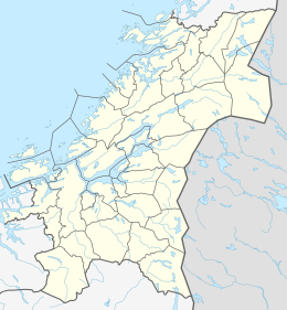 Otterøya Location of the island  Otterøya Otterøya (Norway) | |
| Geography | |
|---|---|
| Location | Trøndelag, Norway |
| Coordinates | 64.4918°N 11.3561°E |
| Area | 143 km2 (55 sq mi) |
| Length | 25 km (15.5 mi) |
| Width | 6 km (3.7 mi) |
| Highest elevation | 446 m (1463 ft) |
| Highest point | Tømmervikfjellet |
| Administration | |
Norway | |
| County | Trøndelag |
| Municipality | Namsos |
| Demographics | |
| Population | 809 (2001) |
| Pop. density | 5.7/km2 (14.8/sq mi) |
Notable residents
- Idar Lind (born 1954), Norwegian writer
See also
References
- Thorsnæs, Geir, ed. (2014-06-25). "Otterøya – Namsos". Store norske leksikon (in Norwegian). Kunnskapsforlaget. Retrieved 2018-04-21.
| Authority control |
|
|---|
This Trøndelag location article is a stub. You can help Wikipedia by expanding it. |
На других языках
[de] Otterøya
Otterøya ist eine Insel in der Gemeinde Namsos in der norwegischen Provinz Trøndelag. Sie ist mit einer Fläche von 143 km² die größte Insel der Gemeinde. Otterøya liegt nordwestlich der Stadt Namsos auf der Nordseite des Namsenfjordes und ist über die Lokkaren-Brücke mit dem Festland verbunden. Die Insel wird oft als „Norwegen in Miniatur“ bezeichnet.[1][2]- [en] Otterøya
Текст в блоке "Читать" взят с сайта "Википедия" и доступен по лицензии Creative Commons Attribution-ShareAlike; в отдельных случаях могут действовать дополнительные условия.
Другой контент может иметь иную лицензию. Перед использованием материалов сайта WikiSort.org внимательно изучите правила лицензирования конкретных элементов наполнения сайта.
Другой контент может иметь иную лицензию. Перед использованием материалов сайта WikiSort.org внимательно изучите правила лицензирования конкретных элементов наполнения сайта.
2019-2026
WikiSort.org - проект по пересортировке и дополнению контента Википедии
WikiSort.org - проект по пересортировке и дополнению контента Википедии