geo.wikisort.org - Island
Orta is an island in Aukra Municipality in Møre og Romsdal county, Norway. The 1-square-kilometre (250-acre) island lies midway between the islands of Harøya and Gossa in the Harøyfjorden. There are ferry connections from Orta to Sandøya and Finnøya (in Ålesund Municipality) and to Gossa (in Aukra Municipality).[1]
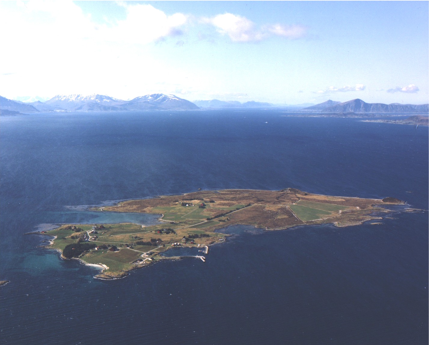 View of the island | |
 | |
 Orta Location of the island  Orta Orta (Norway) | |
| Geography | |
|---|---|
| Location | Møre og Romsdal, Norway |
| Coordinates | 62.7814°N 6.6387°E |
| Area | 1 km2 (0.39 sq mi) |
| Length | 1.5 km (0.93 mi) |
| Width | 1 km (0.6 mi) |
| Coastline | 5.5 km (3.42 mi) |
| Highest elevation | 28 m (92 ft) |
| Highest point | Rambjøra |
| Administration | |
Norway | |
| County | Møre og Romsdal |
| Municipality | Aukra Municipality |
On 1 January 2020, the island of Orta and the small surrounding islets were administratively transferred to the neighboring Aukra Municipality. Prior to that time, they were part of the old Sandøy Municipality.[2]
See also
References
- "Orta" (in Norwegian). yr.no. Retrieved 2010-10-22.
- "Meir om grensejusteringa i Sandøy" (in Norwegian). Nye Ålesund kommune. Retrieved 2019-07-18.
This Møre og Romsdal location article is a stub. You can help Wikipedia by expanding it. |
Текст в блоке "Читать" взят с сайта "Википедия" и доступен по лицензии Creative Commons Attribution-ShareAlike; в отдельных случаях могут действовать дополнительные условия.
Другой контент может иметь иную лицензию. Перед использованием материалов сайта WikiSort.org внимательно изучите правила лицензирования конкретных элементов наполнения сайта.
Другой контент может иметь иную лицензию. Перед использованием материалов сайта WikiSort.org внимательно изучите правила лицензирования конкретных элементов наполнения сайта.
2019-2025
WikiSort.org - проект по пересортировке и дополнению контента Википедии
WikiSort.org - проект по пересортировке и дополнению контента Википедии