geo.wikisort.org - Island
North East Island is the main island of the Snares Island group at 48°01′S 166°36′E approximately 200 kilometres (120 mi) south of New Zealand's South Island. The island forms a central triangle with peninsulas to the north, south and to the west and is some 3 by 2.5 km (1.9 by 1.6 mi) long by wide. Off the South Promontory lies Broughton Island, the second largest island in the group. South off the western peninsula coast lies the islet Alert Stack and off the North Promontory lies the North and South Daption Rocks.
 Looking to the highest point in the West, across North East Island | |
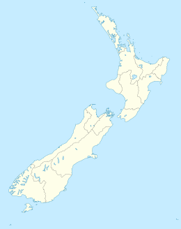 North East Island The position of The Snares relative to New Zealand | |
| Geography | |
|---|---|
| Coordinates | 48°01′30″S 166°36′10″E |
| Archipelago | Snares Islands |
| Length | 3 km (1.9 mi) |
| Width | 2.5 km (1.55 mi) |
| Highest elevation | 130.0 m (426.5 ft) |
| Administration | |
New Zealand | |
| Demographics | |
| Population | 0 |
Climate
North East Island's precipitation occurs mostly during the months of December–May, drier weather then settles in until December.
| Climate data for North East Island, New Zealand | |||||||||||||
|---|---|---|---|---|---|---|---|---|---|---|---|---|---|
| Month | Jan | Feb | Mar | Apr | May | Jun | Jul | Aug | Sep | Oct | Nov | Dec | Year |
| Average precipitation mm (inches) | 113 (4.4) |
169.3 (6.67) |
185.9 (7.32) |
173.7 (6.84) |
44.1 (1.74) |
5.6 (0.22) |
1.7 (0.07) |
1.2 (0.05) |
37.6 (1.48) |
5.1 (0.20) |
28.5 (1.12) |
76.8 (3.02) |
849.0 (33.43) |
| Source: http://www.weatherzone.com.au/climate/station.jsp?lt=site&lc=200782 | |||||||||||||
See also
- New Zealand Subantarctic Islands
- List of Antarctic and subantarctic islands#List of subantarctic islands
- List of islands of New Zealand
- List of islands
- Desert island
References
This article about the geography of New Zealand's outlying islands is a stub. You can help Wikipedia by expanding it. |
На других языках
[de] North East Island
North East Island ist die größte Insel im Archipel der zu Neuseeland gehörenden Snaresinseln im südwestlichen Pazifischen Ozean, rund 200 km südlich der Südinsel Neuseelands gelegen.- [en] North East Island, New Zealand
Другой контент может иметь иную лицензию. Перед использованием материалов сайта WikiSort.org внимательно изучите правила лицензирования конкретных элементов наполнения сайта.
WikiSort.org - проект по пересортировке и дополнению контента Википедии