geo.wikisort.org - Island
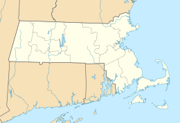
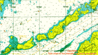
Monohansett Island is one of the Elizabeth Islands between Cedar Island and Naushon Island. It is located in Dukes County, Massachusetts, just east of Naushon Island and 2 miles (3.2 km) southwest of Woods Hole in the Town of Gosnold. The name is of Indian origin that goes back to the close of the seventeenth century.
 Monohansett Island  Monohansett Island | |
| Geography | |
|---|---|
| Coordinates | 41°30′14″N 70°42′11″W[1] |
| Archipelago | Elizabeth Islands |
| Total islands | 1 |
| Highest elevation | 7 ft (2.1 m) |
| Administration | |
United States | |
| State | Massachusetts |
| County | Dukes County |
| The Elizabeth Islands |
|---|
 |
| Major islands |
| Minor islands |
References
- "Monohansett Island". Geographic Names Information System. United States Geological Survey. Retrieved 2018-08-20.
This Dukes County, Massachusetts geography–related article is a stub. You can help Wikipedia by expanding it. |
Текст в блоке "Читать" взят с сайта "Википедия" и доступен по лицензии Creative Commons Attribution-ShareAlike; в отдельных случаях могут действовать дополнительные условия.
Другой контент может иметь иную лицензию. Перед использованием материалов сайта WikiSort.org внимательно изучите правила лицензирования конкретных элементов наполнения сайта.
Другой контент может иметь иную лицензию. Перед использованием материалов сайта WikiSort.org внимательно изучите правила лицензирования конкретных элементов наполнения сайта.
2019-2026
WikiSort.org - проект по пересортировке и дополнению контента Википедии
WikiSort.org - проект по пересортировке и дополнению контента Википедии