geo.wikisort.org - Island
Matiu / Somes Island is the largest of three islands in the northern half of Wellington Harbour, New Zealand. It is the former site of military and quarantine internments, as well as animal quarantine until 1995. Since 1995 it has been designated a Department of Conservation historic and scientific reserve, home to many native species.
Matiu (Māori) | |
|---|---|
 Matiu / Somes Island as seen from Mount Kaukau | |
 Matiu / Somes Island Matiu / Somes Island | |
| Geography | |
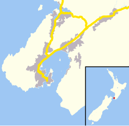
| Location | Wellington Harbour |
| Coordinates | 41°15′29.7″S 174°51′55.4″E |
| Area | 0.249 km2 (0.096 sq mi) |
| Administration | |
New Zealand | |
The island is 24.9 hectares (62 acres), and lies 3 kilometres (1.9 mi) south of the suburb of Petone and the mouth of the Hutt River. Just off the northern tip of Matiu / Somes Island lies tiny Mokopuna Island, also known as Leper Island.[1] Matiu / Somes Island is about 5 kilometres (3 mi) northwest of the much smaller Mākaro / Ward Island.
Names

Legend has it that Matiu and Mākaro islands received their original, Māori names from Kupe, the semi-legendary first navigator to reach New Zealand and return home with knowledge of the new land.[2][3] He named them after his two daughters (or, in some versions of the tale, nieces) when he first entered the harbour about 1000 years ago.[4][5]
After European settlement, the island was known for over a century as Somes Island. In 1839 it fell under the control of the New Zealand Company along with much of the greater Wellington region. The island was renamed after Joseph Somes, the company's deputy-governor and financier at the time. In 1997, the New Zealand Geographic Board assigned the official bilingual name of Matiu / Somes Island in recognition of the island's colourful European and Māori histories. Since then the board has adopted the formatting convention of placing a space before and after the slash, so the official name is now written Matiu / Somes Island.[6][7]
History
Māori history
Prior to the mid-17th century there were two Māori pā on the island. Like the Ngāti Ira pā on Ward Island, they were not permanently inhabited, being "pā of refuge" where people could retreat in times of war. One was in the centre of the island and little more than middens remain there. The other pā was on the northern tip of the island, strategically positioned with cliffs on three sides for ease of defence.
European history

At various times throughout the 19th and 20th centuries the island hosted enemy alien internees during wartime, and quarantine facilities for both human immigrants and (up to 1995[8]) animals. Its use as a quarantine facility is recorded as early as 1864, when James Sellars quarantined sheep on the island.[9] In 1868 the island was declared a quarantine ground and used to isolate passengers from a ship carrying smallpox.[10] When the immigrant ship England arrived in 1872 carrying several passengers with smallpox, passengers and crew were quartered in makeshift accommodation on the island.[11] On other occasions, new arrivals would spend ten minutes in a smokehouse of chlorine, potassium nitrate and sulphur fumes for de-lousing.[8] Forty-five people are known to be buried on the island, mostly immigrants who arrived in the 1870s. In 1971 individual gravestones were removed from the overgrown cemetery and replaced with a large memorial.[12][13] In January 2000 four of the old headstones were retrieved from storage and placed next to the communal memorial.[14]
During World War I, the island housed an internment camp which imprisoned about 300 "enemy aliens." Prisoners during this time included many German prisoners of war and suspected Danish imposter Hjelmar von Danneville.[15]
In 1942, the island was fortified with heavy anti-aircraft gun emplacements on the summit, but they were never used. This whole area was levelled flat for the purpose of this construction, with the result that 17 metres (56 ft) was removed from the island's previous overall height. A degaussing station was built to provide protection for ships against magnetic mines. Many of the physical features of these sites are present on the island today.
From 1947 to 1995 the island was used as a quarantine station for livestock, with limited access to the public from 1981 onwards.[16]
Matiu/Somes became part of Lower Hutt in 1989 and came under the full control of the Department of Conservation (DOC) as a scientific and historic reserve in August 1995.[17]
Transport
Ferry services from Matiu to the Wellington CBD and Days Bay operate as part of ferries in Wellington. An electric ferry was introduced in 2022.[18]
Island geography and ecology
This section needs additional citations for verification. (June 2022) |

A distinct gully runs from the south of the quarantine station and terminates at the sea on the southern end of the island between two largely forested ridges on either side to the east and west. Generally, this gully is a swampy area but it also represents an ephemeral watercourse and during and following heavy rain a small creek flows down it.
The island is a stronghold for the little blue penguin,[19] the spotted shag and black shag,[20][21] the spotted skink,[22][23] the red-billed gull,[20] and several rare and endangered species of plants.
The Royal Forest and Bird Protection Society of New Zealand (Forest & Bird) has been revegetating the island since 1984 and successfully eradicated rats and mice between 1988 and 1989. Red-crowned kākāriki (parakeets) were re-introduced in 2003. There are more than 500 species of invertebrates on the island including two species of wētā – Wellington tree wētā and Cook Strait giant wētā were successfully transferred from Mana Island. A number of endangered plants species have found a refuge on the island.
The island is now home to six species of native reptiles – common skink (Oligosoma nigriplantare), spotted skink (Oligosoma lineoocellatum), copper skink (Cyclodina aenea), common gecko (Hoplodactylus maculatus), Brothers Island tuatara (released in 1998),[24] and forest geckos (Hoplodactylus granulatus), which were transferred to the island in 2006. North Island robins sourced from Kapiti Island were released in April 2006; they bred for the first time in late September and this is viewed as encouraging by DOC staff as it appears to indicate that the island ecosystem represents a suitable habitat for this species. A solar-powered speaker system to attract fluttering shearwaters was installed and began transmitting later that year.
Many of these projects have been supported by the community and the local iwi, Te Āti Awa. The Matiu / Somes Island Charitable Trust was established in 1998 as a partnership between Te Āti Awa and the general community to help protect, nurture and enhance the island by raising funds for projects that increased biodiversity and enhance visitors' enjoyment of the island. Through its active arm, "The Friends of Matiu / Somes", it encourages community participation in work on the island. It also works closely with DOC and community groups such as Forest and Bird.
Tourism
Matiu / Somes Island is an increasingly popular tourist attraction and educational resource for local schools, with about 15,000 visitors per year. The island is free of introduced mammalian predators (such as stoats). Visitors to the island must make sure they are pest-free. Before arriving they must check, clean and seal all gear to make sure no pests, soil, or seeds are brought to the island.[17]
Just to the north lies a much smaller island, Mokopuna Island. To protect endemic wildlife present – particularly nesting seabirds – landing by members of the public is prohibited here.
Matiu / Somes Island lighthouse

The Matiu / Somes Island lighthouse is a harbour navigation light for Wellington Harbour. It is a sector light, marking a safe approach through the harbour channel. The first lighthouse on the site was established in 1866. It was the first inner harbour lighthouse in New Zealand, and one of only eight lighthouses nationwide at that time. However, by 1895 there were multiple complaints that it was inadequate. A replacement lighthouse with a more powerful light was built on an adjacent site and commissioned on 21 February 1900. The light was automated on 1 April 1924 and converted to electricity after 1945.
Matiu / Somes Island in the arts
Maurice Gee's book Live Bodies was set in part on Matiu / Somes Island, with the main character spending time interned there during the Second World War.[25]
Melanie Drewery's book for children Papa's Island tells the story of a family caught up in the internment of "enemy aliens" on Matiu /Somes Island.[26]
David McGill's spy novel The Death Ray Debacle is based on a true story about Victor Penny, an Auckland bus garage attendant and amateur radio enthusiast who in 1935 managed to convince government authorities that he could produce a 'death ray' that was capable of stopping an army, immobilise trucks, and bring down enemy aeroplanes in flight. Penny was placed under the protection of defence authorities initially on Matiu / Somes Island and later at Fort Dorset.[27][28]
In 2013 Bard Productions staged an adaptation on Shakespeare's The Tempest on Matiu / Somes Island, with the boat journey across to the island forming part of the play. Scenes took place at the animal quarantine station and in the open air.[29][30]
See also
References
- O'Neil, Andrea (1 September 2015). "Wellington's Leper Island a legacy of racial hysteria - 150 years of news". Stuff. Retrieved 12 September 2022.
- Walton, Tony; Nester, Richard (May 2001). "Matiu/Somes Island Maori history" (PDF). Department of Conservation. Science & Research Unit, Department of Conservation. Retrieved 17 June 2022.
- Charles Royal, Te Ahukaramū (8 February 2005). "Islands in Wellington Harbour". Te Ara – The Encyclopedia of New Zealand. Retrieved 18 June 2022.
- Thornber, Lorna (30 May 2021). "Kupe's voyage of discovery through Aotearoa still makes for an epic adventure". Stuff.co.nz. Retrieved 18 June 2022.
- Smith, S. Percy (1910). "Kupe: The Navigator". History and Traditions of the Maoris of the West Coast North Island of New Zealand Prior to 1840. New Plymouth: Polynesian Society. Retrieved 18 June 2022.
- "Frameworks of the New Zealand Geographic Board Ngā Pou Taunaha o Aotearoa: Version 10" (PDF). LINZ. 2018. p. 47. Retrieved 3 November 2021.
- "Matiu / Somes Island". New Zealand Gazetteer. Land Information New Zealand. Retrieved 3 November 2021.
- Weekes, John (9 February 2020). "Quarantined: A sordid, sickly, sad underside of New Zealand history". Stuff. Retrieved 16 February 2020.
- "[untitled advertisement]". Wellington Independent. 4 August 1864. Retrieved 12 September 2022 – via Paperspast.
- "Latest telegrams". Star. 22 December 1868. Retrieved 12 September 2022 – via Paperspast.
- "Arrival of a ship at Wellington with smallpox". Daily Southern Cross. 14 March 1872. Retrieved 12 September 2022 – via Paperspast.
- "Hutt Valley Genealogy Branch :: Matiu Somes Island Burials". sites.rootsweb.com. Retrieved 23 October 2022.
- "Human quarantine station". www.doc.govt.nz. Retrieved 23 October 2022.
- "Island gravestones returned". Dominion. 31 January 2000 – via Proquest Australia & New Zealand Newsstream.
- "Defence History of Matiu/Somes Island". New Zealand Department of Conservation. Retrieved 30 December 2020.
- O'Neil, Andrea (8 May 2015). "150 years of news - Matiu/Somes Island's tantalising and miserable history;". Dominion Post. Retrieved 16 June 2022.
- "Matiu/Somes Island Scientific and Historic Reserve: Places to go in Wellington and Kapiti". Department of Conservation. Retrieved 30 May 2019.
- Tso, Matthew (17 November 2021). "Wellington's electric cross-harbour ferry just around the corner following sea trials". Stuff. Retrieved 11 June 2022.
- Cook, Charlotte (28 January 2021). "Starvation behind mass death of little blue penguin chicks". Radio New Zealand. Retrieved 16 May 2022.
- McArthur, Nikki; Ray, Samantha; Crowe, Patrick; Bell, Mike (20 August 2019). "A baseline survey of the indigenous bird values of the Wellington region coastline" (PDF). Greater Wellington Regional Council. Wildlife Management International Ltd. p. 51. Retrieved 16 May 2022.
- Waugh, Susan; Tennyson, Alan; Orange, Rod; Sharp, Steven; Cotter, Reg; Batcheler, Ros; Batcheler, Derek (2013). "Numbers of spotted shags (Stictocarbo punctatus) at breeding sites in Wellington Harbour, 2002-2012". Notornis. 60: 285–289. Retrieved 16 May 2022.
- "Northern spotted skink". New Zealand Herpetological Society. Retrieved 16 May 2022.
- "Spotted skinks on the move". Radio New Zealand. 18 February 2016. Retrieved 16 May 2022.
- Hutching, Gerard; Walrond, Carl. "Story: Threatened species – Page 4. Case histories". Te Ara – The Encyclopedia of New Zealand. Retrieved 16 May 2022.
- Gee, Maurice (1998). Live Bodies. Auckland: Penguin. ISBN 978-0-14-027380-9. OCLC 1045667176.
- Drewery, Melanie (2006). Papa's Island. Fifi Colston. Auckland [N.Z.]: Reed. ISBN 978-1-86948-594-8. OCLC 156753220.
- McGill, David (19 July 2015). The death ray debacle. Paekakariki: Silver Owl Press. ISBN 978-0-9922622-2-8. OCLC 914232606.
- Hindmarsh, Gerard (9 August 2019). "'Death ray' or bedtime story - the curious case of Victor Penny". Stuff. Retrieved 3 July 2022.
- Guest, Bill (22 October 2014). "The tempest on Matiu (Somes Island), 2013". teara.govt.nz. Retrieved 3 September 2022.
- "A tempest off Matiu-Somes Island - Irreverent adaption cuts to an essence". www.theatreview.org.nz. Retrieved 3 September 2022.
Further reading
- Buchanan, Rachel (2011) 'Re-making Memory on Matiu and Other “Settlement” Sites' Memory Connection, Vol 1, no. 1: 284–300.
- Port Nicholson Block Settlement Trust and Department of Conservation. (2012) Mātiu–Makāro–Mokopuna, Wellington Harbour Islands Kaitiaki Management Plan 2012–2017.
- "Matiu/Somes island- Scientific and historic reserve", general information brochure published by the Department of Conservation and the Matiu Somes charitable trust
- Hansford, Dave (2005) 'Matiu / Somes – secrets in plain view' Forest and Bird magazine, no. 318 :14–17.
- McGill, David (2001). Island of secrets : Matiu/Somes Island in Wellington Harbour. Wellington [N.Z.]: Steele Roberts & Silver Owl Press. ISBN 1-877228-37-0. OCLC 48397525.
- Werry, Philippa (2011). "An Island in Time / School Journal Story Library / Instructional Series / English - ESOL - Literacy Online website - Instructional Series". instructionalseries.tki.org.nz. Retrieved 3 July 2022.
- Hector, Janet (2011). A new cloak for Matiu: the restoration of an island ecology. Lower Hutt [N.Z.]: Royal Forest and Bird Protection Society of NZ, Lower Hutt Branch. ISBN 978-0-473-18388-2. OCLC 712647074.
External links
- "Somes Island 1845, drawing by William Swainson". NZETC. 1845.
Authority control | |
|---|---|
| General |
|
| National libraries | |
На других языках
[de] Matiu/Somes Island
Matiu/Somes Island ist mit einer Fläche von 24,9 Hektar die größte von drei Inseln in der nördlichen Hälfte der Hafens von Wellington in Neuseeland. Sie liegt 3 km südlich der Vorstadt Petone und von der Mündung des Te Awa Kairangi / Hutt River sowie etwa 5 km nordwestlich der viel kleineren Insel Makaro/Ward Island.- [en] Matiu / Somes Island
[fr] Île de Matiu/Somes
L'île de Matiu/Somes (Somes Island ; en maori : Matiu) est situé à 3 km au sud de Petone et à l'embouchure de la rivière Hutt, près du port de Wellington dans la région de Wellington (Île du Nord–Nouvelle-Zélande.Другой контент может иметь иную лицензию. Перед использованием материалов сайта WikiSort.org внимательно изучите правила лицензирования конкретных элементов наполнения сайта.
WikiSort.org - проект по пересортировке и дополнению контента Википедии