geo.wikisort.org - Island
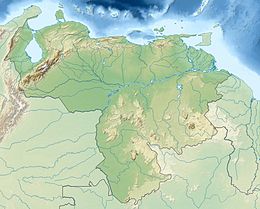
Madrisquí[1][2] (also known as Cayo Madriskí or Madrizqui) is a small island that belongs to the Archipelago of Los Roques,[3] which is administratively part of the Federal Dependencies and is under the authority of the Miranda Island Territory in the waters of the Caribbean Sea of Venezuela . Is part of the tourist or recreational area of the park,[4] is linked to Cayo Pirata through a narrow sand barrier. It has an area of 18.85 hectares (0.18 square kilometers).
 Madrisquí Island | |
| Geography | |
|---|---|
| Location | Lesser Antilles Caribbean Sea |
| Coordinates | 11°56′07″N 66°39′40″W |
| Archipelago | Los Roques |
| Area | 0.18 km2 (0.069 sq mi) |
| Administration | |
| Federal Entity | Federal dependencies of Venezuela |
Location
It is located to the southeast of Isla Gran Roque, to the northeast of Cayo Pirata, to the north of Isla Esparquí and the Ensenada or Bajo de los Corales and to the west of the so-called "Great Barrier Reef of the East".
Tourism
It is one of the keys most visited by tourists, due to its proximity to the island Gran Roque, has some inns to cater to visitors, beautiful beaches and a very practiced activity is diving. It is also very visited by fly fishing enthusiasts. On foot you can reach Cayo Pirata famous for its lobster fishing.
Gallery
See also
- Cayo de Agua
- Gran Roque
References
- La guía Valentina Quintero: Venezuela (in Spanish). Travesía Editorial. 2002.
- Peachin, Mary L. (2014-05-01). Caribbean Scuba Diving. Peachin Adventures. ISBN 978-0-9911981-1-5.
- Huber, Joyce (2007-06-15). Best Dives of the Caribbean. Hunter Publishing, Inc. ISBN 978-1-58843-190-5.
- Adès, Harry (2004). The Rough Guide to South America. Rough Guides. ISBN 978-1-85828-907-6.
External links
На других языках
- [en] Madrisquí
[es] Madrisquí
Cayo Madrisquí[1] (también conocido como Cayo Madriskí o Madrizqui) es una pequeña isla que pertenece al Archipiélago de Los Roques, que administrativamente forma parte de las Dependencias Federales y está bajo la autoridad del Territorio Insular Miranda, es parte de la Zona turística o recreativa del parque, está unido a Cayo Pirata a través de una estrecha barrera de arena. Posee una superficie terrestre de unas 19 hectáreas (0,1885 km²).Другой контент может иметь иную лицензию. Перед использованием материалов сайта WikiSort.org внимательно изучите правила лицензирования конкретных элементов наполнения сайта.
WikiSort.org - проект по пересортировке и дополнению контента Википедии


