geo.wikisort.org - Island
Kvaløya (Norwegian) or Sállir (Northern Sami) (lit. "Whale Island") is an island in Tromsø Municipality in Troms og Finnmark county, Norway. At 737 square kilometres (285 sq mi), it is the fifth largest island in mainland Norway. It is connected to the neighboring island of Tromsøya to the east by the Sandnessund Bridge, to the island of Ringvassøya to the north by the sub-sea Kvalsund Tunnel, to the small island of Sommarøya to the west by the Sommarøy Bridge, and to the mainland to the south by the Rya Tunnel. The island of Sommarøy, on the southwest coast, is a popular recreation area with magnificent coastal scenery.[1]
 Kvaløya seen from Tromsøya; the Sandnessund Bridge connects the two islands. (March 2006) | |
 | |
 Kvaløya Location of the island  Kvaløya Kvaløya (Norway) | |
| Geography | |
|---|---|
| Location | Troms og Finnmark, Norway |
| Coordinates | 69.5759°N 18.3665°E |
| Area | 737 km2 (285 sq mi) |
| Area rank | 5th in Norway |
| Length | 46 km (28.6 mi) |
| Width | 25 km (15.5 mi) |
| Highest elevation | 1,044 m (3425 ft) |
| Highest point | Store Blåmannen |
| Administration | |
Norway | |
| County | Troms og Finnmark |
| Municipality | Tromsø Municipality |
| Demographics | |
| Population | 13,030 (2018) |
| Pop. density | 17.7/km2 (45.8/sq mi) |
Geography

Kvaløya is a mountainous island, with at least ten mountains higher than 700 metres (2,300 ft), and three reaching an elevation of more than 1,000 metres (3,300 ft); of which the highest is Store Blåmann (big blueman at 1,044 metres (3,425 ft), can be climbed without climbing equipment, last part is steep). There are also several small fjords, almost dividing the island in two or three parts: Kaldfjorden, Ersfjorden, and Kattfjorden.
The Rystraumen is a tidal current in the Straumsfjorden strait separating Kvaløya from the mainland to the south. Near this current, on the Kvaløya side, is Straumhella (30 kilometres or 19 miles from the city), a popular recreation area with good fishing opportunities.
Ryøya is an island in the midst of Rystraumen, formerly home to a small population of musk oxen that lived in the pine forest. The last musk ox, known as Alma, was discovered dead in 2013; an autopsy revealed that she had plastic in her stomach. Someone had left the rings of a beer six-pack behind on the island and Alma was found to have eaten them.[2]
Demography
Approximately 13,000 people live on Kvaløya, most of them on the eastern side near Kvaløysletta (which constitutes a suburban area of the city of Tromsø) near the Sandnessund Bridge.
Climate
According to official climate statistics, the west coast of Kvaløya, facing the open ocean, is the warmest part of Tromsø municipality. The weather station at Sommarøy on the west coast has 24-hr averages of −1.9 °C (28.6 °F) in January, 11.9 °C (53.4 °F) in July and a mean annual temperature of 3.9 °C (39.0 °F), while annual precipitation is 940 millimetres (37 in).
Media gallery
 The mountains of Kvaløya seen from Skulsfjord
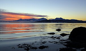 Midday twilight on Kvaløya in winter
 View of the Ersfjorden
 Rekvik village on Kvaløya
 Tromsøya (right) and Kvaløya (left)
 Rock carvings at Skavberget
 Village of Kaldfjord
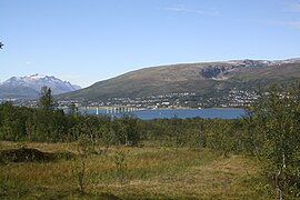 Kvaløysletta


See also
References
- Thorsnæs, Geir, ed. (2018-06-25). "Kvaløya – Tromsø". Store norske leksikon (in Norwegian). Kunnskapsforlaget. Retrieved 2018-08-12.
- Børstad, Sanna Drogset (2018-08-13). "Nå er det ikke lenger moskus på Ryøya" [There are No More Musk Oxen on Ryøya]. ITromsø (in Norwegian). Retrieved 2019-04-21.
External links
- Climbing Store Blåmann - information and pictures
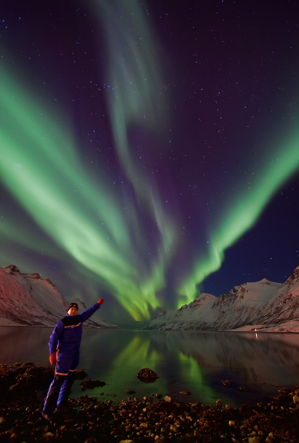
- Spaceweather.com - picture of spectacular aurora borealis above Kvaløya fjord Feb 15 2010
- 37 kg cod caught on fishing rod near Kvaløya
- https://www.independent.co.uk - image of Northern Lights seen through the boreal forest of Kvaløya[dead link]
| Authority control |
|
|---|
На других языках
[de] Kvaløya
Kvaløya („Walinsel“; samisch: Sállir)[1] ist die fünftgrößte Insel Norwegens[2] und gehört zur Fylke Troms og Finnmark. Auf der von mehreren Fjorden stark zergliederten Insel liegen Teile der Stadt Tromsø, der größte Teil von Kvaløya ist aber ländlich geprägt.- [en] Kvaløya (Tromsø)
[fr] Kvaløya (Troms)
Kvaløya (en same du Nord : Sállir) est la cinquième île de Norvège par la superficie (le Svalbard mis à part) avec 737 km2. Il s'agit d'une île montagneuse, qui compte cinq sommets de plus de 700 mètres, et trois de plus de 1 000 mètres, le plus haut étant le Store Blåmann, avec 1 044 m.[it] Kvaløya
Kvaløya (Isola delle balene), indicata in lingua sami settentrionale come Sállir ed in italiano anche come isola di Kvaloy[1], è un'isola della Norvegia settentrionale situata nell'area urbana di Tromsø.[ru] Сёр-Квалёй
Сёр-Ква́лёй[1][2] (норв. Kvaløya, сев.‑саам. Sállir) — остров на севере Норвегии в фюльке (провинции) Тромс. В литературе на русском языке встречаются различные варианты названия острова: Сёр-Квалё[3], Квалё[4], Квалею[5]. Этот остров имеет то же норвежское название (Kvaløya), что и остров в фюльке Финнмарк, на котором расположен город Хаммерфест, — для того острова нормализованной формой русского названия является Квалёйа[6][7].Другой контент может иметь иную лицензию. Перед использованием материалов сайта WikiSort.org внимательно изучите правила лицензирования конкретных элементов наполнения сайта.
WikiSort.org - проект по пересортировке и дополнению контента Википедии