geo.wikisort.org - Island
Kizer Island is an ice-covered island about 30 kilometres (15 nmi) long, lying 20 kilometres (10 nmi) southwest of Cronenwett Island at the west end of the Sulzberger Ice Shelf off Saunders Coast, Marie Byrd Land, Antarctica. It was mapped from surveys by the United States Geological Survey (USGS) and from U.S. Navy air photos (1959–65), and was named for Lieutenant T.L. Kizer, U.S. Navy, a helicopter pilot on the USS Glacier (AGB-4) who sighted the island from the air on January 26, 1962.[1][2]
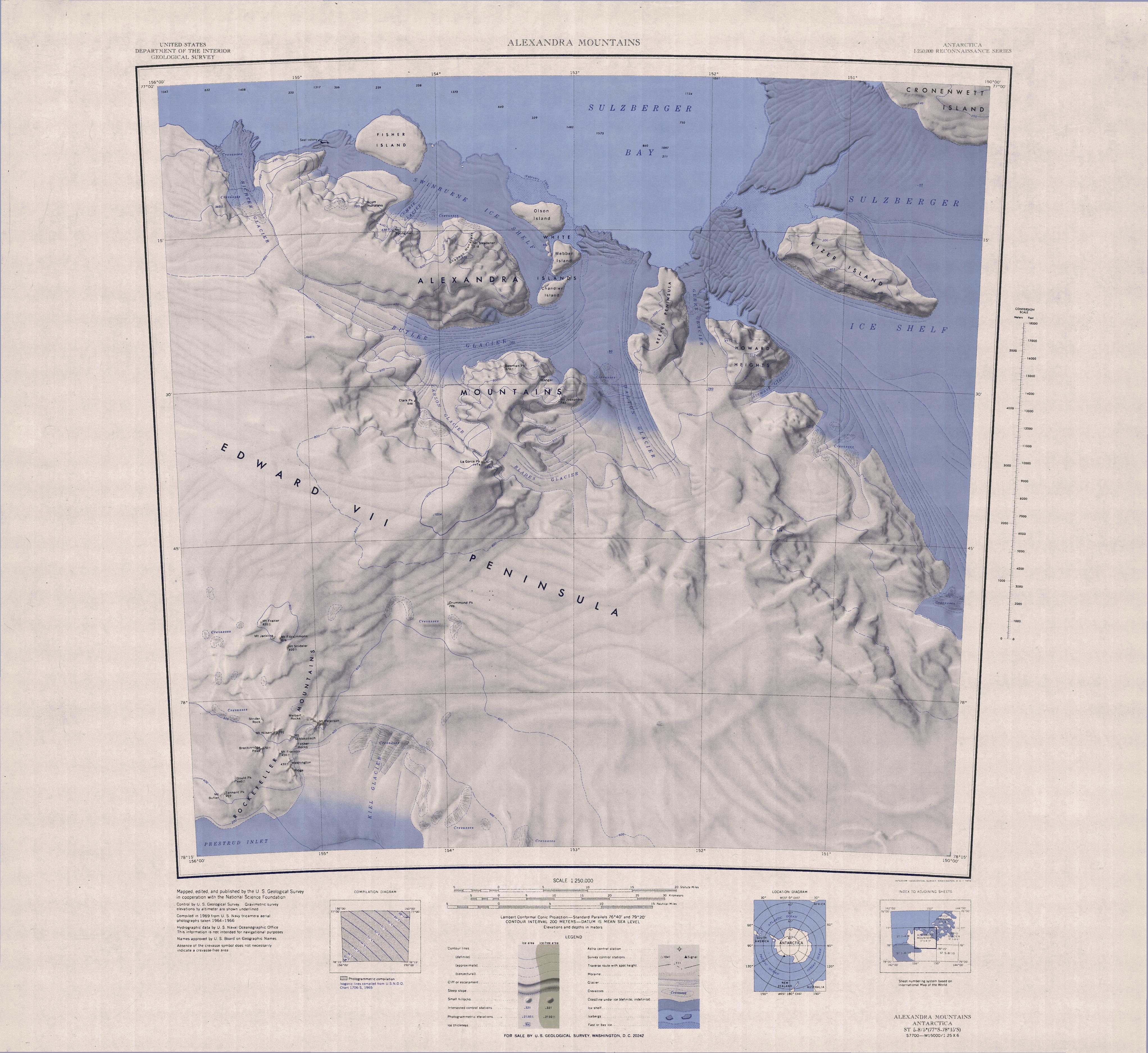 Topographic map sheet with Kizer Island in the Northeast | |
 Kizer Island Location in Antarctica | |
| Geography | |
|---|---|
| Location | Antarctica |
| Coordinates | 77°16′S 150°48′W |
| Length | 30 km (19 mi) |
| Highest elevation | 465 m (1526 ft) |
| Administration | |
| Administered under the Antarctic Treaty System | |
| Demographics | |
| Population | Uninhabited |
See also
- List of antarctic and sub-antarctic islands
References
- "Kizer Island". Geographic Names Information System. United States Geological Survey, United States Department of the Interior. Retrieved 2013-05-09.
- Alberts, Fred G., ed. (June 1995). Geographic Names of the Antarctic (PDF) (second ed.). United States Board on Geographic Names. p. 395. Retrieved 2012-04-05.
![]() This article incorporates public domain material from the United States Geological Survey document: "Kizer Island". (content from the Geographic Names Information System)
This article incorporates public domain material from the United States Geological Survey document: "Kizer Island". (content from the Geographic Names Information System)
This Ross Dependency location article is a stub. You can help Wikipedia by expanding it. |
На других языках
[de] Kizer-Insel
Die Kizer-Insel (oder auch Kizer Island) ist eine vereiste und etwa 24 km lange Insel im Marshall-Archipel vor der Saunders-Küste des Marie-Byrd-Lands. Sie liegt 16 km südwestlich der Cronenwett-Insel am westlichen Ende des Sulzberger-Schelfeises.- [en] Kizer Island
[it] Isola Kizer
L'isola Kizer è un'isola rocciosa della Terra di Marie Byrd, in Antartide. L'isola, che è completamente ricoperta dai ghiacci e che si estende in direzione est/ovest per circa 30 km e in direzione nord/sud per circa 20, è situata nella parte della Terra di Marie Byrd che si sovrappone alla parte nord-orientale della Dipendenza di Ross e della fa parte dell'arcipelago Marshall; come le altre isole di questo arcipelago anch'essa si trova davanti alla costa di Saunders, all'interno della baia di Sulzberger, dove è quasi completamente circondata dai ghiacci della piattaforma glaciale Sulzberger e dove giace subito a est dell'isola Cronenwett.[1]Другой контент может иметь иную лицензию. Перед использованием материалов сайта WikiSort.org внимательно изучите правила лицензирования конкретных элементов наполнения сайта.
WikiSort.org - проект по пересортировке и дополнению контента Википедии