geo.wikisort.org - Island
Grytøya (Norwegian) or Rivttek (Northern Sami) is an island in Harstad Municipality in Troms og Finnmark county, Norway. The 108-square-kilometre (42 sq mi) island lies just north of the large island of Hinnøya and south of the island of Bjarkøya. It is surrounded by the Vågsfjorden in the east and the Andfjorden in the west. The highest peak on the island is the 1,012-metre (3,320 ft) tall mountain Nona. The population of Grytøya (2017) is 433. The southeastern part of the island is the most agriculturally productive.[1]
 Grytøya seen from Hinnøya | |
 | |
 Grytøya Location of the island  Grytøya Grytøya (Norway) | |
| Geography | |
|---|---|
| Location | Troms og Finnmark, Norway |
| Coordinates | 68.9222°N 16.4629°E |
| Area | 108 km2 (42 sq mi) |
| Length | 17 km (10.6 mi) |
| Width | 10 km (6 mi) |
| Coastline | 62 km (38.5 mi) |
| Highest elevation | 1,012 m (3320 ft) |
| Highest point | Nona |
| Administration | |
Norway | |
| County | Troms og Finnmark |
| Municipality | Harstad Municipality |
| Demographics | |
| Population | 433 (2017) |
| Pop. density | 4/km2 (10/sq mi) |
The northern part of the island was formerly part of the old municipality of Bjarkøy, which merged with Harstad Municipality on 1 January 2013.
Transportation
There is a ferry connection from Bjørnå (on Grytøya) to Vika (on the neighboring island of Hinnøya), just north of the town of Harstad. The main road on the island follows the coastline from the northeast at Fenes to Grotavær in the northwest. There is very little settlement on the northern coast, and no road connections there.[1]
There used to be ferry connections to the neighboring islands of Bjarkøya and Sandsøya, but the Bjarkøy Fixed Link project created a bridge and undersea tunnel system connecting the three islands. They will open in late 2018.[2]
Media gallery
 Grytøya, seen from the Southeast
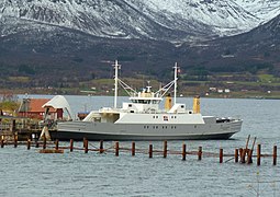 Ferry docked at Grytøya
 Alvestad on Grytøya
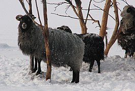 Sheep on Grytøya
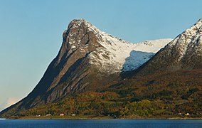 View of Toppen on Grytøya


See also
References
- Thorsnæs, Geir, ed. (2018-02-13). "Grytøya". Store norske leksikon (in Norwegian). Kunnskapsforlaget. Retrieved 2018-09-01.
- "Fv. 867 / Fv. 125 Bjarkøyforbindelsene" (in Norwegian). Statens Vegvesen. Retrieved 17 August 2012.
External links
На других языках
[de] Grytøya
Grytøya ist eine Insel im Fylke (Provinz) Troms og Finnmark in Nordnorwegen.- [en] Grytøya
[ru] Грютёйа
Грютёйа[1](норв. Grytøya) — остров, расположенный к северу от острова Хиннёйа и к югу от острова Бьяркёйа в Северной Норвегии. Территория острова принадлежит двум коммунам Харстад и Бьяркёй, фюльке Тромс. Территория острова 108 км²[2], самая высокая точка острова — гора Нона, высотой 1012 м над уровнем моря.Другой контент может иметь иную лицензию. Перед использованием материалов сайта WikiSort.org внимательно изучите правила лицензирования конкретных элементов наполнения сайта.
WikiSort.org - проект по пересортировке и дополнению контента Википедии