geo.wikisort.org - Island
Gonâve Island or Zile Lagonav (French: Île de la Gonâve, pronounced [ɡɔ.nɑv]; also La Gonâve) is an island of Haiti located west-northwest of Port-au-Prince in the Gulf of Gonâve. It is the largest of the Hispaniolan satellite islands. The island is an arrondissement (Arrondissement de La Gonâve) or Ouest-Insulaire in the Ouest and includes the communes of Anse-à-Galets and Pointe-à-Raquette.[3]
Native name: Goanabo | |
|---|---|
 1994 view of La Gonâve from NASA STS-60 | |
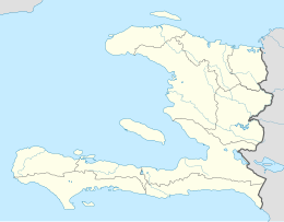 La Gonâve Gonâve Island (Haiti) | |
| Geography | |
| Location | Gulf of Gonâve |
| Coordinates | 18°50′N 73°05′W |
| Area | 689.62 km2 (266.26 sq mi) |
| Highest elevation | 778 m (2552 ft) |
| Highest point | Morne La Pierre |
| Administration | |
Haiti | |
| Department | Ouest |
| Largest settlement | Anse-à-Galets (pop. 49,050) |
| Demographics | |
| Demonym | Gonâvians |
| Population | 87,077 (2015) |
| Pop. density | 126/km2 (326/sq mi) |
| Pointe Fantasque Lighthouse | |
| Foundation | concrete base |
| Construction | metal skeletal tower |
| Height | 15 m (49 ft) |
| Shape | square pyramidal tower with balcony and light[1][2] |
| Markings | white tower |
| Power source | solar power |
| Focal height | 20 m (66 ft) |
| Range | 9 nmi (17 km; 10 mi) |
| Characteristic | Q(6)+LFI W 15s |
Etymology
La Gonave or Gonave is a Frenchify form of Guanabo.
History
Taino Period
The indigenous Taínos called the island Guanabo. Under the leadership of Hatuey, the island was the last refuge of the natives after the invasion of the Europeans.
European Period
No major French or Spanish settlement was built in La Gonave. During the colonial period, the island was uninhabited by colonists, which led the indigenous Taínos to seek refuge there after early battles with the Spanish.[4] Runaway slaves in the French period, too, sometimes sought out the island for a place to hide from their owners on the mainland.[5] Overgrazing and over-exploitation of water resources affect the island's current residents.
Haitian Period
The island became officially under Haitian control since the Toussaint Louverture and the Constitution of 1801.
Modern Period
In 1926, U.S. Marine Corps Sergeant Faustin E. Wirkus (1896–1945) was proclaimed by the residents of the island as King Faustin II. His reign lasted until 1929, when he returned to the United States.[6] For context, Haiti is a republic and abolish monarchy since 1859 with Fabre Nicolas Geffrard, therefore this Faustin II monarchy is folklore.
In the mid-1980s, British singer Cliff Richard wrote and recorded a song "La Gonave" for relief aid for the people of the island. It is included on his album The Rock Connection.
The island's docks were damaged by the 2010 Haiti earthquake of 12 January 2010. In the wake of the damage, supplies have been airlifted in to the 550-metre (1,800 ft) dirt strip.[7]
Independence movement
The island inhabitants have pushed the idea of independence from Haiti in other to achieve economical prosperity. Although this is unconstitutional, La Gonave has a case for being an eventual special territory or department.


Geography
The island sits in the middle of the Gulf of Gonave, south of St-Marc, north of Miragoanes, and west of Port-au-Prince. It forms the canal of St-Marc with the Cote des Arcadins and the Canal of the South and Miragoanes.
Made up of mostly limestone, the reef-fringed island of Gonâve is 60 km (37 mi) long and 15 km (9 mi) wide and covers an area of 743 km2 (287 sq mi). The island is mostly barren and hilly with the highest point reaching 778 m (2,552 ft). The island receives between 800 mm (31 in) to 1,600 mm (63 in) of rain a year, higher elevations representing the latter figure.[8]
The barren, dry nature of the soil has long prevented agricultural development on the island and kept the population lower than it otherwise might have been.
Administrative division
La Gonâve arrondissement is divided into two communes: Anse-à-Galets and Pointe-à-Raquette. These are further subdivided into eleven sections and two towns (villes). The towns are Anse-à-Galets and Pointe-à-Raquette, named after their respective communes. Anse-à-Galets is the largest settlement on the island with an estimated 2015 population of 52,662 of the island's total population of 87,077.[9][10]
| Anse-à-Galets | Pointe-à-Raquette |
|---|---|
| 1st Palma | 5th Gros Mangle |
| 2nd Petite Source | 6th La Source |
| 3rd Grande Source | 7th Grand Vide |
| 4th Grand Lagon | 8th Trou Louis |
| 10th Picmy (Pickmy) | 9th Pointe-à-Raquette |
| 11th Petite Anse |
Water scarcity
In 2005, following a particularly drastic drought, the Mayor of Anse-à-Galets formed the Water Platform, composed of service groups working on the island. Current participants include the Mayors of Anse-à-Galets and Pointes a Racquette, the Deputy, Justice of the Peace, World Vision, Concern WorldWide, Sevis Kretyen, the Matènwa Community Learning Center, the Alleghany Weslyen Church, the Methodist Church, Haiti Outreach and many others. The Water Platform acts as a focal point for activities on the island, providing a coordination point for the multitude of groups working on La Gonâve.
Assistance efforts
The members of the Water Platform have been working to address the water needs of the island by capping springs, building rainwater catchment cisterns, building water systems and drilling wells. Dozens of rainwater catchment cisterns and wells have been drilled on the island as an effort to bring water relief to the residents of the island.
2002–2004 Guts Church funded construction of a school providing first through sixth grade education and construction of a medical clinic providing free medical, dental and vision services for Haitians
As of 2007[update], there were two non-profit groups actively drilling water wells on the island: Haiti Outreach, which has financed and drilled water wells in 25 communities; and Guts Church in Tulsa, Oklahoma. The Tougher Than Hell Motorcycle Rally, organized by Guts Church, has sponsored 10 water wells drilled on the island.
In 2010 Coordinated relief efforts after the 12 January earthquake. $250,000 was raised for this relief project. Medical supplies, building supplies, 150 tons of rice and beans and a backhoe were purchased. Aid was shipped to La Gonâve via a leased vessel and delivered directly to La Gonâve in early March 2010. The aid shipment fed 50,000 people for one month.
As of 2011[update] there are over 70 water wells fully functional on the island
The drilling of more wells on the island has been planned for the near future.[11]
Since 2007, the Washington D.C.-based nonprofit Roots of Development and its La Gonâve-based Haitian sister organization Rasin Devlopman have been providing leadership and capacity-building programs to community leaders and locally elected officials on the island. The two organizations provide leaders access to professional facilitators, workshops and trainings, and material and financial resources, to help them strengthen local capacity and improve quality of life on the island.
Founded in 2014, the Australian-based non-profit organisation For You Haiti began coordinating surgeries for children from la Gonâve island. The children receive medical treatment on the mainland of Haiti and in the United States. For You Haiti has a mentoring program for men and women to start small businesses in Haiti, with the goal of empowering communities to break the cycle of poverty. In 2016, For You Haiti started the Hungry Tummies Project at Complexe Scolaire Amis des Enfants and began growing their own food in the region of Palma, in the hope of making lasting change for the la Gonâvian people.
"Fierté gonavienne" disaster
On 8 September 1997, a ferry from La Gonâve to the Montrouis on the Haitian mainland sank with hundreds of passengers aboard. It is considered the worst disaster in Haitian maritime history since the "Neptune" accident in 1993.[12]
Sports teams
- Roulado - professional football club
Notable natives and residents
- Faustin E. Wirkus - King of La Gonâve (Faustin II)
- Ti Memenne of La Gonâve - Queen of La Gonâve
See also
- List of lighthouses in Haiti
References
- Rowlett, Russ. "Lighthouses of Haiti". The Lighthouse Directory. University of North Carolina at Chapel Hill. Retrieved 22 January 2017.
- List of Lights, Pub. 110: Greenland, The East Coasts of North and South America (Excluding Continental U.S.A. Except the East Coast of Florida) and the West Indies (PDF). List of Lights. United States National Geospatial-Intelligence Agency. 2016.
- Description de Saint-Domingue, M.L.E. Moreau de Saint-Méry, vol. 2, p. 528, Philadelphia: 1798.
- Description de Saint-Domingue, p. 528.
- "Les Affiches Américaines", 19 March 1766, pg. 102 (accessed 30 May 2014)
- Wallace, Amy; Jane Farrow; IRA Basen (November 2005). "9 Ordinary men who became king (#9)". The Book of Lists, the Canadian Edition: The Original Compendium of Curious Information. Knopf Canada. p. 273. ISBN 0-676-97720-0.
- The Bahamas Weekly, "Bahamas Habitat completes 150th Haiti relief flight", GeneralAviationNews.com, 4 February 2010 (accessed 4 February 2010)
- "National Aeronautics and Space Administration". Archived from the original on 10 October 2006. Retrieved 7 September 2006.
- "Sections communales et villes de la République d'Haiti". Gexpert Haiti. Retrieved 29 May 2014.
- IHSI, "POPULATION TOTALE, POPULATION DE 18 ANS ET PLUS MENAGES ET DENSITES ESTIMES EN 2009" Archived 24 November 2014 at the Wayback Machine, March 2009 (accessed 30 May 2014)
- "About | You Help Haiti". Archived from the original on 7 December 2013. Retrieved 29 April 2013.
- Rohter, Larry (9 September 1997). "More Than 300 Feared Lost on Haiti Ferry". New York Times. Retrieved 1 April 2016.
| Artibonite |
|  | |||||||||||||
|---|---|---|---|---|---|---|---|---|---|---|---|---|---|---|---|
| Centre |
| ||||||||||||||
| Grand'Anse |
| ||||||||||||||
| Nippes |
| ||||||||||||||
| Nord |
| ||||||||||||||
| Nord-Est |
| ||||||||||||||
| Nord-Ouest |
| ||||||||||||||
| Ouest |
| ||||||||||||||
| Sud-Est |
| ||||||||||||||
| Sud |
| ||||||||||||||
Authority control | |||
|---|---|---|---|
| General |
| ||
| National libraries | |||
| Additional |
| ||
На других языках
[de] Île de la Gonâve
Die Île de la Gonâve (früher Île de la Gonaïve) ist eine Insel der Großen Antillen in der Karibik, die zum Staatsgebiet Haitis zählt. Die Insel stellt ein Arrondissement im haitianischen Département Ouest dar und besteht aus den Kommunen Anse-à-Galets (Hauptstadt des Arrondissements) und Pointe-à-Raquette. Die Postleitzahlen auf der Île de La Gonâve beginnen mit 65.- [en] Gonâve Island
[es] Guanaba (isla)
La isla de la Guanaba (en francés: Île de la Gonâve) está situada en Haití al oeste de Puerto Príncipe en el golfo de Gonâve (18°50′N 73°5′O). La isla es un arrondissement (distrito) en el departamento Oeste e incluye las comunas de Anse-à-Galets y de Pointe-à-Raquette. Compuesta sobre todo de piedra caliza, la isla tiene 60 km de largo y 15 km de anchura y un área total de 743 km². La isla es, sobre todo, estéril y montañosa con el punto más alto que alcanza 300 m. El paisaje rugoso, estéril y seco impide el cultivo de la tierra para la agricultura, y la población humana en la isla es escasa.[fr] La Gonâve
L'île de la Gonâve (anciennement appelée île de la Gonaïve), est une île de la Caraïbe incorporée à Haïti. Elle se situe dans le golfe de la Gonâve.[it] Isola de la Gonâve
L'isola de la Gonâve (un tempo chiamata isola de la Gonaïve, in creolo haitiano Lagonav, in spagnolo isla de la Guanaba) è un'isola dei Caraibi, appartenente alla repubblica di Haiti. È localizzata nel Golfo de la Gonâve.[ru] Гонав (остров)
Гонав (фр. La Gonâve, гаит. креольск. Lagonav) — крупный остров в заливе Гонав у побережья Гаити. Крупнейший из островов-спутников этого большого острова. В административном отношении Гонав входит в состав Западного департамента страны. Представляет собой одноимённый арондисман (округ), который включает в себя две коммуны. Таино называют остров Гуанабо.Другой контент может иметь иную лицензию. Перед использованием материалов сайта WikiSort.org внимательно изучите правила лицензирования конкретных элементов наполнения сайта.
WikiSort.org - проект по пересортировке и дополнению контента Википедии