geo.wikisort.org - Island
Dolmøya is an island in the municipality of Hitra in Trøndelag county, Norway. The island is located in the Frøyfjorden, just north of the village of Melandsjøen on the island of Hitra. The island of Dolmøya is flat, swampy, and has very few trees. The 14.5-square-kilometre (5.6 sq mi) island is also the location of the southern entrance to the Frøya Tunnel. The medieval Dolm church is located on the southeastern shore of the island. There were about 488 residents living on the island in 2017.[1]
This article needs additional citations for verification. (September 2022) |
 Location in Southern Trøndelag | |
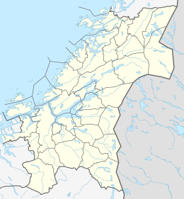 Dolmøya Location of the island  Dolmøya Dolmøya (Norway) | |
| Geography | |
|---|---|
| Location | Trøndelag, Norway |
| Coordinates | 63.6430°N 08.7544°E |
| Area | 14.5 km2 (5.6 sq mi) |
| Length | 10 km (6 mi) |
| Width | 2 km (1.2 mi) |
| Highest elevation | 63 m (207 ft) |
| Highest point | Hjertåsen |
| Administration | |
Norway | |
| County | Trøndelag |
| Municipality | Hitra |
See also
References
- Haugen, Morten, ed. (2017-12-28). "Dolmøya". Store norske leksikon (in Norwegian). Kunnskapsforlaget. Retrieved 2018-02-15.
This Trøndelag location article is a stub. You can help Wikipedia by expanding it. |
Текст в блоке "Читать" взят с сайта "Википедия" и доступен по лицензии Creative Commons Attribution-ShareAlike; в отдельных случаях могут действовать дополнительные условия.
Другой контент может иметь иную лицензию. Перед использованием материалов сайта WikiSort.org внимательно изучите правила лицензирования конкретных элементов наполнения сайта.
Другой контент может иметь иную лицензию. Перед использованием материалов сайта WikiSort.org внимательно изучите правила лицензирования конкретных элементов наполнения сайта.
2019-2026
WikiSort.org - проект по пересортировке и дополнению контента Википедии
WikiSort.org - проект по пересортировке и дополнению контента Википедии