geo.wikisort.org - Island
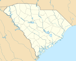
Deveaux Bank is a horseshoe-shaped sand spit island encompassing a 215-acre (87-hectare) bird sanctuary at the mouth of the North Edisto River in Charleston County, South Carolina.[1] It is located on the Atlantic Coast between Edisto Island, South Carolina and Seabrook Island, South Carolina. Its average elevation is three feet.[2] It has approximately 2.75 miles (4.43 kilometres) of sandy beaches on three sides (some of which are completely submerged at high tide) and a tidal lagoon on the side facing the mainland.


 Deveaux Bank | |
| Geography | |
|---|---|
| Location | Atlantic Ocean |
| Coordinates | 32.549°N 80.181°W |
| Area | .33 sq mi (0.85 km2) |
| Length | 1 mi (2 km) |
| Width | 1.2 mi (1.9 km) |
| Highest elevation | 3 ft (0.9 m) |
| Administration | |
United States | |
| State | |
| County | Charleston County |
History
Deveaux bank was first documented in 1921 and by the 1930s was an established seabird rookery. During World War II, Deveaux Bank was used as a bombing range. The bank was completely submerged by Hurricane David in 1979 and tidal shifts that followed the next spring.[3] Over the next several years the island continued to rebuild as sand was deposited by currents.
Today
Currents cause the shape of the island to constantly shift. Due to a lack of land predators, the island has become a heavily utilized bird nesting area. It is protected by the South Carolina Department of Natural Resources. Landings may only be done below the high-water line. Dogs are prohibited and overnight camping is also prohibited.
Flora
Plant species on the island include:
- Russian thistle, Echinops exaltatus
- marsh hay
- camphorweed
- beach elder
- beach tea
- dog fennel
Fauna
Observed species vary from year-to-year but include:
- Brown pelican
- Royal tern
- Least tern
- Wilson's plover
- Sandwich tern
- Black skimmer
- Tricolored heron
- Snowy egret
- Great egret
- Gull-billed tern
- Willet
- American oystercatcher
- Laughing gull
- Ibis
- Hudsonian whimbrel
References
- "Deveaux Bank Seabird Sanctuary". South Carolina Department of Natural Resources. Archived from the original on 28 November 2010. Retrieved 19 November 2013.
- "Deveaux Bank, South Carolina, United States". SatelliteView.co. Retrieved 20 November 2013.
- Langley, Lynne (6 August 1991). "Deveaux Bank plays game of hide and seek". The News and Courier. Charleston, SC. Retrieved 19 November 2013.
Другой контент может иметь иную лицензию. Перед использованием материалов сайта WikiSort.org внимательно изучите правила лицензирования конкретных элементов наполнения сайта.
WikiSort.org - проект по пересортировке и дополнению контента Википедии